
Dog access
No dogs. Other pets on conservation land rules.
Nature's in trouble
Thousands of New Zealand’s native species are heading towards extinction. Once they’re gone, they’re gone for good. Nature needs your help.
These are many places to go in Fiordland National Park:
- Lake Manapouri area – stunning scenery and numerous activities.
- Lake Te Anau area – the closest town with facilities, with walking, hunting, mountain biking, and water activities.
- Doubtful Sound/Patea area – majestic fiord.
- Hollyford Valley area – remote, forested valley from the mountains to the sea, with tramping, hunting, fishing, climbing and more.
- Lake Monowai/Borland Road area ‘off the beaten track’ tramping, hunting, boating and fishing.
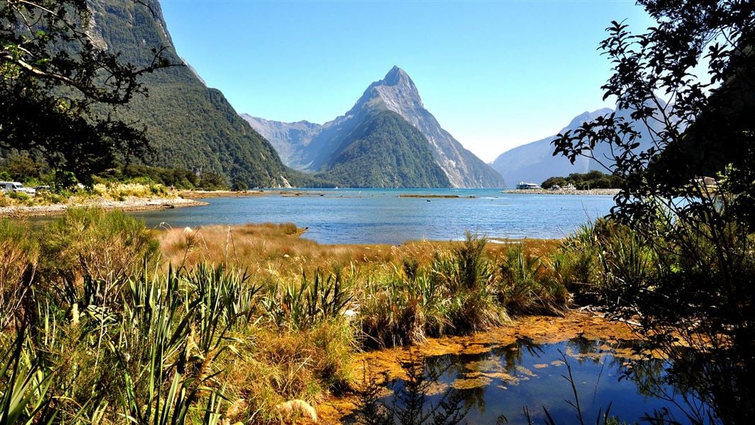
- Milford Road/Milford Sound area, with one of New Zealand's most scenic drives.
- Southern Fiords – fascinating historic sites, walking or kayaking.
- Tuatapere area – wild, dramatic mountain and coastal landscapes in the Waitutu/South Coast area.
Visit Fiordland National Park Visitor Centre for information and tips.
Find out how to get to Fiordland National Park by road, air or boat.
Find information on how to get to Fiordland National Park, what the weather is like, and tips for safety, including what gear you will need.
Weather forecast
All drone use must be authorised by DOC
You must have a permit to fly a drone on public conservation land.
Visit our Drone use on conservation land page for more information.
Over the last 2 million years glaciers have at times covered the area, gouging into the rock and creating U-shaped valleys, many of which are now lakes or fiords.
Today hundreds of lakes dot the landscape, among them Lake Hauroko, the deepest in New Zealand at 462 metres. Fourteen fiords, some stretching up to 40 kilometres inland, extend from Milford Sound/Piopiotahi in the north to Preservation Inlet in the south.
Fiordland National Park was officially constituted in 1952. Today it covers over 1.2 million hectares and was declared a World Heritage Area in 1986.
Ata Whenua
Fiordland was well known to the Māori, and many legends recount its formation and naming. Demigod Tuterakiwhanoa is said to have carved the rugged landscape from formless rock. Few Māori were permanent residents of the region but seasonal food-gathering camps were linked by well worn trails. Takiwai, a translucent greenstone, was sought from Anita Bay and elsewhere near the mouth of Milford Sound/Piopiotahi.
First Europeans
Captain Cook and his crew were the first Europeans to visit Fiordland, and in 1773 spent five weeks in Tamatea/Dusky Sound. Cook’s maps and descriptions soon attracted sealers and whalers who formed the first European settlements of New Zealand. From the middle of the 19th-century surveyors, explorers and prospectors began to penetrate the unexplored interior of Fiordland.
Preservation Inlet boomed briefly in the 1890s after gold was found, but efforts to establish mines, timber mills and farms in Fiordland have generally been short-lived.
Early settlers
Quintin McKinnon and Donald Sutherland opened up the Milford Track in 1889 and began guiding tourists through the now world-famous route. Richard Henry, one of the pioneers of threatened species work transferred kākāpō and kiwi to islands in Tamatea/Dusky Sound in the late 1890s and early 1900s.
Heritage sites
There are several heritages sites in Fiordland National Park:
- Astronomer's Point – where the position of New Zealand was fixed in 1773.
- Caswell Sound Hut – the only physical feature remaining from the New Zealand–American Fiordland expedition of 1949.
- Clark Hut – built in 1941 and used for deer cullers by the New Zealand government.
- Freeman Burn Hut – build in the 1930s for people walking the Bradshaw Sound – Lake Manapouri Track.
- Omanui/McKinnon Pass Memorial – memorial on the route, now famous as the Milford Track, discovered by Quintin McKinnon and Ernest Mitchell in 1888.
- Port Craig Sawmill and settlement site – New Zealand's most complete sawmilling complex featuring all stages and aspects of the timber industry.
- Preservation Inlet – home to over 2,500 gold miners and saw millers in the 1890s, and location of one of New Zealand's most remote lighthouse settlements.
- Richard Henry’s house site – Richard Henry was caretaker of New Zealand’s first island wildlife sanctuary in the 19th century.
- Tarawera Silver Mine and Smelter – one of many failed ore extraction ventures, and the only smelter site on public conservation land in Southland.
Check, Clean, Dry
Clean all gear when moving between waterways to prevent the spread of didymo and other freshwater pests.
Te Rua-o-te-moko/Fiordland National Park Visitor Centre
| Phone: | +64 3 249 7924 |
| Email: | fiordlandvc@doc.govt.nz |
| Address: | 1 Lakefront Drive Te Anau 9600 |
| Hours: | Visitor centre hours and services |