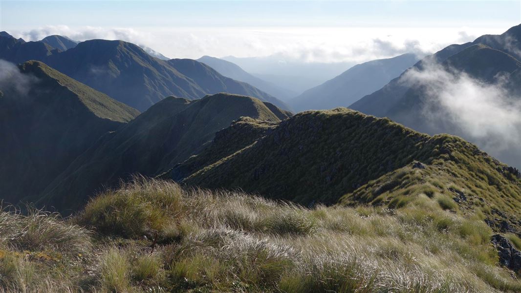
One of four classic tramps in the Tararuas, the Northern Crossing links the Ōhau and Waingawa catchments. Depending on weather conditions it can take between three to five days to complete. It is recommended for experienced trampers only, and requires good navigation and map reading skills as the track is unmarked.
Like the Southern Crossing, It involves travelling along the open tops. The Northern Crossing covers some famous Tararua peaks such as Pukematawai (1432 m), Arete (1505 m), Waiohine Pinnacles (1400 m), Girdlestone (1546 m) and Mitre (1571 m), which is the highest peak in the park. The open tops section from Pukematawai to Mitre peaks is currently not marked.
The difference to the Southern Crossing lies in the river valley approaches instead of the long forested ridge approaches.
High river levels in the Ohau Valley can be a major obstacle, often necessitating a time-consuming deviation along Gable End Ridge.
Huts
The main overnight shelters are Te Matawai Hut in the west and Mitre Flats Hut next to the Waingawa River in the east. The main alpine huts are Arete Hut off Arete peak and Tarn Ridge Hut northwest of Girdlestone.
To access from the western side, on State Highway 1 at Levin, turn into Tararua Road and then into Gladstone Road. Turn right at the signposted junction which takes you to the start of the track. The tramp ends at the Holdsworth road end or the Pines carpark (see the Mitre Flats & Hut walk), although it can be started from either the western or eastern side.
What to expect
- A challenging backcountry tramp, with a rough unformed track, marker poles, and sections of untracked tops that you will have to navigate.
- The Tararua tops are notorious for their frequent strong winds, thick mist, freezing temperatures and rain/snow. Be prepared to encounter these conditions at any time of year, even if the weather looks nice in the morning.
Skills/experience needed
- Extensive experience in backcountry tramping, including in untracked areas and in bad weather. You need to be able to judge when the conditions are safe to proceed and when to wait or turn back.
- Good navigation and map reading skills. You need to be able to navigate in untracked areas and in low visibility.
- Good river crossing skills and the confidence to judge when a river is safe to cross.
- The fitness for a demanding 3-5 day tramp.
Assess the weather often and be ready to change your plans
Frequent freezing temperatures, thick mist and gale-force winds can make the Tararua tops deadly. There have been fatalities in the alpine areas of the Northern Crossing.
Regularly assess the weather and consider turning back or waiting in a hut if you don’t have the experience or equipment for the current conditions.
How to plan and prepare
Only cross the Ohau River is you are confident it is safe. Take particular care if it is in flood or following high/sustained rainfall. You can avoid crossing the Ōhau River by taking a route around Gable End Ridge.
When packing for this trip, note:
- This is a remote tramp and you will need to be self-sufficient. Make sure to pack a distress beacon, emergency shelter and extra food in case of delays.
- Pack plenty of warm and waterproof clothing.
- A map and compass or GPS are essential for this route.
Stay safe in the outdoors
- Choose the right trip for you. Learn about the route and make sure you have the skills for it.
- Understand the weather. Check weather forecasts.
- Pack warm clothes and extra food. Check gear lists.
- Share your plans and take ways to get help. Share directly or use the Outdoor Intentions form or Plan My Walk. Take a distress beacon.
- Take care of yourself and each other.
Wellington/Kapiti information
| Phone: | +64 3 546 9339 |
| Email: | nelsonvc@doc.govt.nz |
| About: | Whakatū/Nelson Visitor Centre provides visitor information for this area |
