The Southern Crossing is one of the four classic tramps of the Tararua Range.
Originally it was the route from Otaki Forks to the Wairarapa Plains (and in later years, the Kaitoke Basin). It was popularised during the 1920s and 30s by the Tararua Tramping Club and other clubs in the Hutt Valley and Wairarapa.
Image gallery
Video
The crossing of the alpine tops section from Table Top to Mount Alpha (1361 m) involves about 6-8 hours of travel, with superb views to the south of Wellington Harbour, the Marlborough Sounds and the Kaikoura Mountains.
The track down from Alpha Hut to the Kaitoke carpark leads through the saddle of Hell’s Gate, over Omega, and through the stunted silver beech along the Marchant Ridge. It joins to Dobsons Loop Track before exiting on Marchant Road.
Huts
Field and Alpha huts, just below the bushline on the western and eastern sides of the alpine section of the crossing, have been the traditional overnight shelters. However, Kime Hut near Hut Mound is an alpine refuge in bad weather, although it is very cold in winter because of the lack of heating.
Otaki Forks – Field Hut
Time: 3–4 hr
Distance: 5 km
From the car park next to the caretaker’s house, follow the marked track through the trees to the swing bridge over the Waiotauru River. Cross the bridge onto a grass terrace and follow a track towards Judd Ridge climbing up into bush. It is a climb from 150 m all the way to Field Hut, which appears in a small clearing below the bushline at 835 m. Depending on the start time and length of daylight hours, Field Hut may be a better overnight option for the first day than Kime Hut.
Field Hut – Kime Hut
Time: 3–4 hr
Distance: 5 km
Continue the climb from Field Hut beyond the bushline into Table Top alpine tussock. Pass the signposted junction to Penn Creek Hut and another junction to Maungahuka Hut. Follow the signposted route to Kime Hut at 1,405 m. A mobile phone signal is usually available along the ridge line near Kime Hut.
Kime Hut – Alpha Hut
Time: 5–6 hr
Distance: 7.5 km
Follow the ridge over Field Peak to Mount Hector (1,529 m), the highest point of the route. Mount Hector bears a large wooden cross that was erected in 1950 (and replaced in 1980) as a memorial to trampers who lost their lives during World War II. The exposed ridge of the Dress Circle takes you to the top of Aston, where there is a signposted junction to Elder Hut. Continue along the ridge route over Alpha (1,361 m) and descend to Alpha Hut, just below the bushline.
Alpha Hut – Kaitoke
Time: 7–9 hr
Distance: 17 km
Continue from Alpha Hut and descend from 1,187 m to the saddle at Hells Gate. From there, climb up to Marchant Ridge, passing the Bull Mound, Omega and Block 16 track turn-offs. These tracks into the Tauherenikau valley offer alternative routes to Marchant Ridge, but involve a river crossing, which may be dangerous after heavy rainfall. Marchant Ridge is a long stretch of bush that is rough underfoot and muddy when wet, so the pace is usually slower. The section from the Smith Creek Shelter junction along Dobson Loop Track has mobile phone reception to book your transport. Look carefully for the track turn-off into the Kiwi Ranch Road car park.
Understand if you are ready for the Tararua Southern Crossing
Watch the NZ Mountain Safety Council’s walk-through video which takes you through how to prepare for this track. Including facilities, key decision points, hazards and typical conditions for the area.
Otaki Forks is 19 km inland from Otaki township – approx. 1½ hour drive from Wellington or Palmerston North. The easiest turn-off from State Highway 1 is at Otaki Gorge Road, just south of the State Highway 1 bridge over the Otaki River. The last 5 km of the Otaki Gorge Road is unsealed, narrow and windy – please drive carefully.
What to expect
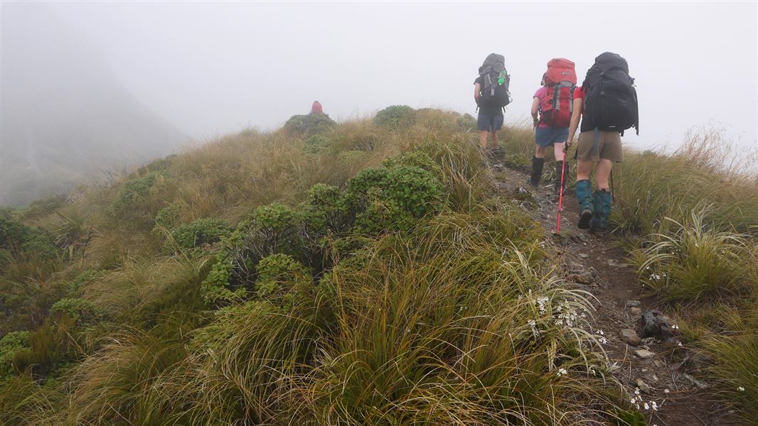
- The Tararua tops are notorious for their frequent strong winds, thick mist, freezing temperatures and rain/snow. Be prepared to encounter these conditions at any time of year, even if the weather looks nice in the morning.
- The Southern Crossing is a tramping track with tree roots, rough sections and mud. While on the open tops marker poles guide the way.
- There will be many hours of uphill walking on your first day.
Skills/experience needed
- Experience in backcountry tramping, including in untracked areas and in bad weather – you need to be able to judge when the conditions are safe to proceed and when to wait at a hut, camp where you are, or turn back.
- Have good navigation skills, e.g. able to use map and compass or GPS to navigate in low visibility conditions
- The fitness to walk for up to 9 hours per day, including lots of uphill on day one

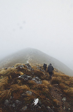
On the Southern Crossing between Kime Hut and Alpha Hut. See larger image (JPG, 300K)
Image: © @mark_mear
Assess the weather and be ready to turn back
Frequent freezing temperatures, thick mist and gale-force winds can make the route between Field and Alpha Huts deadly. There have been a number of fatalities on this part of the crossing.
Use Table Top, Kime Hut and Mt Hector as decision-making points for the Ōtaki to Kaitoke direction. Assess the weather and consider turning back if you don’t have the experience or equipment for the conditions.
Plan and prepare for your trip
Pack plenty of warm and waterproof clothing and we recommend an emergency shelter and distress beacon. Pack a map and compass or GPS and know how to use them. Carry extra food in case you are delayed by bad weather.
Walking poles may help keep you steady.
Stay safe in the outdoors
- Choose the right trip for you. Learn about the route and make sure you have the skills for it.
- Understand the weather. Check weather forecasts.
- Pack warm clothes and extra food. Check gear lists.
- Share your plans and take ways to get help. Share directly or use the Outdoor Intentions form or Plan My Walk. Take a distress beacon.
- Take care of yourself and each other.
Wellington/Kapiti information
| Phone: | +64 3 546 9339 |
| Email: | nelsonvc@doc.govt.nz |
| About: | Whakatū/Nelson Visitor Centre provides visitor information for this area |
