19 km one way
Sections of this track can become impassable in winter conditions due to snow and ice. Check with North Taranaki Visitor Centre for latest track conditions.
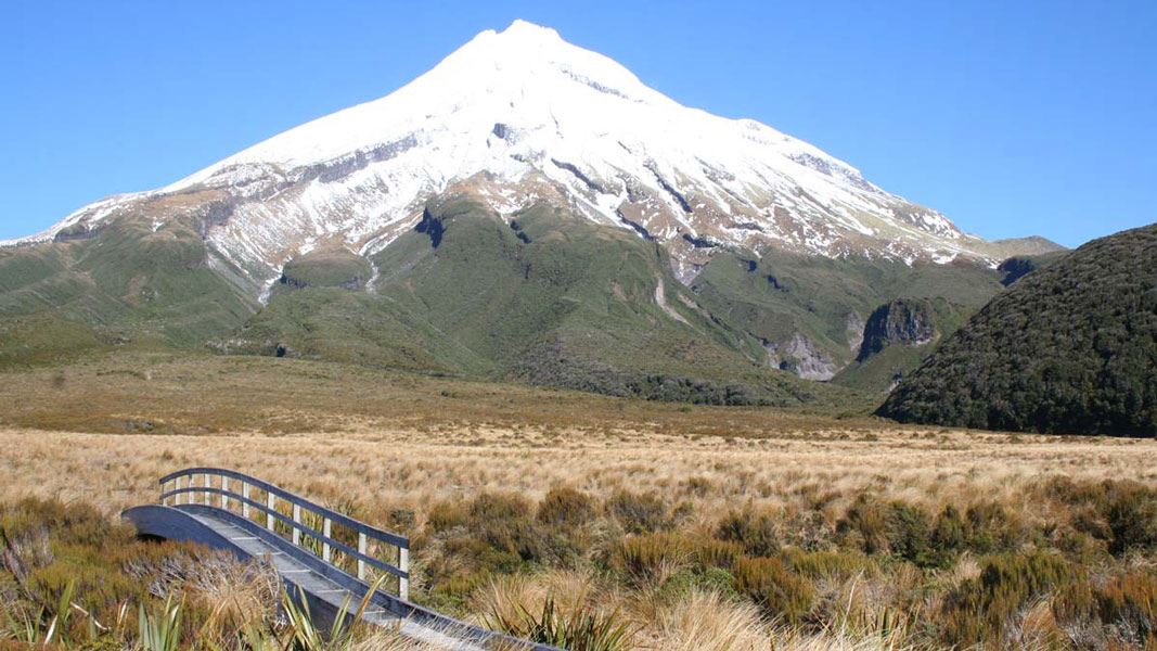
Image gallery
Limited parking at North Egmont road end
Car parking at the North Egmont road end is limited until December 2026 due to construction of the new visitor centre.
Large trucks will be using the road, so drive carefully and expect occasional delays. We recommend carpooling or using a shuttle if you're planning a visit.
North Taranaki Visitor Centre remains open but has moved to a temporary building in the upper car park, above the construction site.

No freedom camping at North Egmont road end
Freedom camping is prohibited at North Egmont Road end. You can overnight camp at Stratford Plateau car park on Pembroke Road or Mangorei Road car park (Pouakai Tarns tramp).
You can walk the track in either direction, but there is less climbing if you walk from the North Taranaki Visitor Centre to Mangorei Road.
This is a backcountry tramp. The track will be rough, muddy, wet or icy in places.

Crossing the loose rock face of Boomerang Slip
North Taranaki Visitor Centre to Holly Hut
Time: 3–4 hr
The Pouākai Crossing begins on the Veronica Loop Track, starting at North Egmont. Follow the boardwalk past the Camphouse. From here the track leads past Ambury Monument and climbs a long series of steps. You will pass a track junction – take the track signposted towards Holly Hut.
Ten minutes past the junction, you will come to a lookout. This is the start of the alpine section of the track, so look at the weather and make sure you have the gear for the conditions. If you aren’t well-equipped enough and/or if the weather is so bad that you cannot see the maunga, then we recommend returning down the Veronica Loop Track and trying the crossing another day.
From the lookout, the track climbs then sidles along the side of Taranaki. The track passes the towering lava columns of the Dieffenbach Cliffs and crosses the Boomerang Slip (watch for rockfall signs and follow their instructions).
After crossing the slip, the track descends and reaches a track junction with Kōkōwai Track. If you are walking in the other direction (from Holly Hut to North Egmont), this is a key decision-point: use it to assess the weather and decide whether to attempt the alpine section of the track. If conditions aren’t favourable, you can return to Holly Hut or take Kōkōwai Track to Egmont Road.
Once past the Kōkōwai Track turnoff, the track gradually descends to the Ahukawakawa Track junction. Turn left for a 5 minute walk to Holly Hut. Minarapa Stream just prior to the hut does not have a bridge and can be impassable after heavy rain.
There are several springs along the track between North Egmont and Holly Hut. These are significant to iwi, hapū and whanau, so please treat them with respect and do not wash in them or walk through the springs.
Side trip: Holly Hut to Te Rere-o-Tahurangi Falls
Time: 1 hr return
It’s worth a side trip down to this mighty waterfall, one of the best in Te Papa-Kura-o-Taranaki. Over many millennia the water of the Hangatahua River has eroded a pathway through the volcanic rock of Te Umu-o-Taomanawa to form the 31 m falls.
Holly Hut to Pouākai tarns
Time: 2 hr
Return to the Ahukawakawa Track junction and follow the boardwalk across Ahukawakawa, alpine swamp. This unique microclimate is home to many plant species, some usual at this altitude and others found nowhere else in the world. You can stop at the viewing platform before continuing on to cross the curved wooden bridge over the Hangatahua River .
This area is a wetland. There is a boardwalk, but expect water and mud, in some places over the track.
The track then climbs steeply through mountain cedar to reach the Pouākai Track junction.
Turn right and continue beneath the aptly named Hump and to the Mangorei Track junction. If you are tired or running out of daylight, we recommend taking the track to Pouākai Hut and Mangorei Road End at this point, rather than continuing to the tarns. A trip to the tarns takes about an hour.
If you have the time and energy, then continue to the picturesque Pouākai tarns. On a fine day, you can see a stunning reflection of Taranaki Maunga in the pools.
The area around these small alpine tarns is very fragile. Keep to the boardwalks to help protect this fragile wetland area. Do not enter the pools.
Side trip: Pouākai Trig
Time: 1 hr 30 min return
On a fine day take a detour at the Pouākai Track junction – turn left towards Pouākai Trig (1,440 m) with stunning views of Te Papa-Kura-o-Taranaki and the coastline. This track is a little rugged in places – be prepared for some mud and track erosion.
Pouākai tarns to Pouākai Hut
Time: 20 min
Backtrack to the junction with Mangorei Track and head downhill to Pouākai Hut. Enjoy a break on the hut deck and take in the spectacular views up the Taranaki coastline.
Pouākai Hut to Mangorei Road end
Time: 2 hr
The long descent to the road end winds through cool forest dripping with mosses and lichens – these twisted kamahi trees are known locally as ‘Goblin forest’ as it is like walking through an enchanted forest.
Starting in Inglewood:
- Head west on State Highway 3 out of Inglewood.
- After around 1.9 km turn left onto Lepper Road Upper.
- Continue on this road for 5.9 km until Egmont Road.
- Continue on Egmont for around 10.4 km until the end of the road. North Taranaki Visitor Centre is at the end of the road.
This is a one-way track so you need to arrange transport to and from one end. Shuttle services are available – book directly with an operator. See Venture Taranaki for more information.
Be prepared for changeable weather
Weather on the mountain changes rapidly – you must be well prepared with suitable clothing and equipment for all weather and conditions.
Snow, high rainfall and storm damage can make tracks impassable – many rivers and streams are unbridged.
Check the Te Papa-Kura-o-Taranaki weather forecast before you go.
Expect a challenging day walk
This is a 19km track that generally takes between 7 hr 30 mins and 9 hr 30 mins. The track passes through an alpine environment where extreme weather is common. You need good fitness and the right gear to do this track.
It is a backcountry tramping track and is steep and uneven in places. The surface can be muddy and wet and has tree roots and embedded rocks.
Alternative hike: You can also visit Pouākai tarns on a much easier day walk from Mangorei Road.
Be aware of rockfall risks
There are several rockfall zones on the Pouākai Circuit (including Boomerang Slip). Follow instructions on signage and cross these without stopping, one person at a time.
This track is much more difficult in winter
This is track is far more challenging in winter. You will need an ice axe, crampons, snow gaiters and goggles for the section of track between North Egmont and Holly Hut, along with the skills to use them.
If there is snow on Taranaki Maunga, check the avalanche advisory and only tramp the track if you have the gear (avalanche transceiver, probe and snow shovel) and skills to manage the avalanche risk.
Take care when crossing creeks
The track crosses several dry stream beds. These can rise quickly during heavy rain and may not be safe to cross. Assess them carefully before crossing: if you have any doubt about whether you can cross safely, wait for the water levels to drop. This often happens quickly.
What to take
Pack everything on the day hikes packing list. Wear sturdy shoes with good grip and ankle support (for example, tramping boots) and always carry a waterproof raincoat and plenty of warm layers of clothing.
As this is a long day tramp, we strongly recommend carrying a torch and spare batteries, in case it is getting dark as you are finishing the track.
There is a section of the track without cell phone coverage, so consider carrying a distress beacon – these can be hired at the North Taranaki Visitor Centre.
If you are tramping in winter or when there is snow, also take an ice axe, crampons, snow gaiters and goggles. If there is avalanche risk, carry an avalanche transceiver, probe and snow shovel. Check the NZ Avalanche Advisory
Ambury Monument /Ambury Bluffs
This monument on the Holly Hut Track is named after Arthur Hamilton Ambury who gave his life in a heroic attempt to save W E Gourlay who slipped on the ice on 3 June 1918. Both died in the fall over this bluff.
Dieffenbach Cliffs
These cliffs take their name from Ernst Dieffenbach (1811-1855) who organised the first ascent of Egmont in Christmas week of 1839. He was accompanied to the summit by a whaler, James Herberley. They reached the top on 23 December, having left Richard Barrett’s whaling station at Moturoa on 19 December.
Stay safe in the outdoors
- Choose the right trip for you. Learn about the route and make sure you have the skills for it.
- Understand the weather. Check weather forecasts.
- Pack warm clothes and extra food. Check gear lists.
- Share your plans and take ways to get help. Leave your intentions with a trusted contact and take a distress beacon.
- Take care of yourself and each other.
North Taranaki Visitor Centre
| Phone: | +64 6 756 0990 |
| Email: | northtaranakivc@doc.govt.nz |
| Address: | 2879 Egmont Road Te Papa-Kura-o-Taranaki 4386 |
| Hours: | Visitor centre hours and services |