Tongariro Forest hunting
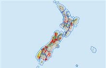
Located in Ruapehu Conservation Areas and Reserves hunting and Tūrangi/Taupō hunting in the Central North Island region
|
Introduction
Tongariro Forest offers good hunting for red deer and pigs. All hunting dogs must have avian avoidance training.Species
- Deer - Red
- Goats
- Pigs
Permit requirements
This hunting area is covered by an 'open area permit' – get it online or from a DOC office.
Dog access
About this hunting block
There is good hunting for red deer and pigs across the whole forest, with goats present primarily on the northern and western boundaries.
General information
Part of the Ruapehu Conservation Areas and Reserves open hunting area, Tongariro Forest is a compact triangle of land administered by the Department of Conservation northwest of Tongariro National Park. The upper Wanganui River forms the northern boundary while State Highway 47 and the Whakapapa River complete the triangle to the south, encompassing some 25700 hectares.
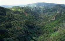
Early logging within the area has drastically changed the forest. The mosaic of logging roads and pulling tracks still offer excellent access to most of the forest, despite heavy toetoe regrowth. Generally the terrain is flat to rolling, with steep gorges along the rivers and streams.
Access
The key access roads include Kapoors Road, John McDonald road, and the 42 Traverse, which offers summer time 4wd access.
Maps
You will need the following Topo 50 series maps:
Raurimu BH34
Dogs
Hunters are allowed to take hunting dogs (under permit) into this forest. Hunters should be aware that it contains important populations of threatened North Island brown kiwi and blue duck. Because of this hunters need to adhere to the following:
- all hunters entering DOC conservation lands must obtain a hunting permit
- dogs are currently certified as ‘kiwi safe’ through the avian aversion training
- the dog must be used for hunting and not just be there for company
- dogs are tied up at night
- any dogs that are lost in these areas are reported to the nearest DOC office immediately.
Huts
There is only one hut in Tongariro forest: 10 Man Hut
Contacts
| Tongariro National Park Visitor Centre | |
|---|---|
| Phone | +64 7 892 3729 |
| tongarirovc@doc.govt.nz | |
| Address | Whakapapa Village State Highway 48 Mount Ruapehu 3083 |
| Hours | Visitor centre hours and services |


