Buller Gorge to Charleston hunting
Located in Buller hunting in the West Coast region
|
Introduction
In this area red deer, goats and pigs can be found year round. Chamois are present but uncommon on the Paparoa Range.Species
- Chamois
- Deer - Red
- Goats
- Pigs
Permit requirements
This hunting area is covered by an 'open area permit' – get it online or from a DOC office.
Dog access
About this hunting block
General information
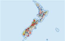
This area covers the northwestern end of the Paparoa Ranges from the Buller river at Inangahua Junction to Charleston and Four Mile Road. The area has a number of moderate sized streams and rivers that provide access into the ranges the largest being the Ōhikanui and Waitākere Rivers.
In the west, there are large areas of cutover forest and pakahi terraces lying between the highway and the toe of the ranges and there are several access points. The vegetation is mainly beech forest with podocarp at lower altitudes. The granite Paparoa Ranges reach about 1400 metres and provide a rugged backdrop to the forested hills sides.
Access
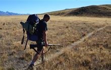
There are many access points into this area. The Ōhikanui and smaller rivers that drain into the Buller Gorge can be accessed directly off SH 6. There are no tracks and travel is slow up these rivers. Bucklands Peak track provides access to the open Paparoa tops. This steep 5-hour track leaves the Buller Gorge road near the coast road junction and crosses private land before entering the forest.
Further south old forestry roads at Totara River, Little Totara River, Charleston and Four Mile provide some access however only the Four Mile Road actually reaches the Paparoa foothills. Note that some of these roads are not well maintained and care is needed. A walking track at Tiropahi (Four Mile) River provides access into a large open pakahi area and links up with the Four Mile road.
The upper Ōhikanui River is a Wilderness Area and no aircraft landings are permitted.
The limestone escarpments around Charleston and Four Mile contain many sinkholes (tomo) and care should be taken when travelling through these areas.
Landholders
There are private land blocks within this area, often not well defined. The main access points do not cross private land.
Maps
Topo50 maps BS20, BS21
Dogs
Dogs are prohibited in all areas unless authorisation has been granted by DOC. People wishing to take a dog into this area should seek authorisation from the local DOC office.
Huts
There is one hut in this area at Bucklands peak a 4-hour walk from SH 6. There is a non-serviced freedom camping area on the Nile River 4 km inland from Charleston.
Hunting
Red deer, goats and pigs can be found throughout the area at any time of the year. Chamois are present but uncommon on the Paparoa Range. Possums are controlled by the AHB throughout the area.
Additional information
Hunters are advised to check for current pesticide operations that may be in progress where they intend to hunt. Pesticide summaries are published every four months.
The use of shotguns, shotgun-rifle combos, .22 calibre and rim-fire firearms is prohibited on public conservation land unless stated otherwise.
Contacts
| DOC Customer Service Centre | |
|---|---|
| Phone | 0800 275 362 |
| paparoavc@doc.govt.nz | |
| Address | DOC offices |