2.6 km one way return via same track
This is the shortest route to the top of Mount Pureora. It's a well maintained track with bridges across all waterways and a boardwalk towards the summit.
From SH30, turn onto Maraeroa Road, then Barryville Road, then Link Road. The start of the track is about 14 km along Link Road.
The carpark is on the opposite side of the road to the track entrance. Note, the track on the same side as the car park is a different track.
There is no petrol available near Pureora village or the track.
There are also no toilets along the track - use the toilets in Pureora Village on Barryville Road.
Check the Mount Pureora weather forecast – NIWA website.
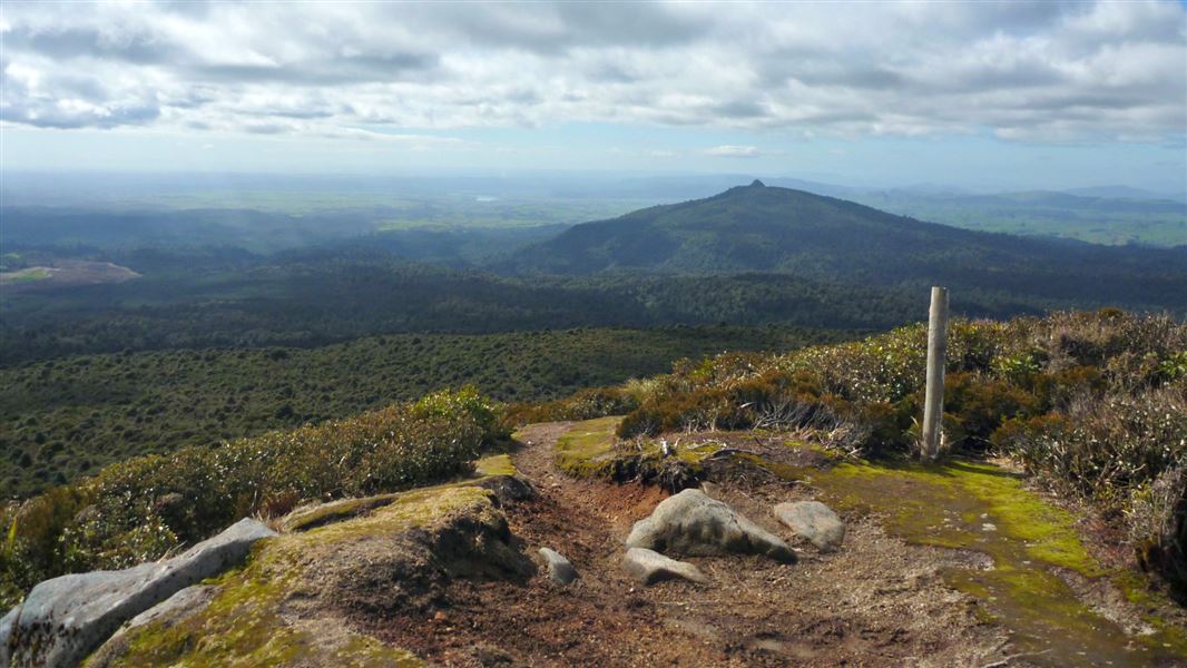
The altitude affects the vegetation pattern on Mount Pureora, where the tallest podocarp trees occur at the lowest altitudes and the canopy height steadily decreasing as the altitude increases. On the summit the vegetation is reduced in many places to a low turf with occasional low shrubs, allowing for amazing views.
Mount Pureora is a sacred mountain for many tribes in the Central North Island, and we recognise the relationship of our iwi partners Ngāti Rereahu, Ngāti Maniapoto, Raukawa, and Ngāti Tuwharetoa with the mountain.
Stay safe in the outdoors
- Choose the right trip for you. Learn about the route and make sure you have the skills for it.
- Understand the weather. Check weather forecasts.
- Pack warm clothes and extra food. Check gear lists.
- Share your plans and take ways to get help. Leave your intentions with a trusted contact and take a distress beacon.
- Take care of yourself and each other.
DOC Customer Service Centre
| Phone: | 0800 275 362 |
| Email: | tekuiti@doc.govt.nz |
| Address: | Te Kūiti Office |