For tide, boundaries and other information on the go, you can download the MarineMate app.
Ngā Motu/Sugar Loaf Islands Marine Protected Area borders Tapuae Marine Reserve. Be aware the rules of these adjoining areas differ. You can't fish or remove marine life or natural material within Tapuae Marine Reserve.
Ngā Motu/Sugar Loaf Islands Marine Protected Area borders Tapuae Marine Reserve. Be aware the rules of these adjoining areas differ. You can't fish or remove marine life or natural material within Tapuae Marine Reserve.
Read more on the NZ Fishing Rules app.
Marine Protected Area rules
- Commercial fishing, except trolling for kingfish and kahawai, is not allowed.
- Spoil dumping and activities that may disturb the foreshore and seabed are restricted. This includes anchoring by commercial vessels, mining and drilling.
- Access to the Ngā Motu/Sugar Loaf Islands is by permit only.
Central area (lower half of the North Island) fishing rules
Check fishing rules in the area before you go fishing. You need to check for:
- the set net ban in Taranaki
- closed and restricted fishing areas
- temporary closures
- other set net restrictions
- food safety closures.
Marine Protected Area location map
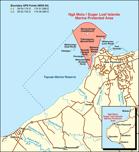
View a larger, print-fomatted map of the Marine Protected Area (PDF, 51K)
Boundary GPS Points (WGS 84)
- 39 04.174 S 174 01.099 E
- 39 02.733 S 174 00.080 E
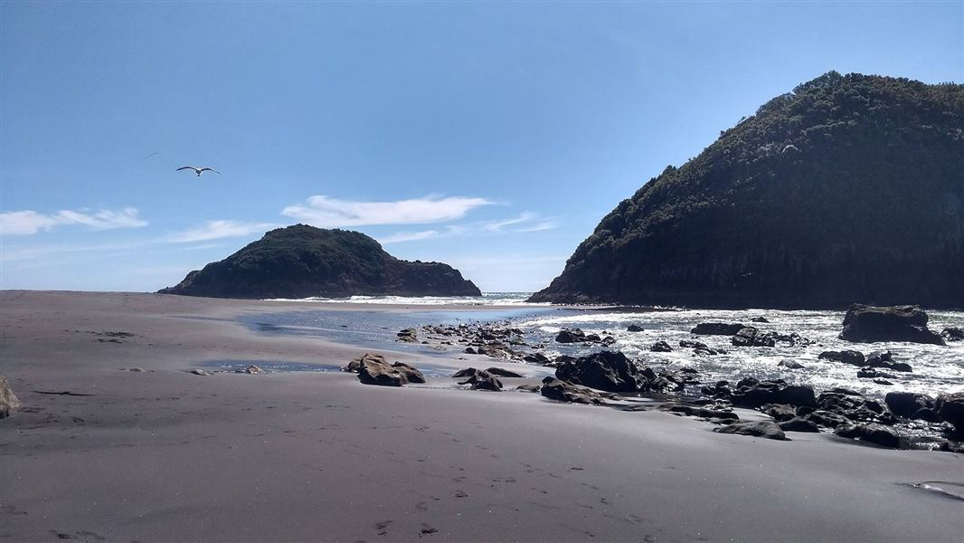
Just offshore from New Plymouth is the stubble of an ancient but massive volcano much older than Taranaki Maunga. Formed 1.75 million years ago, soft rock has long since been eroded away leaving a group of low sea stacks and seven islands that provide a unique semi-sheltered environment along an otherwise exposed coastline.
The Marine Protected Area comprises seabed, foreshore and water around Ngā Motu/Sugar Loaf Islands. It backs onto the northern boundary of the Tapuae Marine Reserve.
Marine environment
The subtidal marine habitats around the Ngā Motu/Sugar Loaf Islands include: spectacular canyons, caves, rock faces with crevices and overhangs, large pinnacles, boulder fields and extensive sand flats.
There are at least 89 species of fish, 33 species of encrusting sponges, 28 species of bryozoans and 9 nudibranchs.
The Ngā Motu/Sugar Loaf Islands are important for 19 species of seabirds, with approximately 10,000 seabirds nesting here. A breeding colony of New Zealand fur seals is there too.
Protection and recognition
The Sugar Loaf Islands Marine Protected Area was established in 1986 to control both fishing (under the Fisheries Act 1983) and non-fishing (under the Harbours Act 1950) activities. The formal protection of this area was supported by a traditional blessing with a tohunga (priest) placing a rahui over the area.
Concern about the areas degree of protection against oil prospecting and development led to the Sugar Loaf Islands Marine Protected Area Act 1991. The Act included a prohibition against mining.
Local Māori called the islands Ngā Motu – 'the islands', and were actively living on them when first European settlers arrived. In 1770 the guano deposits reminded James Cook of the way sugar in Europe was stored in heaps or loaves and he named the islands the Sugar Loaf Islands. In the 1820s a whaling station was established on Moturoa Island.
North Taranaki Visitor Centre
| Phone: | +64 6 756 0990 |
| Email: | northtaranakivc@doc.govt.nz |
| Address: | 2879 Egmont Road Te Papa-Kura-o-Taranaki 4386 |
| Hours: | Visitor centre hours and services |