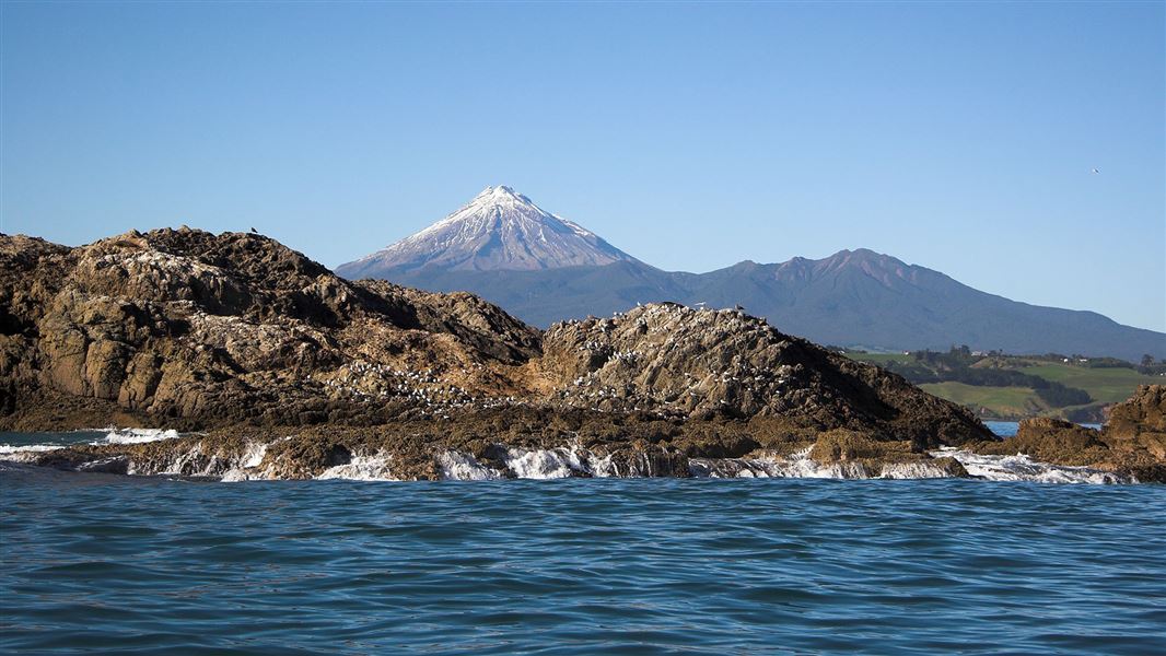
Tapuae Marine Reserve was established in 2008 and is 1,404 hectares. It borders Ngā Motu/Sugar Loaf Islands Marine Protected Area. The rules for these areas are different. In Tapuae Marine Reserve, you can't fish or remove marine life or natural material. In Ngā Motu/Sugar Loaf Islands Marine Protected Area, some forms of fishing are permitted.
The reserve can be accessed by boat from the New Plymouth boat ramp on Ocean View Parade.
Tapuae Marine Reserve borders Ngā Motu/Sugar Loaf Islands Marine Protected Area. Be aware that the rules of these adjoining areas differ:
- you can't fish or remove marine life or natural material within Tapuae Marine Reserve
- some forms of fishing are permitted within the Ngā Motu/Sugar Loaf Islands Marine Protected Area.
View map and boundaries for Tapuae Marine Reserve.
Marine reserve rules
Marine reserves are no-take areas. You may not remove any animal or natural form. That means no fishing of any kind, no shellfish gathering, and no removal of rocks, shells, driftwood or plants.
Information signs marked 'Marine Reserve' are posted at clearly visible locations at the New Plymouth boat ramp and at all major access points along the coastline near the marine reserve.
GPS descriptions are given for the seaward boundaries and pamphlets are freely available in many locations to further inform the public about the reserve.
Surveillance and enforcement of the reserve is carried out by DOC. Warranted officers undertake regular patrols and are assisted by Honorary Rangers, from the community, appointed under the Marine Reserves Act.
However, you can help too. Report offences to DOC on +64 6 759 0350 (office hours), or 0800 DOC HOT (after hours).
Central area (lower half of the North Island) fishing rules
Check fishing rules in the area before you go fishing. You need to check for:
- the set net ban in Taranaki
- closed and restricted fishing areas
- temporary closures
- other set net restrictions
- food safety closures.
Read about staying safe while swimming or boating.
Be prepared
You should always check with Coastguard for weather and sea conditions. Coastguard operates on VHF Ch61.
Weather forecast
Ancient volcano
The remains of an ancient volcano sit at the northern end of Tapuae Marine Reserve, visible as a series of islands and rocks (their steep sides continue deep down beneath the water). The waters here cover a craggy labyrinth of pinnacles, canyons and caves.
Species and habitat
It hosts a diverse and flourishing range of sea life. Their shelter provides a habitat for around 400 species of fish (especially around Seal Rock). These landforms are also encrusted with the usual reef species of sponges and shellfish, and colonies of bryozoans – tiny animals that build skeletons resembling coral.
Visitors may fur seals, as well as humpback, pilot and southern right whales, and orcas.
Wild coast
The southern part of the reserve is typical of the wild Taranaki coast – reef, mud and sand below, and black sand beaches above. About a third of the area is rocky reef, mostly cobble and boulder platforms. These scattered reefs shelter many species of marine animals and plants.
Nga Mahanga a Tairi gave support to the marine reserve application. Their traditional rohe/tribal area extends across the Tapuae Marine Reserve. The area is of cultural, spiritual, historical and traditional importance to local iwi.
Protect our marine reserves
- No fishing of any kind.
- Don't take or kill marine life.
- Don't remove or disturb any marine life or materials.
- Don't feed fish - it disturbs their natural behaviour.
- Take care when anchoring to avoid damaging the sea floor.
Taranaki/Egmont National Park Visitor Centre
| Phone: | +64 6 756 0990 |
| Email: | egmontvc@doc.govt.nz |
| Address: | 2879 Egmont Road Egmont National Park 4386 |
| Hours: | Visitor centre hours and services |
