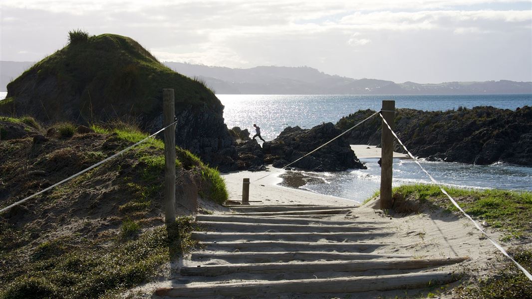
The marine reserve was originally established as a marine park in 1981 and then became a marine reserve in 2011. It is 394 hectares.
Nearby Tāwharanui Regional Park is an ideal location for picnicing and exploring.
The marine reserve runs along the northern side of Tāwharanui Regional Park (on Takatu Peninsula) and is a 90 minute drive north of Auckland.
Tāwharanui Marine Reserve is on the northern coast of the Tawharanui Peninsula in the Rodney District, approximately 90 km (one and a half hours) from Auckland City.
Take State Highway 1 north to Warkworth. Follow the signs to Matakana. Just past Matakana turn right at the Omaha turn off and drive along Takatu Road, following the signs to the Tawharanui Regional Park.
Once you reach the regional park, continue through the predator proof fence to Anchor Bay, where parking is available.
There are no townships or stores nearby so make sure that you bring plenty of food and drinking water.
Do not exceed five knots in a boat or on a jetski within 200 m of the mainland, a dive flag, or within 50 m of a boat or person in the water.
Dogs are not permitted in the Tāwharanui Regional Park or the marine reserve at any time.
Do not light fires on the beach or on the grassy areas.
What to bring
With opportunities above and below the water, prepare for a full day in the sun. Bring good walking shoes, swimming and snorkelling gear, sunblock, sunhat, and plenty of water. Even consider bringing a surfboard or boogie board if the waves are right.
Swim and snorkel safety
If you are not confident in the water, be realistic about your skills and swim only during calm weather or enjoy this place from land.
Check the surf forecast for Tāwharanui and pay close attention to the wind speed and swell height: Tawharanui Surf Forecast. This is a surf forecast and the red/orange/green surfboard rating is not relevant to safe swimming, snorkelling or diving.
We recommended visitors swim or dive in pairs.
Snorkellers are strongly advised to wear a wetsuit or life jacket, or take another flotation device such as a boogie board. This particularly applies to those who are not strong swimmers or used to swimming in the open sea. Beginners should keep near the shore.
The area has been off limits for fishing since 1981, but it was only made a marine reserve in 2011. It sits within the much larger Hauraki Gulf Marine Park. Adjacent to Tāwharanui Regional park, the reserve creates a Mountain to Sea protection for the region.
What makes this marine reserve stand out is the unique geological features. Greywacke rock is exposed forming huge grey-green rocks that are studded with fossils from the Jurassic period. Taking fossils from the reserve is prohibited.
Tāwharanui contains extensive intertidal and subtidal reefs typical of the moderately exposed coast of the outer Hauraki Gulf. About 50 species of fish have been recorded in the reserve, which also supports a thriving population of lobster. Bottle nosed dolphins and orcas often visit the area.
The marine reserve is picturesquely situated alongside sandy beaches and gentle farmland, with some stands of native bush and large regenerating wetlands (outside the reserve).
Tāwharanui was originally occupied by ancient people known as Ngāti Kui, Tūtūmaiao and Tūrehu. A small hapū of the Te Kawerau tribe, called Ngāti Raupō, lived in the area until the 1870s. Tāwharanui was rich in food resources on land and sea, and Ngāti Raupō, Ngāti Manuhiri and related hapū came to the area to fish until well into the 20th century. The cliffs above Waikōkōwai (Anchor Bay) were also a valued source of kōkōwai (red ochre), which was traditionally mixed with oils to make sacred red paint.
After 1870, Tāwharanui was farmed by the Martin, Jones and Young families. Kauri trees were milled for timber and shingle was extracted from the area for 100 years. The former Auckland Regional Authority purchased the land in 1973. A 2.5 km pest-proof fence was constructed across the peninsula in 2004, creating an open sanctuary, in which the Tāwharanui Open Sanctuary Society now carries out restoration work.
Archaeological sites
Many archaeological features have been found near Tāwharanui. These include five pā, terraced hillsides for housing, food storage pits, groves of karaka trees (planted for their edible fruits) and shell middens. Fish bones (particularly snapper) are commonly found in the middens and 18 species of shellfish have also been identified. Some evidence of the nine ships wrecked around the Tāwharanui coastline also remains.
Protect our marine reserves
- No fishing of any kind.
- Don't take or kill marine life.
- Don't remove or disturb any marine life or materials.
- Don't feed fish - it disturbs their natural behaviour.
- Take care when anchoring to avoid damaging the sea floor.
No dogs allowed
To protect our native wildlife, dogs are not allowed anywhere in this place.
DOC Customer Service Centre
| Phone: | 0800 275 362 |
| Email: | auckland@doc.govt.nz |
| Address: | Tāmaki Makaurau / Auckland Office |
DOC Customer Service Centre
| Phone: | 0800 275 362 |
| Email: | warkworth@doc.govt.nz |
| Address: | Mahurangi / Warkworth Office |
