Catchment summary report
The conservation values, issues and priorities for action in the catchment were summarised in a report published in 2019. This information provides useful background information for the restoration work, but is not DOC policy.
Rangitata River catchment conservation values, Instream Consulting 2019 (PDF, 2,090K)
Fine sediment model
A computer model to predict how fine sediment is deposited in the lower part of the river is being developed by a PhD student at the University of Canterbury in partnership with other agencies. The project is exploring the relationship between flow regimes, sediment deposition and effects on biodiversity.
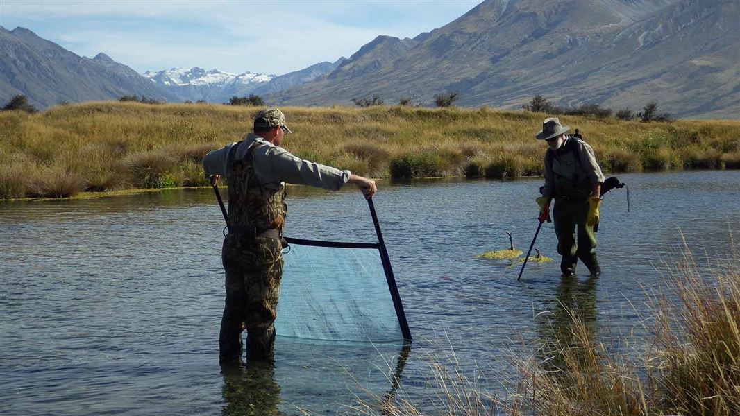
Fish and invertebrate surveys
A survey of the river’s fish and invertebrates was completed in 2018–19. The results were compared with surveys carried out in 1983–84 and found some changes in the fish communities.
An update on fish and benthic macroinvertebrate populations of the Rangitata River (PDF, 1,426K)
A survey of upland longjaw galaxiids (a threatened non-migrating fish) was carried out in the upper river 2020.
Waterways Rangitata upland longjaw report (PDF, 10,999K)
The Rakitaka River is one of the last strongholds of Stokell’s smelt, which have a conservation status of At-risk – naturally uncommon. A multi-year survey of hāpua (lagoons) began in 2020.
PDP Canterbury hapua fish survey – November 2020 interim report May 2021 (PDF, 2,512K)
Watch a video about the survey
South Branch values assessment
Values assessment plan
The values assessment is investigating ways to manage normal flows and floods in the river’s south branch. It includes documenting the values and aspirations of mana whenua and understanding the values of stakeholder and community groups. The information will be used to design potential options for changes to the south branch, supported by technical investigations to gauge their feasibility and impacts.
Historical and current flows in the south branch
Historically, the Rakitata River split into two main channels between Arundel and State Highway 1, separated by Rangitata Island. The channels are known as the north and south branches. All existing records show most of the flow in the north branch, but the south branch flows during larger floods.
Environment Canterbury’s flood protection work includes erosion control planting and low stopbanks. It is designed to prevent flows of less than 1,500 cubic metres per second in the south branch, which are estimated to occur every 5 years on average.
Flood-prone land in the south branch and on Rangitata Island has been developed for agriculture in the last 20 years. This has increased land values and put pressure on Environment Canterbury to keep floods out of the south branch. However, it has also significantly reduced the natural values of the river.
Te Rūnanga o Arowhenua have long held that the south branch of the river must be restored to a natural system to restore the awa as a whole system, ki uta ki tai – from mountains to sea.
Spatial tool development
The agencies involved in this programme need a common tool to hold the database of the historical and upcoming works in the area. This will facilitate planning, consents granting and progress updates across agencies.
Toitū te Whenua Land Information New Zealand is developing a fit-for purpose geospatial tool to serve as a single source of information for the project partners to use, on the historical and upcoming works and to analyse data gaps.
Other research projects
- Water balance and LiDAR mapping to establish riverbed levels.
- 2D modelling of various flows.
- Building understanding of sedimentation at variable flow rates.
- Berm and fairway widths review and maintenance.
- River mouth openings.
- Assess river health using tools in development by Ngā Awa, which may include cultural monitoring tools.