The Whangarei Harbour Marine Reserve protects 237 hectares and is made up of Motukaroro (Aubrey/Passage Island) near Reotahi, and an intertidal mudflat/mangrove environment at Waikaraka.
Boundary markers and signs
View the Whangarei Harbour Marine Reserve brochure (PDF, 1,200K) for an overview of the boundaries and the various boundary markers.
Shoreline boundary markers and floating boundary buoys, both visible from the water, mark the physical boundaries.
Information signs are posted on land at a number of sites and boat ramps around the harbour. These signs outline the rules and regulations relating to the reserve.
Maps
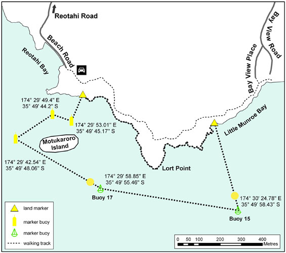
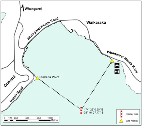
Maps of the Motukaroro and Waikaraka reserves provide GPS coordinates of the floating boundary markers:
Map of Motukaroro with GPS points (WGS 84)

Download an A4-size version of the Motukaroro map (PDF, 1,407K)
Map of Waikaraka with GPS points (WGS 84)

Download an A4-size version of the Waikaraka map (PDF, 389K)