You can get to the park from:
Mōtū township: Follow the signs from the Matawai township (located on SH2 between Gisborne and Ōpōtiki)
Ōpōtiki: Follow SH35 to the Old Mōtū Road turnoff which heads inland to Toatoa. From here follow the Takaputahi Road to the park boundary.
East West Traverse
This is a route through the Raukumara conservation area. It is not maintained and marking is minimal. If you choose to walk the traverse you will need to have excellent navigational skills and experience in remote locations.
Safety
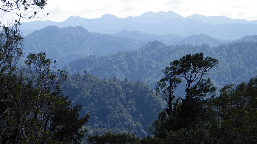
The park covers 115,000 hectares of extremely rugged bush-clad land. Visitors should be experienced and capable in the outdoors and be prepared for sudden weather changes, cloud whiteouts and high winds on the ranges and rapidly rising water levels in rivers and streams. River levels in the area may be slow to drop.
Fires
Extreme fire conditions can exist during summer. The park is a restricted fire area, which means permits to light fires are required all year round.
Dogs
Only registered, avian aversion certified hunting dogs, guide dogs, companion dogs (certified by the Top Dog Companion Trust) and dogs used for special services (including conservation management activities) are permitted in the park. All other dogs are banned.
The park is almost entirely in forest, apart from tussock grasslands and herbfields on the peaks of Whanokao and Hikurangi. The forests include a wide range of podocarp-broadleaved species like rimu, rata, tawa, hinau, rewarewa, kamahi, kahikatea, miro, beech and totara. There is an important wetland area at Lake Mangatutara and bogs in the Mangawaru area.
Three main river systems flow west into the Bay of Plenty the Mōtū, Raukokore, and Haparapara / Kereu Rivers. The unspoilt Mōtū River is fully protected by a national water conservation order and is well used by whitewater rafters, fishermen and other recreational users.
Many native birds and animals are found in the area. As well as common native bush birds like fantails and tui, more rare species such as blue duck/whio, kaka, falcons and kereru are also found. There is also a wide variety of animals found including native snails, lizards, skinks, freshwater frogs and bats.
Introduced animal species include deer, goats, possums, pigs, cattle and mustelids which all pose threats to native plants and animals.
Inside the park is the 39,650 ha Raukumara Wilderness Area. The area is located in the central region of the park to the northeast of the Mōtū River. Although the area is not closed to recreational visitors it is managed specifically for its conservation values and therefore no recreational facilities are maintained within it.
Mount Hikurangi
Mount Hikurangi is the highest peak (1,752 m) in the Raukumara Range. It's recognised as the first point on the mainland to greet the morning sun.
The summit comprises the northern-most extent of alpine vegetation in New Zealand. The alpine plants include large buttercups (Ranunculus spp.), prickly wild spaniards (Aciphylla spp.) and other alpine shrubs and delicate herbs.
Of particular interest is the small subalpine Hikurangi tutu (Coriaria pottsiana) which is only known from the grassy scree slope behind the tramping hut. Treat all plants on Mount Hikurangi with care.
The Raukumara Conservation Park has a long history of human association. It contains the rich history of a number of iwi and affiliated hapu who have occupied and continue to maintain mana whenua on all flanks of the ranges. Ngati Porou, Te Whanau-a-Apanui, Te Ehutu, Ngai Tai, Whakatohea and Te Aitanga-a-Mahaki are iwi who have historically had a powerful influence in the region.
Waiata (songs), whakapapa (genealogy) and pakiwaitara (legends) embody and convey the history of their occupation, and the importance of the Raukumara both as a mahinga kai (cultivation) area, and as a major thoroughfare for missions of peace and war between iwi. Occupation and associated historic activities are captured in the names of key geographical features of the region.
There is archaeological evidence of cultivation on river terraces and various pa sites, including the Hungahungatoroa Pa. Tracks traversing the Mangatutara and Raukokore Rivers and indicative of the use of the area as a thoroughfare between the eastern coast and the Ōpōtiki and Whakatane area. It is also likely that waka were taken up the Mōtū River to the Mangatutara Stream.
Some of the rivers and other areas were surveyed in the 1870s, but many areas remained largely unexplored. Bush clearing and logging for farming began in the late 1800s. There have been few attempts to permanently settle in the ranges due to their remote and rugged nature.
Mount Hikurangi
Mount Hikurangi is revered by the Ngati Porou tribe as its sacred mountain. For them Mount Hikurangi is the resting place of Nukutaimemeha, the waka (canoe) of Maui, who is said to have fished up the North Island of New Zealand.
To Ngati Porou, Mount Hikurangi was and is an integral part of their traditions and history. The association of the people and the mountain is recorded in waiata (song), haka (war dance), whakatauaki (tribal proverbs) and karakia (incantations).
DOC Customer Service Centre
| Phone: | 0800 275 362 |
| Email: | gisborne@doc.govt.nz |
| Address: | Tūranganui-a-Kiwa / Gisborne Office |
