Gold fossicking
Introduction
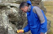
Find out about recreational gold fossicking (including gold panning) in New Zealand.Gold fossicking is the activity of collecting gold by a stream or river using pans, shovels, and sluice boxes.
You can do this in designated public gold fossicking areas. There is a low concentration of alluvial gold (found in soil usually around rivers and streams) within all the gold fossicking areas.
On this page:
Designated public areas where you can fossick for gold
New Zealand Petroleum and Minerals (NZPAM) has set aside designated gold fossicking areas under the Crown Minerals Act 1991. At these public sites, you can freely enjoy recreational gold mining without a permit. They include sites administered by DOC.
Use the NZPAM maps to see exactly where these designated areas are. Search for an area using the permit number from the following table.
| Gold fossicking area | Permit number | Location | Operator |
|---|---|---|---|
| Aorere River A (GFA 13) | 42013 | Nelson/Tasman – Kahurangi National Park | NZPAM |
| Aorere River B (GFA 14) | 42014 | Nelson/Tasman – Kahurangi National Park | NZPAM |
| New Creek (GFA 15) | 42015 | Nelson/Tasman – Glenhope Scenic Reserve | NZPAM |
| Louis Creek (GFA 12) | 42012 | Nelson/Tasman – Glenhope Scenic Reserve | NZPAM |
| Lower Louis Creek | 55529 | Nelson/Tasman – Glenhope Scenic Reserve | Tasman District Council |
| Jones Creek (GFA 4) | 42004 | West Coast – Ross area | NZPAM |
| Jones Creek (GFA 5) | 42005 | West Coast – Ross area | NZPAM |
| Lyell Creek (GFA 6) | 42006 | West Coast – Lyell area | NZPAM |
| Britannia Stream (GFA 7) | 42007 | West Coast – Denniston area | NZPAM |
| Nelson Creek (GFA 10) | 42010 | West Coast – Greymouth area | NZPAM |
| Waiho River (GFA 11) | 42011 | West Coast – Westland Tai Poutini National Park | NZPAM |
| Slab Hut Creek (GFA 30) | 42030 | West Coast – Victoria Forest Park | NZPAM |
| Moonlight Creek | 42031 | West Coast – Southern Paparoa range | DOC |
| Shamrock Creek | 53804 | West Coast – Goldsborough (Waimea) - Kumara area | NZPAM |
| Twelve Mile Creek (GFA 20) | 42020 | Otago – Queenstown area | NZPAM |
| Five Mile Creek (GFA 21) | 42021 | Otago – Queenstown area | NZPAM |
| Arrow River (GFA 22) | 42022 | Otago – Queenstown area | NZPAM |
| Shotover River (GFA 23) | 42023 | Otago – Queenstown area | NZPAM |
| Gabriels Gully (GFA 33) | 42033 | Otago – Gabriels Gully Historic Reserve | NZPAM |
* Permit data from the NZPAM website
You need a permit for other areas
If you want to fossick for gold outside of the designated gold fossicking areas, you'll need permission from NZPAM. Contact nzpam@mbie.govt.nz.
If this area is on public conservation land, you might also need a permit from DOC. See a map of public conservation land.
Rules on gold fossicking
- Only fossick for gold in the allowed area – use the detailed NZPAM maps.
- Only use non-motorised hand tools. This may include:
- pick
- shovel
- pan
- metal detector
- riffle/sluice box – there may be size restrictions in some areas.
- Stay within the active creek bed.
- Never use explosives.
- Restore the ground as you found it.
- Do not disturb any animals, vegetation, historic site, or place of cultural significance.
- Know the statutory regulations.
Know before you go
- If you need to cross private land, you have to get permission from the landowner first.
- Only drive on formed roads or tracks open to the public.
- Be aware of sudden river rises from heavy rain or hydro dam controls.