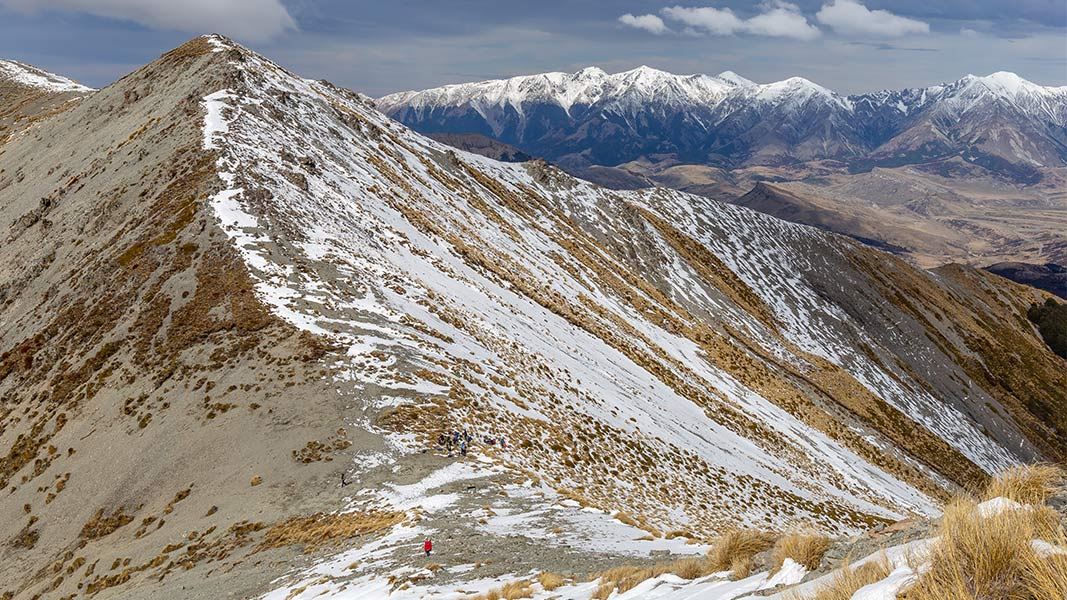
Camp Saddle
Camp Saddle Track

Located in Craigieburn Forest Park in the Canterbury region

An access track leads to Camp Saddle. From here, experienced backcountry trampers can explore untracked terrain.

There are avalanches in this area in winter and early spring (May-November). We recommend choosing another track at these times.

Camp Saddle Track

The track from Broken River ski field road is the easiest way to get to Camp Saddle. From the locked gate and carpark where the road crosses Camp Stream, walk 1 km to the signposted track (opposite the ski club tractor shed).

A wide four-wheel drive track narrows as it climbs steadily towards the saddle. It passes through beech forest then emerges into open tussock, and poles mark the route to Camp Saddle. The climb to the saddle generally takes 1-2 hours.

Going beyond Camp Saddle

There are no tracks or marked DOC routes beyond Camp Saddle. It is best suited for experienced backcountry trampers, who have good gear and are confident navigating in untracked terrain (including using a map and compass).

Camp Saddle to Lyndon Saddle (no track)

Time: 1 - 2 hr one way

From Camp Saddle, trampers can navigate themselves to Lyndon Saddle by continuing southeast along the well-defined ridge. After an hour descend steeply down a scree slope. Stay on the left of the scree to join an unmarked track through the beech forest to Lyndon Saddle. It is much easier to go down scree than scramble up it, so this trip is better done as a descent.

Camp Saddle to Craigieburn Edge Track (no track)

Time: 2 hr one way

You can descend from Camp Saddle down soft scree and tussock to Craigieburn Edge Track. It is also possible to ascend to Camp Saddle this way.

To access Camp Saddle Track, follow Broken River Road. This road is about 110 km from Christchurch on State Highway 73 towards Arthur’s Pass and is a signposted side-road to Mistletoe Flat, the Environmental Education Centre and Broken River ski field.

Follow Broken River Road until you reach the locked gate and carpark where the road crosses Camp Stream, then walk 1 km to the signposted track (opposite the ski club tractor shed).

Decide whether you have the skills for untracked areas

The untracked terrain beyond Camp Saddle is best suited to experienced trampers, who are confident navigating and can judge the risks of the terrain and choose an appropriate route. This includes judging the danger presented by avalanches and rockfall.

Carry a map and compass. NZtopo50 maps BV20 (Otira), BV21 (Cass), BW20 (Lake Colleridge), BW21 (Springfield) cover the Craigieburn Forest Park.

There are avalanches in winter and spring

When there is snow on the steep slopes above this track, there can be avalanches that cross the track, including when the track is in the bush. This is most common in winter and early spring. Even if there is no snow where you are walking, if there is snow higher up then there can still be avalanches.

We recommend walking this track at times of year with no snow, which is generally summer and early autumn.

If you are considering walking this track when snow is present on the upper slopes, check the NZ Avalanche Advisory for Craigieburn Range.

Be ready for extreme weather

This is a mountain tramp and people should be prepared for extremes of weather. Always check the forecast before you go.

Carry warm layers, a waterproof raincoat and sun protection. Find packing lists here.

Expect wasps, especially in summer and early autumn

Wasp populations reach high numbers from January to March – wear light coloured clothing and carry antihistamine cream/tablets as a precaution.