This track is for experienced trampers only. It is poorly marked and requires navigation skills and a map. Numerous search and rescue responses have occurred recently due to trampers getting lost.
The Know before you go section of this page has more information.
8.3 km one way
Image gallery
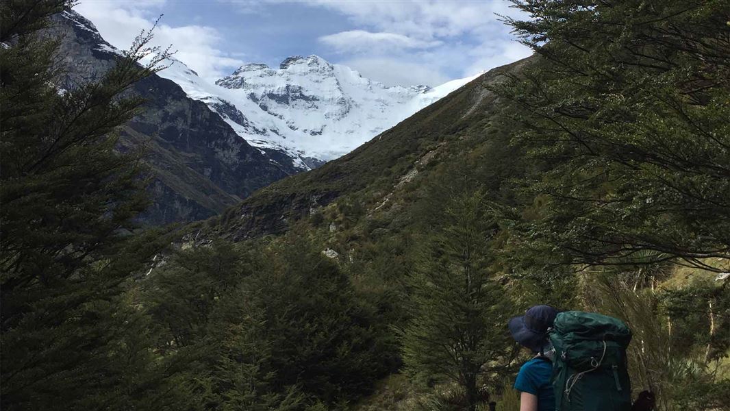
Follow the Earnslaw Burn Track through the bush to a viewpoint. This viewpoint has impressive views of an icefall on Mt Earnslaw/Pikirakatahi at the edge of the forest where the track ends. For shelter an overhanging rock is just within the forest on the true right, looking downstream, of Earnslaw Burn.
River crossing and route finding experience is essential. There is also windfall and slips along the track that you need to get over.
The track starts on the true left bank of the Earnslaw Burn partway along Lovers Leap Road, a right turn off the gravelled Glenorchy - Paradise Road, 20 minutes from Glenorchy.
Camping
Camping is allowed on the public conservation land at the forest edge or Rock bivvy. Camping is not allowed on the private land in the upper valley.
Be prepared
Earnslaw Burn Track does not have any toilet facilities, plan accordingly.
Poo in a loo – and be prepared for when there isn’t one
Hazards
This area is subject to severe weather events, flooding, frost/snow and extremes of temperature.
This is a challenging track which is not recommended for young children.
- This track is difficult to find in places – you will need strong track finding skills
- There can be extensive windfall along this track which may slow your progress
- Numerous slips along Earnslaw Burn Track. Expect longer walking times.
- The river crossing to get to the bivvy is dangerous in heavy rain
- There is no toilet on the track. What to do if there's no toilet.
- There is no mobile phone coverage in this area.
Completing the track in a day
If plan to complete the Earnslaw Burn track in a day, you need to consider:
- day light hours – check NIWA Weather: Harris Saddle for sunrise and sunset times
- whether you have the necessary fitness and navigation skills
- bringing a communication devices (PLB).
It is a very long day walk. When tiredness and darkness set in, navigation is difficult.
The DOC managed track finishes at the forest edge. The waterfalls are an added 1 hours’ walk one way further up the valley, and not part of the official track. The way is overgrown with speargrass. Anything above the forest is not included in the track time of 4-6 hours (one way).
Alternative hikes
If you do not have the necessary experience, fitness or gear, consider walking day walk tracks instead:
If you have the fitness and gear, consider hiking this track instead:
Stay safe when crossing rivers
If you plan to cross unbridged rivers, know how to cross safely and be prepared for if you cannot cross.
Do not cross if the river is flooded, you cannot find safe entry and exit points or are unsure it’s safe. Turn back or wait for the river to drop. If in doubt, stay out.
NIWA river flow forecasts: View a video of national followed by regional river flows
Nature's in trouble
Thousands of New Zealand’s native species are heading towards extinction. Once they’re gone, they’re gone for good. Nature needs your help.
Stay safe in the outdoors
- Choose the right trip for you. Learn about the route and make sure you have the skills for it.
- Understand the weather. Check weather forecasts.
- Pack warm clothes and extra food. Check gear lists.
- Share your plans and take ways to get help. Leave your intentions with a trusted contact and take a distress beacon.
- Take care of yourself and each other.
Whakatipu-wai-Māori/Queenstown Visitor Centre
| Phone: | +64 3 442 7935 |
| Email: | queenstownvc@doc.govt.nz |
| Address: |
50 Stanley Street |
| Hours: | Visitor centre hours and services |