10.5 km loop
From the road end car park, walk to the swing bridge to cross the Kauaeranga River. Take the first track on your right which leads you for 5 minutes to Billygoat Landing. Here you see good views of the Billygoat Falls (180 m high).
Follow the track to the Webb Creek – Moss Creek junction. Follow the Webb Creek Track to Hydro Camp (1 hr 30 min – 2 hr).
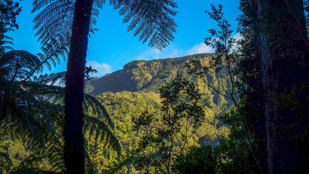
From the Hydro Camp junction, take the Billygoat Track where a steady 30 minute climb leads to a saddle with excellent views down the Kauaeranga Valley to the Hauraki Plains. A little further on, a knoll overlooks the Billygoat Basin. The first attempt to log this basin was made in the 1880s but was abandoned within a few years as driving logs down the Billygoat Falls proved too destructive. The basin was successfully logged in the 1920s after the construction of the Billygoat incline to bypass the falls, and the use of a steam hauler.
Dropdown into Billygoat Basin and cross a bridged stream before passing through Billygoat Basin Campsite.
A few minutes further on, a 50 m side track overlooks the site of a collapsed long trestle bridge, once part of the bush tramline. The trestle was 160 m long and 11 m above the ground at the highest point.
Back on the main Billygoat walking track, pass the junction for the Tarawaere and Hihi tramping tracks and follow the tramline through deep cuttings past two short trestles. Near the hauler site at the top of the incline there are good views of Billygoat Falls (180 m). From here it is another 40 mins downhill to the Kauaeranga Valley Road which requires crossing the Kauaeranga River to the Tarawaere car park. Walk 300 m north along the road to get back to the road end car park.
For a longer day or overnight walk, continue on the Kauaeranga Kauri Trail (Pinnacles Walk).
Note that parts of Billygoat Circuit are steep, unformed and extremely slippery. There is an unbridged river crossing at the bottom of the track which may be uncrossable depending on weather.
From SH25 at the southern entrance to Thames, turn right into Banks Street beside the service station. Banks Street veers right into Parawai Road, which then becomes Kauaeranga Valley Road.
Follow this for 13 km to the Kauaeranga Visitor Centre.
The road continues unsealed a further 9 km to the road end. Most of the walks start from various points along this part of the road.
Heavy rain floods the track and access road
The track and access road flood during large storms and heavy rain. This can happen at any time of year but is most common in Spring.
We strongly advise that you do not attempt to walk the track or drive the road at these times.
Check the weather for Pinnacles Hut
Take care when crossing streams and rivers
There are unbridged streams and an unbridged crossing of the Kauaeranga River (you need to wade across the river) on the Billygoat Circuit. These can be dangerous during/after heavy rain – we recommend not crossing the river or using the track at these times.
Assess the streams and river carefully before crossing and if in doubt, stay out. Learn about river crossing on the MSC website, including the signs of an unsafe river.
The track is very slippery
Parts of the Billygoat Circuit are down to the clay level and can be very will be slippery. You need sturdy tramping boots with good grip. Sneakers are not suitable.
There are some narrow sections of that have steep drops beside them and become very slippery when wet. This means it is best to save this track for dry weather and choose an alternative during rain.
Pack well, even for a day walk
Be ready for all weather by carrying warm layers, a waterproof raincoat, sun protection and 3L of water per person (the hut supply can run dry).
The track is extremely slippery in places, so you need sturdy shoes with good grip. Sneakers are not suitable for this track.
For an overnight trip, find a packing list here.
The Billygoat Circuit is a long day walk. You need everything on the day hikes packing list. Leave early and pack a torch in case the track takes longer than planned.
Pack a communication device, a distress beacon is best.
Know the alternative tracks
The Webb Creek Track is an easier walk up to the Pinnacles Hut and does not require a crossing of the Kauaeranga River. How to do the Webb Creek Track.
Cookson Kauri Walk is a good wet weather alternative.
Stay safe in the outdoors
- Choose the right trip for you. Learn about the route and make sure you have the skills for it.
- Understand the weather. Check weather forecasts.
- Pack warm clothes and extra food. Check gear lists.
- Share your plans and take ways to get help. Leave your intentions with a trusted contact and take a distress beacon.
- Take care of yourself and each other.
Kauaeranga Visitor Centre
| Phone: | +64 7 867 9080 |
| Email: | kauaerangavc@doc.govt.nz |
| Address: | 995C Kauaeranga Valley Road Thames 3577 |
| Hours: | Visitor centre hours and services |