2 km loop
Image gallery
This is a Tohu Whenua heritage site. Located in stunning landscapes and rich with stories, these sites offer some of our best heritage experiences.
About the walk
- Historic Denniston Incline railway
- West Coast coalmining heritage
- Mostly flat walk on gravel tracks
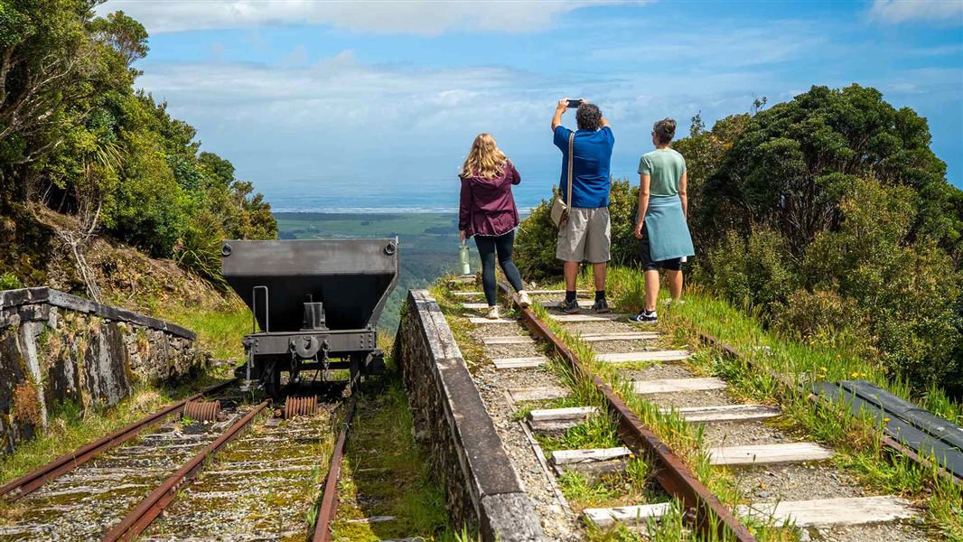
Denniston Brakehead is the name for the area at the top of the Denniston Incline – a marvel of 1800s engineering.
The incline operated between 1880 and 1967. It brought wagons of coal down from the Denniston Plateau to the base of the hill – a dizzying drop of 518 m. At the time of its construction, it was one of the world’s steepest railways.
This wild and remote place was once home to 1,500 people.
Today, you can explore Denniston’s heritage on family-friendly walking tracks. Richly detailed information panels tell the fascinating stories of this place and the people who lived here.
Lower car park to Denniston Incline viewpoint
5 min / 150 m (return)
Wheelchair accessible short walk
Accessible access to the Denniston Incline viewpoint starts at the lower car park, where there’s mobility parking. Alternatively, there’s walking access from Denniston Brakehead Walk.
The track begins at the lower car park shelter. The shelter has information about the construction and operation of the incline.
A gravel track with boardwalk sections leads to the viewing platform. Enjoy views out over the famous incline and, on a good day, the Tasman Sea.
Return to the shelter the same way you came.
Denniston Brakehead Walk
1 hr / 2 km (loop)
Easy short walk
Denniston Brakehead Walk starts at the main Denniston car park, by the large shelter.
The track descends from the car park down to the top of the incline. Here, you’ll find remains of the historic brakehouse and other coalmining relics.
Take a side trip to the incline viewpoint, then follow the marked track to the site of Denniston’s first settlement, ‘The Camp’. The settlement once hosted a library, school, hotel and butchery. Today, there’s regenerating native forest.
Follow the signposted track to take a side trip to Banbury Arches (15 min return).
This impressive drystone bridge was built by Cornish stonemasons in 1878. It crossed a steep rock bluff to provide tramway access to Banbury Mine – the area’s first commercial coalmining operation.
The loop track takes you back to the car park via the historic ‘rope road’ haulage system, coal workshops and powerhouse.
Directions
Denniston is a former coalmining town high up on the West Coast’s Denniston Plateau. It’s 26 km (30 min by car) from Westport.
From Westport, follow SH67 to Waimangaroa. Turn right at the junction with McGill Street and follow the signs to Denniston Historic Coalfield Area.
Continue past the sign at the junction of Conns Creek Road, which leads to the bottom of Denniston Bridle Track. It’s another 8 km from here up a steep and winding sealed road to Denniston.
At the junction with Boswell Street, turn left to reach the main Denniston car park.
Parking
Denniston car park has:
- free parking for cars and campervans
- no marked mobility spaces.
Lower car park
There is limited parking at the lower car park for visitors with accessibility requirements.
Follow Boswell Street past the turnoff to the main car park. The sealed road becomes a gravel road.
Park at the flat gravel area near the shelter leading to Denniston Incline viewpoint.
Safety and hazards
Historic structures: Denniston is a heritage area with historic structures and closed mines. Follow all safety signs, keep children close and watch your step.
When to go
- Denniston Plateau is a subalpine environment with rapidly changing weather. It can be cold and wet at any time of year and is often foggy, even when it’s fine on the coast.
- Check the weather forecast before you go, and be prepared.
Plan your visit
- Bookings are not required for Denniston Brakehead Walk.
- Toilets and an accessible toilet are located at Denniston car park.
- Drinking water is not available. Bring your own.
- Picnic tables are provided at Denniston car park. There is seating at the lower car park shelter.
- Food and petrol can be found in Westport (30 min by car). There are no shops in Denniston.
- Mobile phone coverage is often unavailable.
What to take
Care for nature
- No rubbish bins are provided. Take your rubbish with you.
- Gold fossicking is only permitted in designated areas.
Gold fossicking areas and rules
No mountain biking
Mountain bikes are not permitted on Denniston Brakehead Walk.
For mountain biking nearby, see Denniston Plateau mountain biking tracks.
Denniston Plateau is home to many rare and threatened native ecosystems and species, including giant carnivorous land snails and the West Coast green gecko.
Birds
On Denniston Brakehead Walk, you might see or hear:
- weka
- kea
- New Zealand pipit/pīhoihoi
- New Zealand robin/toutouwai
- rifleman/titipounamu
- fernbird/mātātā.
Great spotted kiwi/roroa
If you’re here at dusk, you might hear great spotted kiwi/roroa calling. Roroa are the largest kiwi species. They only live in the top half of the South Island.
Plants
On Denniston Brakehead Walk, you’ll pass through:
- low podocarp-beech forest
- mānuka and Dracophyllum scrub.
In mid and late summer, southern rātā flower bright red.
For many decades, Denniston was New Zealand's largest producing coal mining area. This wild and remote township was once bursting with life and pioneering spirit.
Today, Denniston is a Category 1 Historic Place and Tohu Whenua heritage site. Remains of homes, buildings and industrial structures are an evocative reminder of life on ‘The Hill’.
Nature's in trouble
Thousands of New Zealand’s native species are heading towards extinction. Once they’re gone, they’re gone for good. Nature needs your help.
Paparoa National Park Visitor Centre
| Phone: | +64 3 731 1895 |
| Email: | paparoavc@doc.govt.nz |
| Address: | 4294 Coast Road Punakaiki RD 1 Runanga 7873 |
| Hours: | Visitor centre hours and services |