23 km one way
The access via Roys Peak Track is closed for lambing from the 1 October - 10 November inclusive.
Image gallery
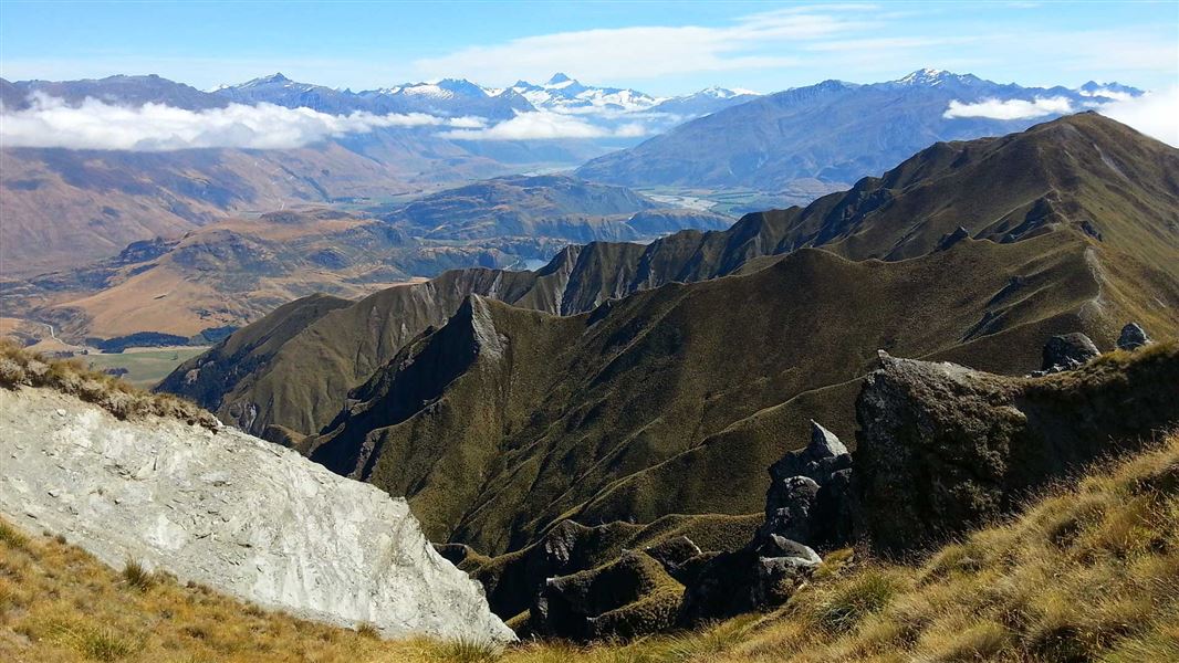
This strenuous hike begins with the track to Roys Peak (1578 m), leading through farmland and up into the tussock tops.
From the peak, the Skyline track becomes more remote, narrower, and greater concentration is required. At several points, faint animal tracks lead away from the track, so follow the orange poles carefully to stay on the right track.
The track follows the ridgeline towards Mt Alpha (1630 m). Shortly before Mt Alpha, the track skirts around some rocks. This section is technical and narrow, with a steep drop off on one side, and requires care when crossing. It is loose underfoot and is particularly treacherous in wet, icy, or snowy conditions.
From Mt Alpha, the track descends through snow tussock to a 4WD farm track, before reaching a signed junction. A poled track from this junction drops down into Spotts Creek then out to the Cardrona Valley Road and carpark.
There are several creeks and bogs to cross in the last 5 km of the track. Take care after very heavy rain.
The Skyline Track can be walked in either direction.
The track starts at the Roys Peak Track carpark on the Mt Aspiring road, 6 km from the Wanaka township. It ends on the Cardrona Valley Road,10 km from Wānaka township (look for a small carpark next to a deer fence at Spotts Creek).
Skyline Track in summer
This track has no shade along much of the route and no drinking water. We recommend starting early in the day and bringing sun protection and plenty of water.
There can be bad weather, strong wind gusts and low visibility at any time of year. Check the Mount Aspiring National Park weather forecast – NIWA website and reschedule your hike if there's poor weather. Be sure to check the wind gusts when checking the forecast.
Skyline Track is not recommended in winter
Low cloud is common in winter and makes it hard to follow the track. There can also be snow and ice on the track in winter, which makes the narrow and high sections of the track much more difficult.
What to take when hiking Skyline Track
This track is fully exposed to the weather, especially on the ridgelines. Be prepared for fast-changing weather by having warm, waterproof, windproof clothing, sun protection, and sturdy footwear with good grip. You cannot buy food or water on the track, bring plenty with you. Day Hikes gear list.
This track is prone to low cloud and is not recommended in poor weather or during the winter.
There is no water or shade along the majority of this track.
Safari hunting takes place on Spotts Creek Station. Be alert and stay visible, especially during the March to May roar.
Access from Spotts Creek crosses private land, firearms are not permitted on this track.
Avalanche risk
This area has terrain that can produce avalanches that cross the track, usually from May into November. View avalanche information.
Private property and permissions
This track crosses private land. There is no camping until the conservation area boundary.
Respect the landowner's livestock and property:
- stay on the marked track until you reach the conservation land
- leave gates as you find them
- use stiles where provided
- keep your distance from livestock.
Responsible camping practices are essential if camping in this area. Be responsible with your waste (including human). Carry in, carry out. Leave no trace. There is no water supply or toilet facilities in the conservation area.
Stay safe in the outdoors
- Choose the right trip for you. Learn about the route and make sure you have the skills for it.
- Understand the weather. Check weather forecasts.
- Pack warm clothes and extra food. Check gear lists.
- Share your plans and take ways to get help. Leave your intentions with a trusted contact and take a distress beacon.
- Take care of yourself and each other.
Wānaka Tititea/Mount Aspiring National Park
Visitor Centre
| Phone: | +64 27 269 6871 |
| Email: | wanakavc@doc.govt.nz |
| Hours: | Visitor centre hours and services |