There are two tools to help you assess avalanche danger:
- New Zealand Avalanche Advisory (NZAA) - based on the stability of snow and changes with the weather.
- Avalanche Terrain Exposure scale system (ATES) - based on terrain and does not change with the weather.
Anytime that snow and steep slopes are combined there is potential for an avalanche.
New Zealand Avalanche Advisory (NZAA)
The best way to understand the avalanche danger is the Southern Lakes area is to check the New Zealand Avalanche Advisory (NZAA). The NZAA provides daily assessments of avalanche likelihood at different elevation bands and aspects, primary and secondary dangers, along with recent avalanche activity, current snowpack conditions and mountain weather. The NZAA is also available at DOC visitor centres.
The NZAA is provided by the Mountain Safety Council (MSC) as an advisory only. We recommend you also the Southern Lakes weather forecast and Mt Aspiring National Park weather forecast as part of your trip planning.
Avalanche Terrain Exposure Scale (ATES)
The Avalanche Terrain Exposure Scale (ATES) rates avalanche terrain based on the angle and shape of the ground or the number of established avalanche paths.
How ATES applies in Wakatipu and Wānaka
Routeburn Track
Avalanche paths exist on the Routeburn Track between Routeburn Flats Hut, Harris Saddle and Howden Hut.
Avalanches on the Routeburn Track are managed by DOC staff during the Great Walks season (late October to the end of April).
Avalanches on the Routeburn Track are not managed outside of this period, so users need to inform themselves of the ATES and New Zealand Avalanche Advisory (NZAA) current conditions before departure.
Other tracks
Many other tracks (eg, Rees/Dart, Greenstone, West Matukituki Valley, Cascade Saddle and Gillespies Pass) have avalanche paths that reach the valleys. This activity can occur in the winter, spring and early summer.
These tracks are not managed for their avalanche risk so users need to inform themselves of the ATES and NZAA current conditions before departure.
ATES ratings for public conservation land in Wakatipu and Wānaka
You need to have the right level of experience to safely travel simple, challenging or complex terrain. To find out what experience is needed for each, check our avalanche safety page.
Simple
- Routeburn Roadend to Routeburn Flats Hut
- The lower Dart Track as far as the confluence with the Whitbourn River, just below Dart Hut
- The lower Rees Track as far as the last 1.5km before Shelter Rock Hut
- Gillespie Pass Track from lower Young Valley to Young Hut.
- Gillespie Pass Track from Siberia Hut to Gillespie Stream confluence.
- Lower Wilkin Valley track as far as the Siberia Stream confluence (Kerin Forks) and then on to Siberia Hut.
- The Caples Track
- The upper part of the Greenstone Track above Greenstone Hut
- Rob Roy Track from Rob Roy Swingbridge to Lower Lookout.
- Kopuwai Conservation Area
- Remarkables Conservation Area (Upper Nevis only)
- Oteake Conservation Park - Upper Manuherikia including Mt St Bathans Range
- Oteake Conservation Park - Hawkdun Range (excluding southern faces)
- Oteake Conservation Park - Ida Range (excluding Deep Ck & Near undaunted Ck)
- Oteake Conservation Park - St Marys Range (excluding Mt Domett/Little Mt Domett)
- Bendigo CA (excluding Devil’s Creek catchment)
- Pisa CA Western side (watch for steep sided gullies)
- Neinei I Kura CA (southern end)
- Lauder CA (excluding southern end)
- Rock and Pillar CA (Northern end and on top)
- Wills Valley from road end to Wills hut
- Makarora Valley from road end to Makarora Hut on track
- Hunter Valley floor from Lake Hawea to Forbes Hut
- Scrubby Flat Creek track to maintained track end
- Long Flat Creek track to maintained track end
- Sawyer Burn Track to Bushline
- Boundary Creek track to track end
Challenging
- Routeburn Flats to Routeburn Falls Hut (there are avalanche paths across this section of track which are unable to be avoided. Do not stop when passing side valleys or under steep terrain)
- The Dart Track from the Whitbourn River confluence to the Dart Hut (there are avalanche paths across this section of track which are unable to be avoided. Do not stop when passing side valleys or under steep terrain).
- West Matukituki Valley between Rough Creek (just beyond Aspiring Hut) and the intersection with the Liverpool Track.
- The lower Greenstone Track before Greenstone Hut (there are avalanche paths across this section of track which are unable to be avoided. Do not stop when passing side valleys or under steep terrain).
- Oteake Conservation Park - Southern faces, Hawkdun Range
- Oteake Conservation Park - Mt Domett/Little Mt Domett (part St Marys Range)
- Matatiaho CA
- Devil’s Creek catchment (Bendigo CA)
- Pisa CA Eastern faces and Colour Burn catchment.
- Lindis CA
- Neinei I Kura CA (northern end)
- Lauder CA (southern end)
- Rock and Pillar CA (generally on East faces)
- Roy’s Peak track above 1000m
- Grandview Ridge (simple on top but must travel through challenging terrain to reach top)
- Corner Peak track
- Above Moonlight and Roses Hut
- Sawyer Burn track above bush line
- Dingle Burn between bush line above Top Dingle Hut and Ahuriri Valley floor
- Timaru River above Timaru Hut
- Glen Dene ridge track above 1000m
- Melina Ridge track above 1000m
Complex
- Routeburn Falls Hut to the Harris Saddle
- Rees/Dart Track for the final 1.5km before Shelter Rock Hut, when travelling up the Rees track
- Rees/Dart Track between Shelter Rock Hut and Dart Hut
- Cascade Saddle Route
- Upper West Matukituki Valley from the bridge at the beginning of the Liverpool Track to the head of the valley.
- Gillespie Pass Track between Young Hut and Gillespie Stream.
- Above the Siberia Valley bushline on the way to Crucible Lake.
- Upper East Matukituki over Rabbit Pass to Top Forks Hut in upper Wilkin Valley
- Wilkin Valley North Branch beyond Lake Diana.
- Above Brewster Hut to the summit of Mount Armstrong and access to Brewster Glacier.
- Rob Roy Track above the Lower Lookout to end of the formed track.
- Oteake Conservation Park - Part Ida Range (Deep Creek/Near Undaunted Ck
- McKerrow Range (Hawea CA)
- Young Range (Hawea CA)
- Shotover CA (upper Shotover Saddle route)
- Lindis CA some broad basins
- Rumbling Burn CA
- Albert Burn CA excluding end of marked track in valley
- Mount Alta CA
- Stack CA
- Black Peak CA
- Motatapu CA
- Hawea CA excluding other named areas
Avalanche season
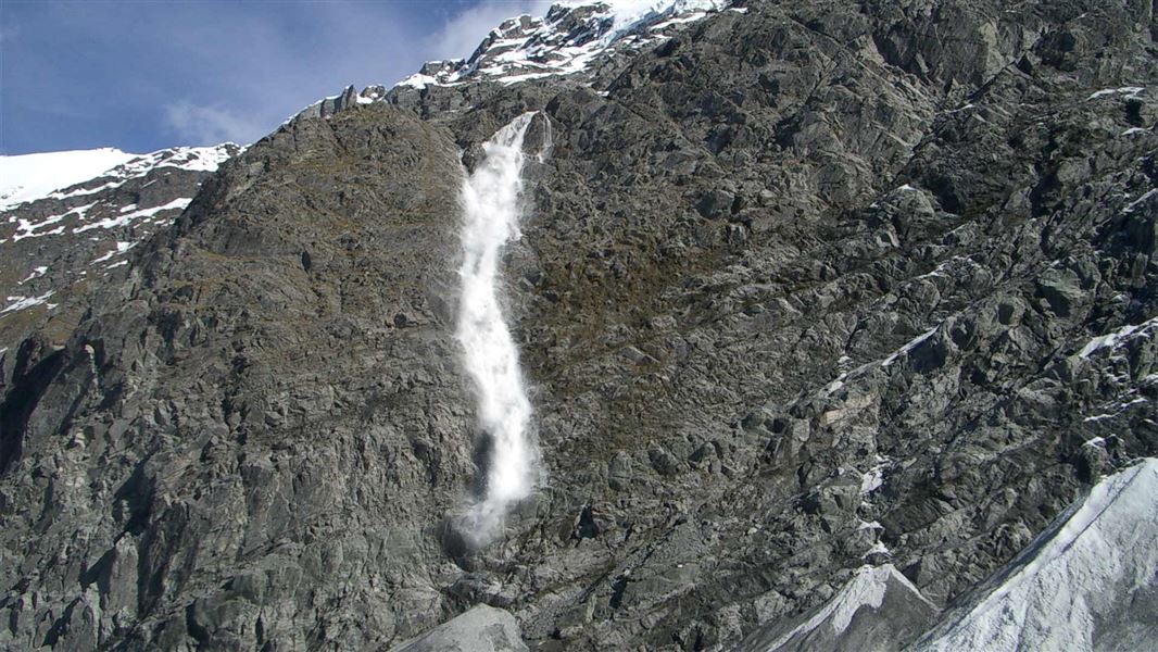
The avalanche season in the Wakatipu/Wānaka and Central Otago areas is usually from May into November. Avalanches are most likely during periods of heavy rain or snow, and for 24 hours after the end of a storm.
Avalanches can reach the valley floors below the snowline as smaller side valleys funnel the avalanche down and into the valley far below. This is especially so in the spring and early summer when warmer temperatures or rain make the snow heavy and unstable.
Even if you cannot see snow from the track there may be enough snow in upper slopes above you to form an avalanche that could reach the track.
Take care if crossing old avalanche debris, especially in bad weather, as this provides a smooth surface for the next avalanche to travel down on.
Be avalanche aware!
If you are going into places avalanches could occur, make sure you:
- have checked the ATES class for where you want to go and the NZAA for the avalanche rating
- have the skills for the ATES class you are going into
- take an avalanche transceiver, a snow shovel and a probe. Know how to use these tools.