19 km one way
From the Larches car park, the Cardrona River to the Little Criffel section of track is closed annually for lambing from 1 October to 1 November inclusive.
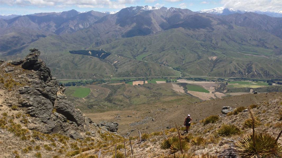
Avalon car park to Little Criffel Summit
Time: 3–4 hrs
Distance: 9 km
The route up to 1,341 m Little Criffel from Avalon car park is on a steep and unformed track. It provides a good opportunity for fit, experienced walkers to enjoy extensive views over the Upper Clutha Basin. It also gives a spectacular panorama of the Southern Alps/Kā Tiritiro o te Moana.
From the car park, cross the Cardrona River and follow the markers and stiles up the hill to the summit of Little Criffel.
Little Criffel Summit to The Larches car park
Time: 3–4 hrs
Distance:10 km
The marked route between the summit of Little Criffel and the Larches car park is mostly on a 4WD track apart from where it crosses through the Larches Conservation Area. This conservation area is a small pocket of shrubland dominated by kānuka, matagouri and native broom.
A special lease area provides access between two sections of the Pisa Conservation Area – there are no marked tracks in this section to follow.
Mountain biking
Mountain biking is permitted on the Larches track. This is an advanced level rated cycle track that involves some steep climbs and poor traction. Some sections will require riders to get off their bikes and walk.
Access to/from the route is signposted from either the Larches car park (9.5 km from Wānaka) or the Avalon car park (12 km from Wānaka); Cardrona Valley Road.
- In summer very hot and dry conditions are common. Carry an adequate supply of both drinking water and sun protection.
- Alpine conditions may be experienced at any time of the year, with the higher country being subject to snow during the winter months.
- Access to the Pisa Conservation Area via Little Criffel Track is an easement over private land. Dogs are not allowed on the access track. Dogs pose a serious risk to stock and the spreading of fatal sheep measles.
Take extreme care when crossing the Cardrona River, especially after rain.
Stay safe when crossing rivers and streams
If you plan to cross unbridged rivers or side streams, know how to cross safely and be prepared for if you cannot cross.
Do not cross if the river or stream is flooded, you cannot find safe entry and exit points or are unsure it’s safe. Turn back or wait for the river to drop. If in doubt, stay out.
NIWA river flow forecasts: View a video of national followed by regional river flows
Be avalanche alert
Avalanches can occur in any season. Any time that snow and steep slopes are combined there is potential for an avalanche. You need to understand the risks before you visit avalanche-prone country.
This area has terrain that can produce avalanches that cross the track, usually from May into November. View avalanche information and the terrain rating for this track.
- The steep section of the track before you enter the conservation area may be subject to avalanche danger in winter.
Private property and permissions
This track crosses private land. There is no camping until the conservation area boundary.
Respect the landowner's livestock and property:
- stay on the marked track until you reach the conservation land
- leave gates as you find them
- use stiles where provided
- keep your distance from livestock.
Stay safe in the outdoors
- Choose the right trip for you. Learn about the route and make sure you have the skills for it.
- Understand the weather. Check weather forecasts.
- Pack warm clothes and extra food. Check gear lists.
- Share your plans and take ways to get help. Leave your intentions with a trusted contact and take a distress beacon.
- Take care of yourself and each other.
Wānaka Tititea/Mount Aspiring National Park
Visitor Centre
| Phone: | +64 27 269 6871 |
| Email: | wanakavc@doc.govt.nz |
| Hours: | Visitor centre hours and services |