25 km one way
Tuohys Gully carpark to Meg Hut
Time: 2–3 hr
Distance: 7 km
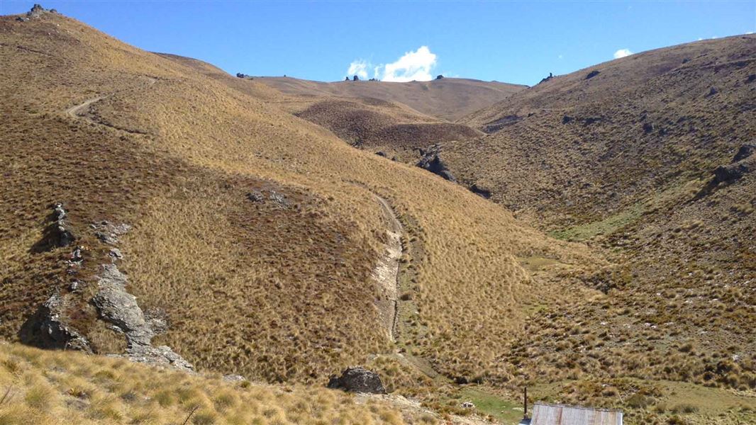
From Tuohys Gully carpark, follow a 4WD track climbing steadily up to Tuohys Saddle (1,140 m). At the top, the track forks.
At the top, follow the track to the left to descend 200 m to Meg Hut (960 m).
Meg Hut to Deep Creek Hut
Time: 3–4 hr
Distance: 8 km
Just after reaching Meg Hut you will have to cross the Roaring Meg stream – this may be impassable during or after heavy rain.
After Meg Hut on the other side of the stream, the poled track goes through golden tussock grasslands. It then follows one of the area’s many prominent ridgelines, rising above 1,400 m. The track continues alongside an old water race and goes through some side creeks. You then descend a 4WD road to the Deep Creek Hut (1,325 m).
Deep Creek Hut to Lowburn
Time: 4–5 hr
Distance: 10 km
This section of the track belongs to Lowburn Station and is not maintained by DOC. Visitors must follow the orange poled route and not the farm road marked on Topo50 Maps.
From the hut, follow the farm road up to the ridge. Signage on a farm gate indicates the start of access through Lowburn Station. This is a working farm – please respect the landowner’s access conditions and remain on the poled route.
The route follows the ridge on a farm road for a short distance before dropping steeply down a fence line to an old cattle track. The route sidles along the cattle track until it intersects and again follows a farm road down to the valley floor and the ruins of an old stone cottage.
Here you cross the Low Burn stream for one last uphill climb before crossing through farm paddock to the stile on Swann Road.
There are two carparks at either end of this track.
Tuohys Gully carpark
- Starting on the Cardrona Valley Road turn left into the entrance to Waiorau Snow Farm.
- Tuohys Gully carpark is signposted to the right immediately after the bridge.
- Follow the farm road until you reach the carpark in a small paddock. Leave gates as you find them
Lowburn carpark
- From Cromwell, drive 5 km north on SH6 and turn left into Lowburn Valley Road.
- A couple of km up the road, turn right into Swann Road.
- Follow Swann Road through Lowburn Station until you reach a stile and a Walking Access Commission sign indicating the start of the track.
Leave all farm gates as you find them.
Weather
In summer, very hot and dry conditions are common. Carrying an adequate supply of both drinking water and sun protection is essential.
In winter, mountaineering experience is required along with knowledge of avalanche conditions.
Adverse weather: The weather can change rapidly in New Zealand. Hypothermia is a real risk even in summer. Be prepared by having warm, waterproof, windproof clothing and the appropriate footwear. Whiteout conditions caused by snow or low cloud may be present.
Check the Roys Peak weather forecast – NIWA website.
Be avalanche alert: This area has terrain that can produce avalanches that cross the track, usually from May into November.
Firearms
Firearms are not permitted on easements through private property including transportation in vehicles. Entry with a firearm is only allowed via Rock Peak Track.
Dog access
Dogs are allowed in the Pisa Conservation Area, but entry and exit is restricted to the Rock Peak Track. All other entry points are via easements through private property and require landowner permission to enter with a dog including transporting them in vehicles.
Private property
This track crosses private land. Respect the landowner's livestock and property: stay on the marked track until you reach the conservation land, leave gates as you find them and use stiles where provided. Livestock can be unpredictable – keep your distance at all times or go around if necessary.
No camping until the conservation area boundary.
People wishing to connect Deep Creek Hut with the Pisa Ridge Track must stay on public conservation land. Previous DOC maps indicated a trail connecting Deep Creek Hut to the Pisa Ridge via Mitre Rocks. However, this is on private property. Check your route by going to DOC maps: Discover the outdoors, and under DOC features, tick “Public conservation areas.” Contact the Wanaka Visitor Centre with any questions.
Stay safe in the outdoors
- Choose the right trip for you. Learn about the route and make sure you have the skills for it.
- Understand the weather. Check weather forecasts.
- Pack warm clothes and extra food. Check gear lists.
- Share your plans and take ways to get help. Share directly or use the Outdoor Intentions form or Plan My Walk. Take a distress beacon.
- Take care of yourself and each other.
Wānaka Tititea/Mount Aspiring National Park
Visitor Centre
| Phone: | +64 3 443 7660 |
| Email: | wanakavc@doc.govt.nz |
| Address: | 1 Ballantyne Road Wānaka 9305 |
| Hours: | Visitor centre hours and services |
