4 km return via same track
The route is closed for lambing from 17 October to 7 November inclusive.
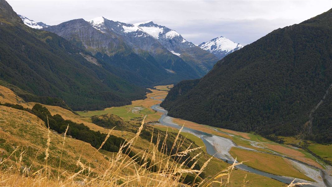
The start of this marked but largely unformed route is 5 km from the Raspberry Creek car park, just before the Brides Veil waterfall. A sign indicates the start of the route.
The route climbs steeply up towards Shotover Saddle. It begins with pasture land and patches of bracken before reaching higher tussock slopes.
The marked route ends just below the saddle itself, on a shelf with a large tarn. From the shelf, there are views across the West Matukituki valley to Rob Roy Peak.
Beyond the end of the route, off-track tramping experience and navigational skills are required.
Permission is required from Branches Station for those who plan to exit the route via the Shotover River.
Private property and permissions
This track crosses private land. There is no camping until the conservation area boundary.
Respect the landowner's livestock and property:
- stay on the marked track until you reach the conservation land
- leave gates as you find them
- use stiles where provided
- keep your distance from livestock.
Exit via Shotover River
To exit the route via the Shotover River, you need permission from Branches Station.
To request permission, phone Branches Station before you go on +64 3 441 8421.
Bad weather
The weather can change rapidly in New Zealand. Hypothermia is a real risk even in summer. Be prepared by having warm, waterproof, windproof clothing and the appropriate footwear. Whiteout conditions caused by snow or low cloud may be present. Check the Mount Aspiring National Park weather forecast – NIWA website.
Avalanche risk
This area has terrain that can produce avalanches that cross the track, usually from May into November. View avalanche information.
Stay safe when crossing rivers and streams
If you plan to cross unbridged rivers or side streams, know how to cross safely and be prepared for if you cannot cross.
Do not cross if the river or stream is flooded, you cannot find safe entry and exit points or are unsure it’s safe. Turn back or wait for the river to drop. If in doubt, stay out.
NIWA river flow forecasts: View a video of national followed by regional river flows
Stay safe in the outdoors
- Choose the right trip for you. Learn about the route and make sure you have the skills for it.
- Understand the weather. Check weather forecasts.
- Pack warm clothes and extra food. Check gear lists.
- Share your plans and take ways to get help. Leave your intentions with a trusted contact and take a distress beacon.
- Take care of yourself and each other.
Wānaka Tititea/Mount Aspiring National Park
Visitor Centre
| Phone: | +64 27 269 6871 |
| Email: | wanakavc@doc.govt.nz |
| Hours: | Visitor centre hours and services |