5 km return via same track
Image gallery
Video
Car park to Brewster Hut
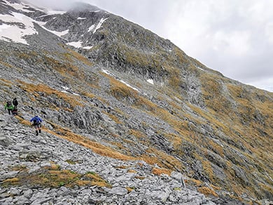
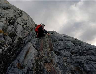
Brewster Track is very steep and unformed. You need good fitness and balance
Image: Alice Milne (@alice.adventuring) ©
The track starts from Fantail Falls. The track crosses the unbridged Haast River – if river levels are high (for example, during/after rain or if the snow is melting), you may not be able to cross the river safely. Assess the river carefully before crossing and if in doubt, stay out.
Always check the weather forecast before starting Brewster Track. We strongly recommend that you do not tramp this track if rain is forecast – the Haast River may rise during your hike and mean you cannot cross the river back to the car park.
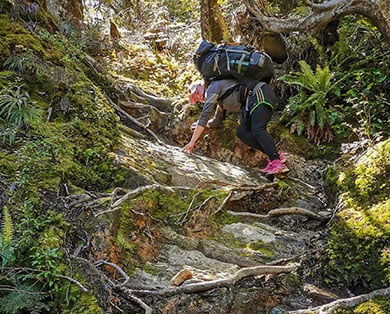
After crossing the Haast River, the track climbs steadily through beech forest to the bush line. The track is a rough, steep, slippery tramping track. Wear sturdy footwear with good grip.
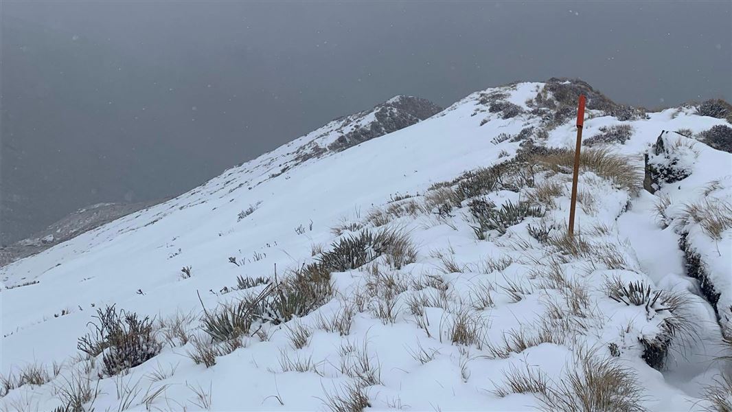
From the bush line, the track continues up a snow grass face and onto a narrow ridge leading up towards Brewster Hut.
There is no track beyond Brewster Hut
The terrain beyond Brewster Hut is challenging
Image: Alice Milne (@alice.adventuring) ©
Brewster Track ends at the hut and there is no track to Mt Armstrong or Brewster Glacier. Do not attempt to hike beyond the hut unless you:
- have experience in hiking off-track in remote New Zealand alpine areas
- know how to navigate in thick cloud that stops you seeing where you are going.
The terrain is much more difficult than it looks. There are steep drops and it is easy to get lost or fall. Many people have had to be rescued from the area.
The face of the glacier and ice caves are unstable. Large chunks of ice fall regularly. We strongly recommend staying well back from this area.
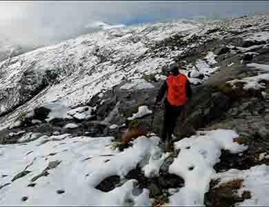
Challenging untracked terrain beyond Brewster Hut
Image: © NZ Mountain Safety Council
Challenging untracked terrain beyond Brewster Hut
Image: © NZ Mountain Safety Council
Alternative hikes
If you do not have the necessary experience, fitness or gear, or the weather is poor, consider walking this track instead:
- Blue Pools Track, 1 hr, 3 km return.
If the river is high but you have the fitness and gear, consider hiking this track instead:
- Isthmus Peak Track, 5-7 hr, 16 km return.
Understand if you are ready for the Brewster Track
Watch the NZ Mountain Safety Council’s walk-through video. It takes you through how to prepare for this track including facilities, key decision points, hazards and typical conditions for the area.
Be ready for bad weather
The weather changes fast and freezing, wet weather is common even in summer. Hypothermia is a real risk. Be prepared for all weather by having warm, waterproof, windproof clothing and sturdy footwear.
Always check the Mount Aspiring National Park weather forecast – NIWA website before hiking.
In winter, alpine skills are essential. See section on May to November.
Unbridged crossing of the Haast River
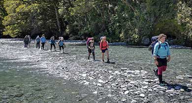
The Haast River crossing in normal flow
Image: Alice Milne (@alice.adventuring) ©
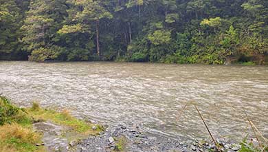
The Haast River is in flood in this photo – crossing would not be recommended
Image: Campbell Harris | DOC
Brewster Track crosses the Haast River. There is no bridge and the crossing is dangerous when the river is high or flooding.
The river may not be crossable on your return if there is rain or snowmelt during the day. We recommend not hiking Brewster Track if rain is forecast.
When you get to Haast River, look out for the warning signs of an unsafe river: water flowing faster than walking pace, discoloured water and debris in the river.
If you aren’t sure it’s safe to cross, don’t cross – wait for the river to drop, or change your plans and return another day or return to the hut.
Be ready for delays from this river crossing. Carry an emergency shelter, plenty of spare food, and plan your day so a wait at the river won’t inconvenience you.
Learn how to cross a river safely on the Mountain Safety Council website.
Don’t tramp beyond the hut if there is rain or low cloud
Whiteout conditions are common year-round in this area. Low visibility can quickly disorientate hikers and cause them to get lost or wander into dangerous terrain. Rain makes the rocks slippery and a fall more likely.
Tramping beyond the hut in low cloud, rain or white-out is not advised. If you see bad weather coming, turn back and return to the hut.
Low visibility is a common cause of rescues in this area. However, it also can slow rescue efforts. This is why it is important to carry an emergency shelter and other gear to help you survive an unexpected night out.
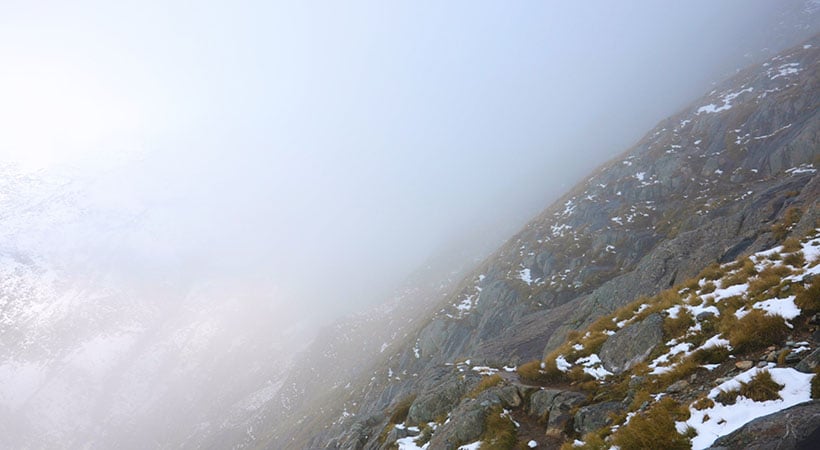
Low cloud near Brewster Glacier
Image: © NZ Mountain Safety Council
What to take
A distress beacon, emergency shelter and spare food are essential for this trip, even as a day walk in summer.
In winter, you will need extra gear. See section on May to November.
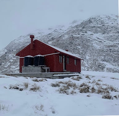
Brewster Hut in snow
Image: Campbell Harris | DOC
You need special skills and preparation to tramp Brewster Track from May to November. There are increased risks from snow, ice, avalanches, bad weather and sub-zero temperatures.
You need mountaineering skills and experience
In winter, Brewster Track is only suitable for people with mountaineering skills, experience and equipment. You must:
- know how to navigate if cloud or snow covers the marker poles and you cannot see them
- know where avalanches are a risk and be able to rescue someone if an avalanche occurs
- have the equipment and skills to prevent a slide on icy terrain
- have the clothing for sub-zero temperatures and be able to survive if the weather gets worse.
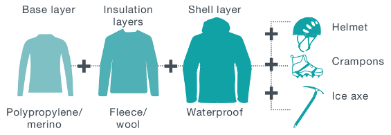
Pack for alpine winter conditions
Conditions can change quickly. Layer your clothes to trap warm air in and keep cold wind out. Start with a base layer of polypropylene/merino, add an insulation layer of fleece/wool and finish with a waterproof shell layer. Carry a distress beacon.
Be avalanche alert
This area has terrain that can produce avalanches that cross the track, usually from May into November. View avalanche information and the terrain rating for this track.
Know the avalanche forecast. If there is avalanche danger, take an avalanche transceiver, avalanche probe and snow shovel, and make sure you are confident using them.
Stay safe in the outdoors
- Choose the right trip for you. Learn about the route and make sure you have the skills for it.
- Understand the weather. Check weather forecasts.
- Pack warm clothes and extra food. Check gear lists.
- Share your plans and take ways to get help. Leave your intentions with a trusted contact and take a distress beacon.
- Take care of yourself and each other.
Wānaka Tititea/Mount Aspiring National Park
Visitor Centre
| Phone: | +64 27 269 6871 |
| Email: | wanakavc@doc.govt.nz |
| Hours: | Visitor centre hours and services |