2.5 km to Camp Flat one way
Brochures
Tramping in the Makarora region (PDF, 3,200K) - trips to Brewster Hut and the Wills, Cameron and Makarora valleys
Blue Pools car park to Camp Flat
Time: 2 - 3 hr one way
Distance: 2.5 km one way
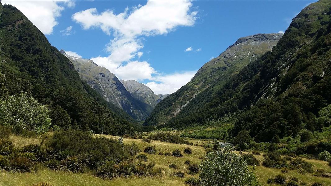
The Blue valley is easily accessible and an interesting day or overnight trip. The track starts at the Blue Pools car park. After 20 minutes, the valley track branches off just after the swing bridge over the Makarora River. The scenic Blue Pools are a 10 minute (return) side trip from this point.
From the junction, the track climbs around and above the Blue River and drops to cross a forested basin of mature tawhai / silver beech. The track then climbs again, sidles up a gorge and descends
to Camp Flat, a grassy and pleasant lunch stop or campsite
Camp Flat to head of valley
Time: 6 - 7 hr one way
Distance: 13.5 km one way
Follow the poled track up the true left of the valley. Take care around a semi-active slip and awkward access along the river’s edge. Cross the Blue River about 50 metres below its north branch and stay on the true right for about 6-7 hours to reach the upper grassy flats.
The track starts at the Blue Pools car park off SH6, opposite Cameron Flat campsite. From Wānaka, drive north on the Haast Highway (SH6) to Makarora township. Continue along the highway for about 12 km.
Bad weather
The weather can change rapidly in New Zealand. Hypothermia is a real risk even in summer. Be prepared by having warm, waterproof, windproof clothing and the appropriate footwear. Whiteout conditions caused by snow or low cloud may be present. Check the Mount Aspiring National Park weather forecast – NIWA website.
There may be fallen trees after adverse weather, so be prepared for longer tramping times.
Avalanche risk
This area has terrain that can produce avalanches that cross the track, usually from May into November. View avalanche information.
Stay safe when crossing rivers and streams
If you plan to cross unbridged rivers or side streams, know how to cross safely and be prepared for if you cannot cross.
Do not cross if the river or stream is flooded, you cannot find safe entry and exit points or are unsure it’s safe. Turn back or wait for the river to drop. If in doubt, stay out.
NIWA river flow forecasts: View a video of national followed by regional river flows
No visitor centre in Makarora
Contact the Awarua/Haast or Tititea/Mount Aspiring National Park visitor centres instead.
Stay safe in the outdoors
- Choose the right trip for you. Learn about the route and make sure you have the skills for it.
- Understand the weather. Check weather forecasts.
- Pack warm clothes and extra food. Check gear lists.
- Share your plans and take ways to get help. Leave your intentions with a trusted contact and take a distress beacon.
- Take care of yourself and each other.
Wānaka Tititea/Mount Aspiring National Park
Visitor Centre
| Phone: | +64 3 443 7660 |
| WhatsApp: | +64 27 629 1012 |
| Email: | wanakavc@doc.govt.nz |
| Hours: | Visitor centre hours and services |