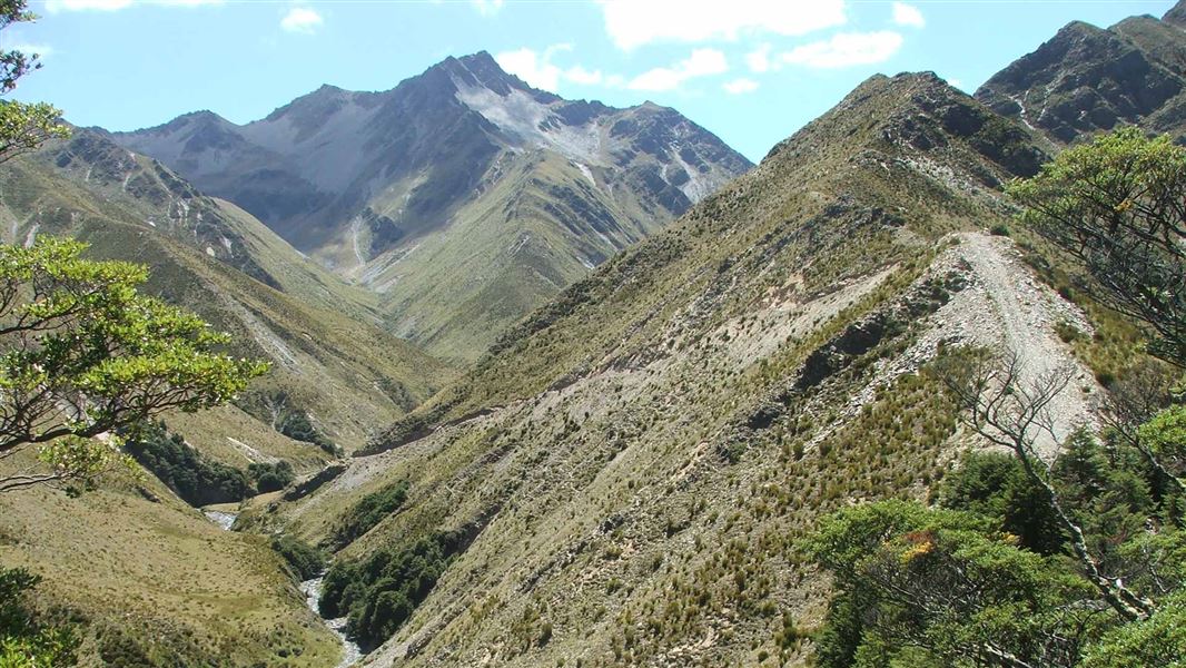
The Timaru River Track follows the river to the head of the valley. It crosses 1,680 m Mount Martha Saddle to descend into the Ahuriri Valley and Conservation Park.
It passes through mānuka, kānuka, matagouri and briar on the valley floor and in the upper sections, mountain beech/taumaka forest and tussock.
The lower section, on the Lake Hawea side, has a loop track for day walkers and also access to both Corner and Dingle Peaks.
The track is also a section of the Te Araroa Trail - The Long Pathway - the national walking trail from Cape Reinga to Bluff.
Tīmaru River carpark to Top Timaru Hut
Time 10 - 11 hr
Distance: 23 km
The marked track starts on the river's true left and crosses it several times during the first hour.
It then crosses open flats near Junction Hut (private). The going becomes more awkward, but the track is clearly marked. It progresses through heavily gorged sections around side streams, and along scree slopes.
A slip on a section of track 50 m downstream from the Timaru River/Breast Hill track junction requires care when crossing, as it is a bluffy section with a vertical drop on one side. From the treeline, it's an hour of open travel to Top Timaru Hut.
Top Timaru Hut to Birchwood Road
Time: 5 -6 hr
Distance: 21 km
Follow the farm track above the hut to the head of the valley and climb up the 1,680 m saddle below Mount Martha. From this high point, the track descends into the Avon Burn catchment and passes Tin Hut (private). This is a pleasant walk above the burn, leading to the carpark on Birchwood Road.
Timaru River Loop Track
Time: 4 - 5 hr return
A high river track, signposted 50m along the road leads to a 4WD track above the Tīmaru River. Follow this undulating track to Deep Spur Creek near Junction Hut (1.5 km), cross the river and return via the way of the Lower Timaru River track.
River crossing skills required; loop track may not be possible after heavy rain.
Mt Prospect Track (side trip)
Track category: Tramping track
Distance: 12 km return from Top Timaru Hut
Time: 5 – 6 hrs
Follow Timaru River track 1 km downstream from Top Timaru Hut to reach the start of Mt Prospect Track.
The track steadily climbs for 5 km to reach Mt Prospect at 1770 m. For the last 1 km to Mt Prospect there is no track so follow the fenceline passing the junction with Mt Melina track on your left. Return the same way. This track is mostly an unmarked old 4WD road. Good navigational skills are required.
Be aware there are several stream crossings that can become uncrossable in heavy rain.
The carpark at the start of the Timaru River Track is 10 km from Lake Hāwea Township, on the unsealed Timaru River Road.
Adverse weather
The weather can change rapidly in New Zealand. Hypothermia is a real risk even in summer. Be prepared by having warm, waterproof, windproof clothing and the appropriate footwear. Whiteout conditions caused by snow or low cloud may be present. Check the Mount Aspiring National Park weather forecast – NIWA website.
Avalanche risk
This area has terrain that can produce avalanches that cross the track, usually from May into November. View avalanche information.
Stay safe when crossing rivers
If you plan to cross unbridged rivers, know how to cross safely and be prepared for if you cannot cross.
Do not cross if the river is flooded, you cannot find safe entry and exit points or are unsure it’s safe. Turn back or wait for the river to drop. If in doubt, stay out.
Pack well for this tramp
This is a backcountry tramp and you need to be well-equipped. Pack plenty of warm and waterproof clothing, navigational equipment (such as a map and compass), a distress beacon, an emergency shelter and at least an extra day’s food (in case you are delayed by weather or rivers).
Check our DOC multi-day tramping packing list
Stay safe in the outdoors
- Choose the right trip for you. Learn about the route and make sure you have the skills for it.
- Understand the weather. Check weather forecasts.
- Pack warm clothes and extra food. Check gear lists.
- Share your plans and take ways to get help. Share directly or use the Outdoor Intentions form or Plan My Walk. Take a distress beacon.
- Take care of yourself and each other.
Wānaka Tititea/Mount Aspiring National Park
Visitor Centre
| Phone: | +64 3 443 7660 |
| Email: | wanakavc@doc.govt.nz |
| Address: | 1 Ballantyne Road Wānaka 9305 |
| Hours: | Visitor centre hours and services |
