49 km one way
The track can be started from Hāwea Conservation Park end or Ahuriri Conservation Park end. This page describes starting from the Hāwea end.
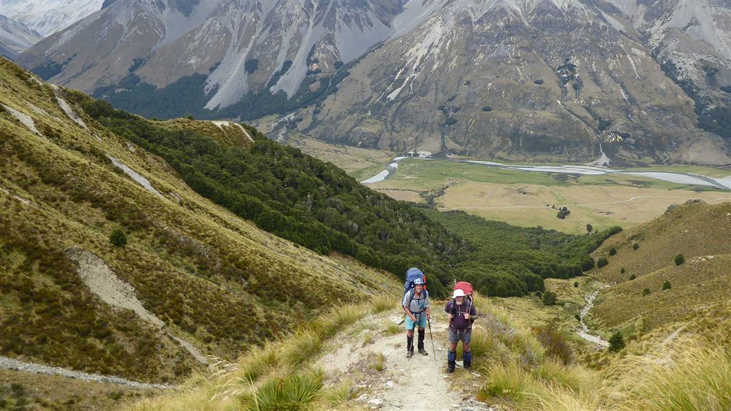
Dingle Burn car park to Bush Hut
Time: 7-9 hr
Distance: 22 km
Follow the Dingle Burn Peninsula Track to the Turihuka Conservation Area, at the confluence of the Dingle Burn and Lake Hāwea. The Dingle Burn Track then follows the Dingle Burn's true left for 6 km before climbing to a terrace 120 m above the river, where a cut track starts at the edge of the bush.
A 20 m section above a 10 m bluff is steep and exposed with loose shingle and no handholds and is followed by a descent through a steep shingle fan. It is recommended that this section of track only be used when the river is high, in low to normal river flow follow the burn all the way to the six-bunk Bush Hut (above sea level 480m), this does involve numerous river crossings.
Bush Hut to Cotters Hut
Time: 7-9 hr
Distance: 10 km
Beyond Bush Hut, the track continues up the valley through beech forest before climbing steeply up a narrow ridge with loose rock and a 15m drop. The 200 m top section is a detour over a large, unstable slip. After descending the track crosses a series of gullies before reaching the two-bunk Cotters Hut (asl 710m).
Cotters Hut to Top Dingle Hut
Time: 3-4 hr
Distance: 12 km
After Cotters Hut travel is much easier, along grassy flats and terraces for much of the way to the historic Ben Avon Hut (day use only) and then to the six-bunk Top Dingle Hut (asl 880m).
Top Dingle Hut to Ahuriri Valley
Time: 3-4 hr
Distance: 5 km
A well-formed track from Top Dingle Hut rises 600 m to the Dingle Burn Saddle (1448 m) ridge line, before descending into the Ahuriri Valley.
From Hāwea end
From Hāwea Township follow the unsealed Dingleburn Station Road to the public carpark. No vehicle access permitted beyond this point.
From here access is by foot. The Dingle Burn Peninsula access track winds along the bluffs, and then alongside Lake Hāwea, leads to the Turihuka Conservation Area, where a sign points to the start of the Dingle Burn Track.
From Ahuriki Conservation Park end
Turn off SH8 onto Birchwood Road, 17 km south of Omarama. The turnoff is signposted for Ahuriri Conservation Park. The road is suitable for cars until the conservation park boundary 21 km down Birchwood Road. After that a high clearance 4WD vehicle is required to travel the 7 km to the start of the track.
Dog access
Dogs are not allowed if you start or end via Dingleburn Station Road, Lake Hāwea. This road crosses private property.
Dogs are only allowed if you start and finish from Birchwood Road, Ahuriri River or use helicopter access.
Adverse weather
The weather can change rapidly in New Zealand. Hypothermia is a real risk even in summer. Be prepared by having warm, waterproof, windproof clothing and the appropriate footwear. Whiteout conditions caused by snow or low cloud may be present. Check the Mount Aspiring National Park weather forecast – NIWA website.
There may be avalanche danger
Avalanches usually occur from May to November in Wakatipu, Wānaka and Central Otago. There can also be avalanches outside this period, if there is still snow coverage.
If you are going into avalanche terrain, always:
- Have the relevant avalanche skills and training.
- Check the ATES rating and the New Zealand Avalanche Advisory.
- Go with a buddy. Both of you should carry and know how to use an avalanche transceiver, a snow shovel and a probe.
Stay safe when crossing rivers and streams
If you plan to cross unbridged rivers or side streams, know how to cross safely and be prepared for if you cannot cross.
Do not cross if the river or stream is flooded, you cannot find safe entry and exit points or are unsure it’s safe. Turn back or wait for the river to drop. If in doubt, stay out.
NIWA river flow forecasts: View a video of national followed by regional river flows
Private property and permissions
This track crosses private land. There is no camping until the conservation area boundary.
Respect the landowner's livestock and property:
- stay on the marked track until you reach the conservation land
- leave gates as you find them
- use stiles where provided
- keep your distance from livestock.
Hunters
Hunters may carry unloaded firearms on the track, if they have a current DOC hunting permit. Under no circumstances are firearms to be discharged before entering a permitted hunting area.
Track closures for stock movement
The Dingle Burn Peninsula Track will sometimes be closed for up to five hours while stock is moved along the track. This is because the track goes through a working farm. Closure signs will be at either end of the Dingle Burn Peninsula Track, do not continue past the signs.
Stay safe in the outdoors
- Choose the right trip for you. Learn about the route and make sure you have the skills for it.
- Understand the weather. Check weather forecasts.
- Pack warm clothes and extra food. Check gear lists.
- Share your plans and take ways to get help. Leave your intentions with a trusted contact and take a distress beacon.
- Take care of yourself and each other.
Wānaka Tititea/Mount Aspiring National Park
Visitor Centre
| Phone: | +64 27 269 6871 |
| Email: | wanakavc@doc.govt.nz |
| Address: | 1 Ballantyne Road Wānaka 9305 |
| Hours: | Visitor centre hours and services |
DOC Customer Service Centre
| Phone: | 0800 275 362 |
| Email: | info@doc.govt.nz |
| Address: | Te Manahuna / Twizel Office |