6.5 km one way
This is a great track if you want an easy day walk with endless views of historic and natural significance. The track has a gentle gradient and was originally a pack track. You may see blue duck/whio while walking alongside the riverbed, so be sure to have your camera with you! You will also see the predator traps which protect the wildlife in the surrounding area.
Huts on this track are not suitable for accommodation. This is because they are derelict historic huts.
Andersons Flat - Meechams Historic Hut site
Time: 1 hr
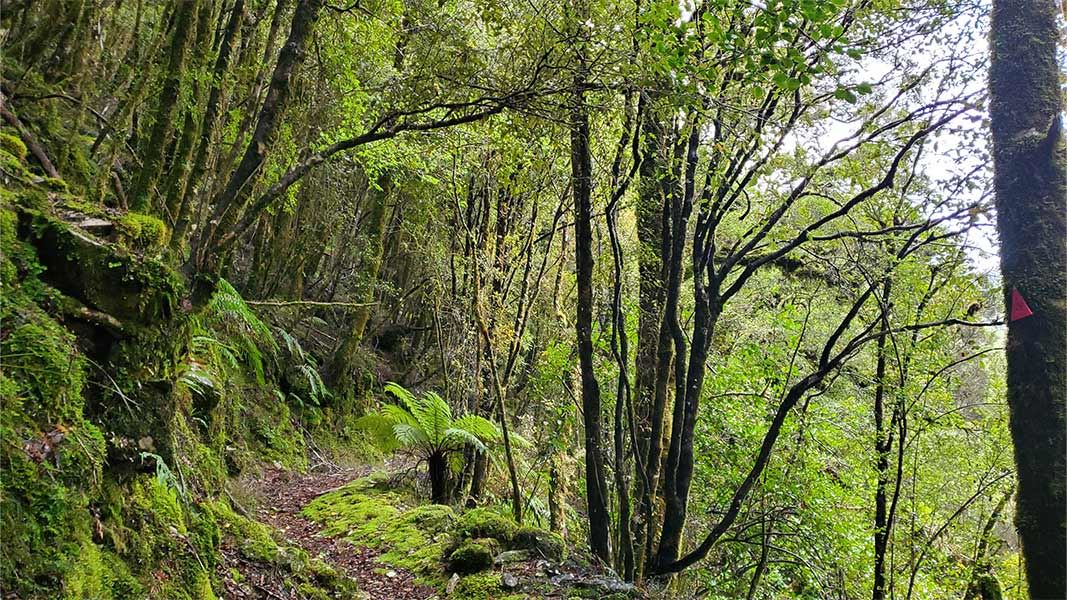
From the clearing at Andersons Flat, the well-formed track runs up the valley through regenerating forest at a moderate gradient. The track crosses the creek once on the way up. Meechams Historic Hut site is signposted right after the second swing bridge. The hut is slightly off the track and you will also see walls of stacked stone tailings from gold claims.
Meechams Historic Hut site – Passenis Historic Hut site
Time: 30 min
After crossing the swing-bridge the river forks out, and after a brief walk you will see the sign-posted Passenis Historic Hut site just before the third swing bridge. You will also see parts of the Moonlight quartz stamping battery above the river that is forked. You will begin to notice the transition between the beech and hardwood forests.
Passenis Historic Hut site – Meikles Historic Hut site – Paparoa Tops
Time: 1 – 1 hr 30 min
Once you have crossed the third swing bridge the track gradually inclines towards the Meikles Historic site. Along the river bed keep an eye out for blue duck/whio.
The track then zigzags upwards with the bench formation ending 30 minutes later where the forest starts to take on a sub-alpine appearance. A rough, steep track continues for 20 minutes to emerge in the open 'tops' about 10 minutes below the crest of the range.
Mountain biking
Start point: Moonlight car park
End point: Meikles Hut
Another great ride along a historic miner’s path. The start of this track weaves in between some impressive, boulder-stacked gold tailings. As a result the initial terrain is rough and rocky.
Once across the first swing-bridge, the track becomes a mix of very smooth, benched single track with intermittent rougher sections. Find the old Meikles Hut tucked in the bush. There is a short section of rideable track just beyond here.
9 km north of the Blackball turn-off, where the Atarau Road bends past a picnic area, turn left onto the Moonlight Valley Road as it runs off toward the range. It's a good but narrow gravel road.
After 6 km the road crosses the creek at the site of Middletown, then climbs to end 3 km further on at Andersons Flat. The Moonlight Track ends at the historic Meikles Hut and then turns into the Croesus Moonlight route taking you along the tops of the Paparoas.
View a map of the Croesus and Moonlight Pack Tracks (PDF, 831K)
Stay safe in the outdoors
- Choose the right trip for you. Learn about the route and make sure you have the skills for it.
- Understand the weather. Check weather forecasts.
- Pack warm clothes and extra food. Check gear lists.
- Share your plans and take ways to get help. Leave your intentions with a trusted contact and take a distress beacon.
- Take care of yourself and each other.
Paparoa National Park Visitor Centre
| Phone: | +64 3 731 1895 |
| Email: | paparoavc@doc.govt.nz |
| Address: | 4294 Coast Road Punakaiki RD 1 Runanga 7873 |
| Hours: | Visitor centre hours and services |