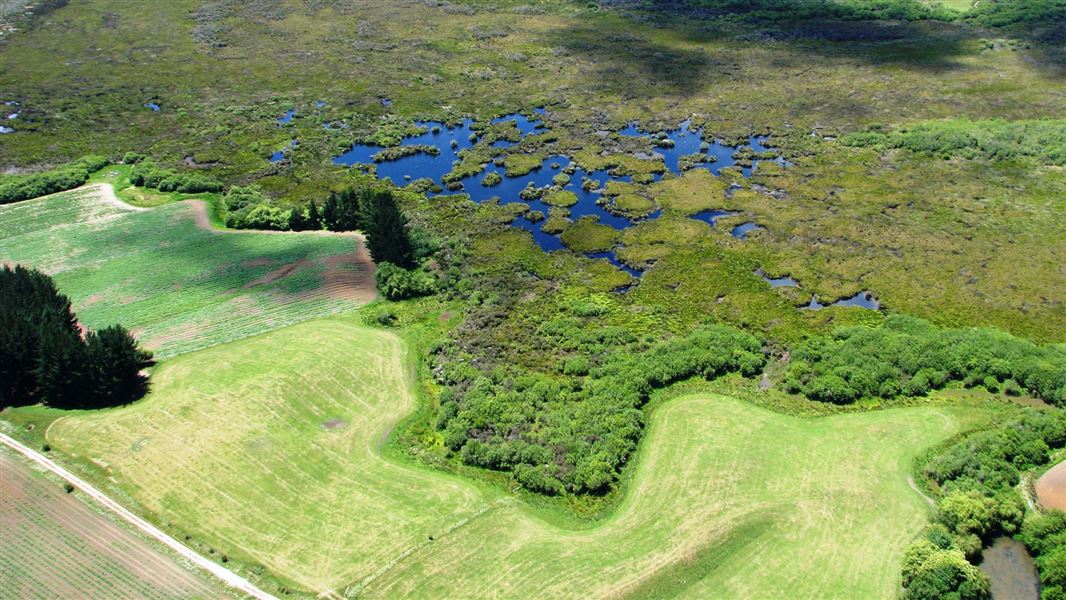
Walk to the historically significant sites of Whangamarino Redoubt, Meremere Redoubt and Te Teoteo’s Pā.
Te Teoteo’s Pā is now hard to distinguish, but the pā and the neighbouring redoubt (fort) were significant sites in the New Zealand Wars, and are regularly visited by those interested in this history. The pā, situated on the end of a ridge overlooking the Waikato River, also affords magnificent views. The neighbouring redoubt, Meremere Redoubt, is well preserved. These sites are on Heritage New Zealand's Waikato War Driving Tour.
This large wetland is located between Mercer and Te Kauwhata, to the east of SH1. You can also drive to the wetland via Island Block Road at Meremere, or Falls Road from Te Kauwhata.
Whangamarino Redoubt is off SH1 south of Mercer via Oram Road. Meremere Redoubt is in Meremere Village, between Hamilton and Auckland, a short detour off SH1
There is no vehicle access into the wetland, but there are boat ramps on both these roads if you want to get closer to the water and explore the wetland by boat or kayak.
Whangamarino Wetland has been a Ramsar Site since 1989 - a wetland of international importance.
The freshwater wetland is made up of 7,000 ha mosaic of swamps, fens and peat bogs around the Whangamarino and Maramarua Rivers. It is the second largest bog and swamp complex in the North Island.
It is managed as both wetland and wildlife management reserves by DOC. Whangamarino is part of a substantial and effective flood control scheme on the lower Waikato River.
Find out more about Whangamarino and the Arawai Kākāriki wetland restoration programme.
Te Teoteo's Pa, Meremere Redoubt, Whangamarino Redoubt are significant sites from the New Zealand Wars.
DOC Customer Service Centre
| Phone: | 0800 275 362 |
| Email: | waikato@doc.govt.nz |
| Address: | Te Rapa Base |
