![]()
No mountain biking or cycling
22 km return via same track
This walkway uses the Kapuni to Auckland gas pipeline route for 11 km. The laying of the pipeline involved an immense amount of heavy construction work. These operations opened up walking access to the dramatic forest and coastal country of the region.
Most of the walkway crosses private land, including farmland. Be respectful of the private property.
The track has several steep climbs and descents and can be muddy, slippery and rutted at times. It is recommended for people with a good level of fitness and experience. Good footwear is essential.
No mountain biking or cycling is allowed on this walkway.
The northern section to Tongaporutu is closed. The northern end of the walkway between the stock tunnel and Clifton Road at Tongaporutu is closed. There is no access to the walkway from Tongaporutu.
There are two walking options along the Whitecliffs Walkway:
Pukearuhe to Wai Pingao Stream, returning to Pukearuhe via the beach (low tide only)
Distance: 6.5 km loop
Time: 3–4 hr
From the boat ramp the walkway crosses open farmland towards Mt Davidson. It then follows the pipeline route along the ridge tops before descending to the Wai Pingao Stream. A section of the track along the Wai Pingao Stream between the swing bridge and the beach has washed out. The track remains open but the washout may be challenging to cross.
Here you can divert from the main track and return to Pukearuhe by following the stream to the coast and walking south along the beach.
Beach section hazards
You can only walk along the beach at low tide (between Wai Pingao Stream mouth and Pukearuhe). Do not attempt unless you can reach Pukearuhe while the tide is still on its way out. Check the tide timetable before you go.
Due to changing sand conditions the beach section may not be passable even at low tide. Be prepared to turn back.
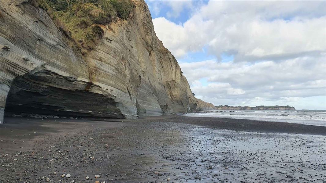
There is a large active cliff slip just south of the Wai Pingao Stream. Beware of falling rocks and take extreme caution.
Pukearuhe to Mt Messenger
Distance: 12 km one way
Time: 7–7 hr 30 min
Continue on the walkway across the Wai Pingao Stream bridge before climbing to the Parininihi Ridge high point and descending to the junction with the Mt Messenger Track. From here, although the track follows a defined ridgeline it may be overgrown in places and navigation may be difficult.
Turn right to climb toward the summit of Mt Messenger before descending to the track exit at SH3.
White Cliffs Walkway Track begins at the Pukearuhe boat ramp at the end of Pukearuhe Road, north of Urenui.
Make sure you park to allow access to the boat ramp and farm property and be considerate of other visitors needing to park at the road end.
- Be prepared for changes in the weather. Take warm clothes, including hat and gloves and waterproof raincoat.
- Respect private land, use the stiles and keep to the track.
Note: There is no mountain biking or cycling biking allowed on the White Cliffs Walkway Track.
Stay safe in the outdoors
- Choose the right trip for you. Learn about the route and make sure you have the skills for it.
- Understand the weather. Check weather forecasts.
- Pack warm clothes and extra food. Check gear lists.
- Share your plans and take ways to get help. Leave your intentions with a trusted contact and take a distress beacon.
- Take care of yourself and each other.
North Taranaki Visitor Centre
| Phone: | +64 6 756 0990 |
| Email: | northtaranakivc@doc.govt.nz |
| Address: | 2879 Egmont Road Te Papa-Kura-o-Taranaki 4386 |
| Hours: | Visitor centre hours and services |