10.5 km from the road bridge one way
Image gallery
This is a challenging tramping track which requires backcountry experience. It is technical and steep in places, with some scrambling needed, unstable slips, and fallen trees on the track. Plan plenty of time – this is not a straightforward valley walk.
The track starts on the true left of the road bridge between Kiwi Flat and Davis Flat on the Haast Highway (SH6). The track leads alongside the Makarora River towards Stewart Falls.
If the Makarora River is low, experienced hikers could cross the river at Davis Flat and join the track on the true left.
The track then climbs steeply climb beside Stewart Falls. Above the falls, the track sidles above the gorge – slippery when wet – before traversing and descending a large unstable slip to a small river flat. The route over the slip is marked with tape only and some route-finding skills are necessary.
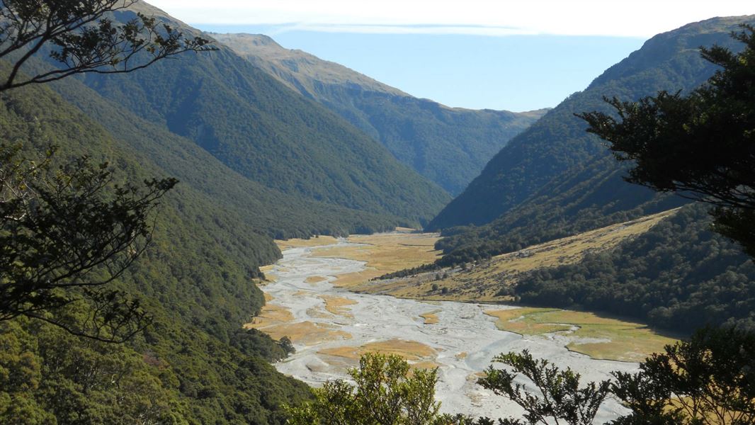
Continue through small open flats, forest and slips to the main valley flat. From here the track is unmarked to the four-bunk Makarora Hut, about 50 minutes away. The easiest route through the unmarked section may involve crossing the river several times, provided it is low and therefore safe to do so.
The hut is located on the true left of the river at the northern end of the flat, close to the bush edge.
The track starts at the road bridge between Kiwi Flat and Davis Flat on the Haast Highway (SH6). There is a small layby on the true left of the road bridge than can be used for parking. If this is already in use, do not park on the highway.
There is alternative parking at Davis Flat car park. However, trampers should only park there in dry conditions as this car park is in danger of being flooded and washed out during heavy rain.
Plan extra time
This is a steep and technical tramping track. We recommend planning plenty of time. The track takes 7 hours to walk even though it is only 10.5 km long.
Expect there to be fallen trees and branches on the track.
Bad weather
The weather can change rapidly in New Zealand. Hypothermia is a real risk even in summer. Be prepared by having warm, waterproof, windproof clothing and the appropriate footwear. Whiteout conditions caused by snow or low cloud may be present. Check the Mount Aspiring National Park weather forecast – NIWA website.
Avalanche risk
This area has terrain that can produce avalanches that cross the track, usually from May into November. View avalanche information.
Stay safe when crossing rivers and streams
If you plan to cross unbridged rivers or side streams, know how to cross safely and be prepared for if you cannot cross.
Do not cross if the river or stream is flooded, you cannot find safe entry and exit points or are unsure it’s safe. Turn back or wait for the river to drop. If in doubt, stay out.
NIWA river flow forecasts: View a video of national followed by regional river flows
Stay safe in the outdoors
- Choose the right trip for you. Learn about the route and make sure you have the skills for it.
- Understand the weather. Check weather forecasts.
- Pack warm clothes and extra food. Check gear lists.
- Share your plans and take ways to get help. Leave your intentions with a trusted contact and take a distress beacon.
- Take care of yourself and each other.
Wānaka Tititea/Mount Aspiring National Park
Visitor Centre
| Phone: | +64 27 269 6871 |
| Email: | wanakavc@doc.govt.nz |
| Hours: | Visitor centre hours and services |