13 km return via same track
Image gallery
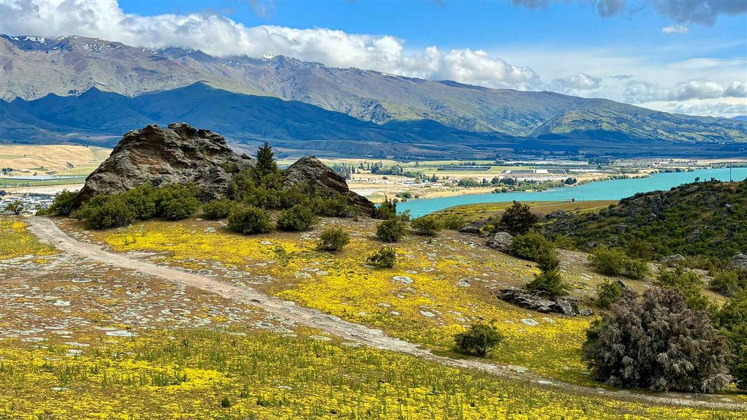
This public easement will lead you from SH8 up a steep farm track to the boundary of Bendigo Conservation Area near Pt 1035. There are good views of Lake Dunstan and the Pisa Range from the tops.
Although the track ends at the conservation area boundary, experienced trampers with navigational skills can carry on cross-country to the summits of Mount Kinaki (1,309 m) and Mount Apiti (1,509 m), or all the way through to Thomson Gorge Road.
If you are planning to tramp beyond the Devils Creek Track into the conservation area in winter, you may cross areas of avalanche risk.
The track starts from a small car park located along SH8 on the eastern side of Lake Dunstan, 9 km north of Cromwell.
Your safety is your responsibility. Stay safe in the outdoors and follow the five essential steps of the Land Safety Code.
The Central Otago climate can swing to either extreme in the course of a day. In winter the ranges are blanketed in snow, a complete contrast to the dry and very hot conditions of summer. Prepare for these extremes with suitable clothing and equipment: sun hat, sun screen, water, warm and waterproof clothing and suitable footwear.
When walking ensure that you have a map and compass. The relevant NZTopo50 series map for this area is CB13 Tarras.
There may be avalanche danger
Avalanches usually occur from May to November in Wakatipu, Wānaka and Central Otago. There can also be avalanches outside this period, if there is still snow coverage.
If you are going into avalanche terrain, always:
- Have the relevant avalanche skills and training.
- Check the ATES rating and the New Zealand Avalanche Advisory.
- Go with a buddy. Both of you should carry and know how to use an avalanche transceiver, a snow shovel and a probe.
Stay safe in the outdoors
- Choose the right trip for you. Learn about the route and make sure you have the skills for it.
- Understand the weather. Check weather forecasts.
- Pack warm clothes and extra food. Check gear lists.
- Share your plans and take ways to get help. Leave your intentions with a trusted contact and take a distress beacon.
- Take care of yourself and each other.
Wānaka Tititea/Mount Aspiring National Park
Visitor Centre
| Phone: | +64 27 269 6871 |
| Email: | wanakavc@doc.govt.nz |
| Hours: | Visitor centre hours and services |