10 km | 20 km return via same track
Graveyard Gully to Butchers Point
Easy walking track: 3 hr return
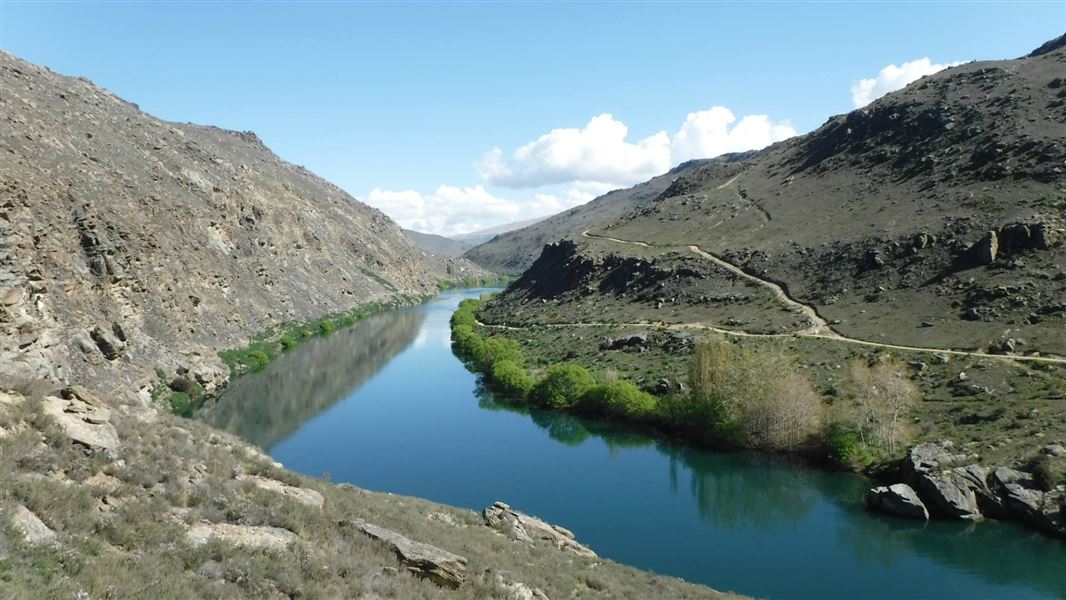
The walkway starts at the Graveyard Gully Monument. It follows an old bridle path constructed in the 1890s to supply coal to the numerous gold dredges working the river. Over the first 4 km there are only a few ruined rock shelters and huts.
Opposite the mouth of Butchers Creek, the track climbs over a large rock outcrop and drops down to a cluster of stone huts at Colemans Gully. The best preserved and largest hut is known as Leaky Lodge. Mary Ann’s, a 3-roomed hut, is just upstream of Leaky Lodge and uses a schist boulder as a wall. Mary Ann was the last Chinese miner in the Alexandra area.
Butchers Point to Doctors Point
Advanced tramping track: 4–7 hr return
Beyond Butchers Point the track becomes a lot rougher and is sometimes poorly defined as it traverses rocky sections, exposed sidles on loose stones and a bench cut into a bluff with a rope handrail. Care should be taken.
Past the bluff, the gorge opens out and at the start of a big bend in the river is the Maltese Cross cottage, located in a grove of tall poplars. Directly behind is a rock shelter known as Blackman’s Cave. A couple of hours will be needed to fully explore the extensive Doctors Point workings which extend about 500 m along the edge of the lake and 200 m up-slope from the shoreline.
This section of the track is not suitable for mountain bikes.
From Alexandra, turn right off Tarbert Street into Little Valley Road, then right again into Graveyard Gully Road (gravel). Follow it for approximately 2 km to the Graveyard Monument.
Mineshafts and Tunnels: There are old and very deep mining shafts throughout this area. Extreme care must be taken and children closely supervised.
Weather extremes: Due to the harsh nature of the country and the threat of changeable conditions, care should be taken in this area. The climate can swing to either extreme in the course of a day. In winter the ranges are blanketed in snow, a complete contrast to the low humidity and very hot conditions of summer. Prepare for these extremes with suitable clothing, footwear and equipment.
The discovery of gold in the Dunstan in 1862 transformed the Roxburgh Gorge. Many miners stopped there on the way to the Dunstan and, finding favorable prospects, set up camp.
The steepness of the gorge limited the growth of towns or settlements along its banks. There were many Chinese miners in the area. Most lived in rock shelters which a local minister described as “roomy and comfortable, cool in summer and warm in winter, but they had no ventilation at all, and when the door (usually a thick rice bag) was shut, they were in pitch dark.” Many of these dwellings were empty in summer when the river rose, to be taken up again in winter when the river level dropped.
Panning and cradling soon gave way to less time-consuming ways of obtaining gold. Sluicing was used whenever enough water was available, through the diversion of side creeks via races to the mining sites. Doctors Point provides an excellent example of this type of mining with is wide-spread tailing mounds. It was originally worked in the 1880s and again in the 1930s when the government introduced a subsidized relief scheme to grubstake gold mining, advancing funds to the prospectors in return for a share of the profits.
About 80 miners worked the Roxburgh Gorge during the Depression years. Many of the original huts and rock shelters were upgraded and lived in again during this period. The lower workings feature parallel stacked tailings. Water for sluicing was brought to the site by two high level stone riveted races from Shanty Creek. The races were refurbished in the 1930s using steel fluming, usually in the form of open piping.
After the Depression, the gorge was once again abandoned until the government began surveying the valley in the 1940s with the view of building a hydro dam at Coal Creek. The dam started in 1948 and was completed in 1956, flooding much of the early mining history in the gorge.
Stay safe in the outdoors
- Choose the right trip for you. Learn about the route and make sure you have the skills for it.
- Understand the weather. Check weather forecasts.
- Pack warm clothes and extra food. Check gear lists.
- Share your plans and take ways to get help. Share directly or use the Outdoor Intentions form or Plan My Walk. Take a distress beacon.
- Take care of yourself and each other.
Wānaka Tititea/Mount Aspiring National Park
Visitor Centre
| Phone: | +64 3 443 7660 |
| Email: | wanakavc@doc.govt.nz |
| Address: | 1 Ballantyne Road Wānaka 9305 |
| Hours: | Visitor centre hours and services |
