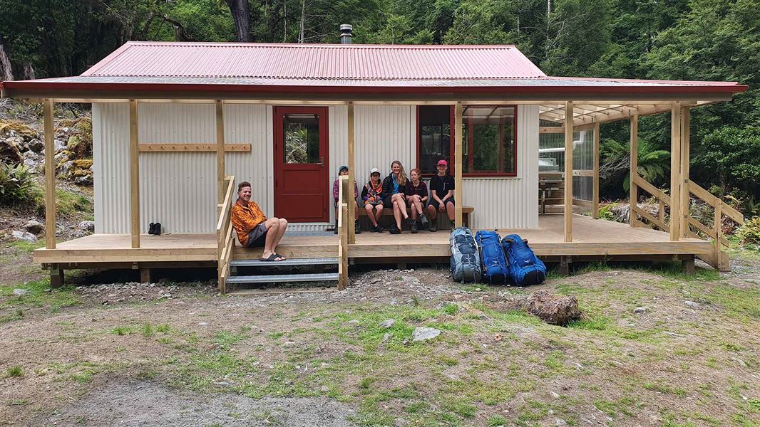
Rebuilt in 2019, in partnership with the New Zealand Defence Force, Iron Gate Hut (altitude: 750 m) offers comfortable accommodation overlooking the Oroua River. This is a great destination for the weekend or as part of longer multi-day tramps.
Blue duck/whio are present in this area and a trapping programme has been set up to protect this endangered species. Visit Ruahine Whio Protectors to find out more or get involved.
Facilities
- Heating source – woodburner
- Platform bunks
- Big deck
- Picnic tables
- Meat safe
History
The original Iron Gate Hut was a modified NZFS70 style hut, built for wild animal control operations in the Ruahine Forest Park.
Fees
- Adult (18+ years): $10 per night
- Youth (5–17 years): $5 per night
- Child/Infant (0–4 years): free
Before you go, buy 1 Standard Hut Ticket (blue for adults, yellow for youth) for each night's stay. Put this in the honesty box at the hut. Or buy a Backcountry Hut Pass that gives unlimited use at most Standard and Serviced huts for a 12 month period.
About hut tickets and passes | Retailers that sell hut tickets and passes
The main access to this hut is along the Iron Gate Hut Track, which starts at Alice Nash Memorial Lodge.
You can also access this hut from other places within the Ruahine Forest Park via:
- Rangiwahia Carpark to Oroua carpark
- Oroua carpark to Kashmir Road (West-East Crossing)
- Ngamoko Range Access Track.
Getting to Oroua carpark
Iron Gate Hut is a 5 hr (5.5 km) tramp from Oroua carpark.
Driving to Oroua carpark from Kimbolton (1 hr): Head north from Kimbolton on Kimbolton Rd/Rangiwahia Rd. After 1.5 km turn right onto Apiti Rd (becomes Oroua Valley Road). After 17.8 km turn right onto Table Flat Rd, which turns into a gravel road. After 9.2 km turn left up the hill onto Petersons Road. Oroua carpark turnoff is reached by turning left after 850 m and going through the farm gate.
Driving to Oroua carpark from Mangaweka (30 min): Just out of town towards Taihape, turn off SH1 onto Ruahine Rd. After 18.3 km, turn left onto Te Parapara Rd (Manawatū Scenic Route) and turn left onto Table Flat Rd after 17.4 km. From here follow the instructions above.
Tracks to this hut
-
Duration: 4 - 5 hr Difficulty: Advanced -
Duration: 2-3 days Difficulty: Advanced -
Duration: 2-3 days Difficulty: Advanced
Location
NZTopo50 map sheet: BL36
Grid/NZTM2000 coordinates: E1861396, N5576021
DOC Customer Service Centre
| Phone: | 0800 275 362 |
| Email: | manawatu@doc.govt.nz |
| Address: | Te Papaioea / Palmerston North Office |
