18.5 km
From the track entrance, the track climbs steadily up through beech forest to the bush line.
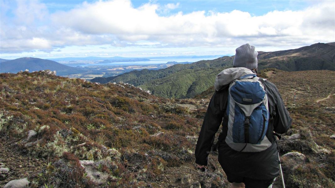
After the bush line, the track continues to climb towards the summit of Urchin. It passes an interesting array of alpine plants.
The Urchin trig is located at 1391 m, usually reached 2-2 hours 30 mins from the road end. The trig is a good place to stop for lunch, with a wide vista of Lake Taupō and the volcanoes of Tongariro National Park.
From the trig, the track travels for about 2 km across the open tops. You reach a track junction, with the option of descending off the side of the ridge or continuing along a ridge towards Umukarikari.
Take the track that stays on the ridge, heading straight ahead towards Sharp Cone on the Umukarikari Range. Follow this bushed ridgeline, which eventually emerges from the forest and climbs to the top of the Umukarikari Range.
Once you meet the Umukarikari Track, take the left-hand (west) track. This follows a poled route along the tops past Sharp Cone (1481 m) then descends back into the bush. The track descends steadily through beech forest and ends at the Umukarikari car park.
This is a popular (but long) one day tramp. You need to arrange transport (eg, a car shuttle or someone to pick you up/drop you off), as there is some distance between the Urchin and Umukarikari track ends.
Mountain biking
No mountain biking allowed.
Urchin track end: Turn off SH1 onto Kaimanawa Road, 15 km south of Tūrangi. After the bridge over Tongariro River, take the next right. Follow this road past the Pillars of Hercules turnoff and almost all the way to Urchin Campsite. Turn off onto a 4WD road shortly before the campsite, then continue up this road until you see the Urchin Track entrance.
Umukarikari track end: From Tūrangi, follow SH1 south for 15 km, then turn off onto Kaimanawa Rd. After the bridge over Tongariro River, stay left at the fork. Follow the road then turn left at the Waikoko Campsite and continue for 500 m before turning left on to Umakarikari Road.
Be ready for a long day
This is a long route (18.5 km) and generally takes people between 8 hr 30 min and 10 hours. However, some people will find it takes longer.
It’s best walked in summer (when there are longer daylight hours) and with an early morning start. There are DOC campsites near the two track ends, if you wish to stay the night before. Pack a torch in case it takes you longer than expected.
The Mt Urchin Trig Track is an easier and shorter day walk alternative, which still offers fantastic views and Kaimanawa alpine scenery.
You need to arrange transport
This is not a loop track. The car parks at the two track ends are a good distance away by road and there is no track between them.
This is a backcountry tramp, you need to pack well for it
This trip requires good gear, even if done as a day walk. Carry a waterproof jacket, warm clothing, a fully charged mobile phone and a distress beacon, lots of food and water, emergency shelter, hat and gloves. Wear sturdy boots.
There are no water sources on the track, we advise carrying 2-3L per person.
The weather in Kaimanawa Forest Park is extremely changeable. Be prepared for cold wet conditions even in summer.
Stay safe in the outdoors
- Choose the right trip for you. Learn about the route and make sure you have the skills for it.
- Understand the weather. Check weather forecasts.
- Pack warm clothes and extra food. Check gear lists.
- Share your plans and take ways to get help. Share directly or use the Outdoor Intentions form or Plan My Walk. Take a distress beacon.
- Take care of yourself and each other.
DOC Customer Service Centre
| Phone: | 0800 275 362 |
| Email: | turangi@doc.govt.nz |
| Address: | Tūrangi Office |
