32 km one way
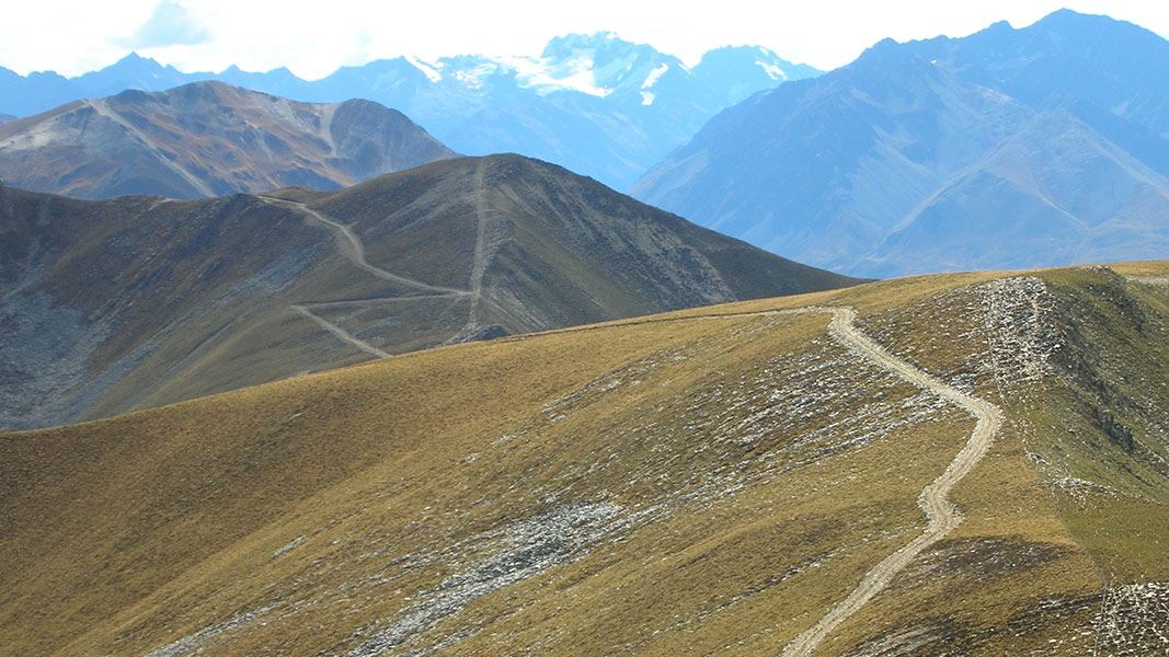
Another track good for long distance runners. It is a steep climb up Pavilion Peak from the Avon Burn valley. An undulating ridge provides great views as you travel along to Dromedary Peak. Trampers will need a pick up at the exit point on SH8 north of Lindis Pass (near Dalrachney Road Bridge).

Pavilion Peak Track on western side of Pavilion Peak (1632 m)
Mountain biking
This track is a better ride if you start from SH8 and exit down the Avon Burn valley. The western side of Pavilion Peak is steep so makes an ideal descent on a bike.
This is a shared-use track. Follow the mountain bikers code: respect others, respect the rules, respect the track.
Map: NZTopo50 CA14 Lindis Pass
Stay safe in the outdoors
- Choose the right trip for you. Learn about the route and make sure you have the skills for it.
- Understand the weather. Check weather forecasts.
- Pack warm clothes and extra food. Check gear lists.
- Share your plans and take ways to get help. Leave your intentions with a trusted contact and take a distress beacon.
- Take care of yourself and each other.
Wānaka Tititea/Mount Aspiring National Park
Visitor Centre
| Phone: | +64 27 269 6871 |
| Email: | wanakavc@doc.govt.nz |
| Hours: | Visitor centre hours and services |