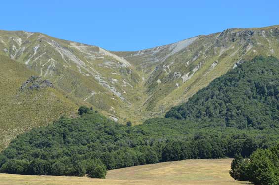
A well-formed track rises from the Ahuriri valley to Dingle Burn Saddle (1448 m). From the saddle snowpoles mark a steep descent to Top Dingle Hut in Dingle Burn valley. From Top Dingle Hut the tracks continues to Lake Hawea. For more detail about the track from Lake Hawea to Top Dingle Hut see Dingle Burn Track.

The Dingle Burn Hut Track zig zags upwards from Ahuriri valley floor
Turn off SH8 onto Birchwood Road, 17 km south of Omarama. The turnoff is signposted for Ahuriri Conservation Park. The road is suitable for cars until the conservation park boundary 21 km down Birchwood Road. After that a high clearance 4WD vehicle is required to travel the 7 km to the start of the track.
Map: NZTopo50 BZ14 Mount Barth
Dog access
Dogs on a lead can be taken on the track up to Dingleburn Pass, however they must be confined to your vehicle on the drive up Birchwood Road as you are passing through private farmland. Note: dogs are not permitted past Top Dingle Burn Hut.
There may be avalanche danger
Avalanches usually occur from May to November in Wakatipu, Wānaka and Central Otago. There can also be avalanches outside this period, if there is still snow coverage.
If you are going into avalanche terrain, always:
- Have the relevant avalanche skills and training.
- Check the ATES rating and the New Zealand Avalanche Advisory.
- Go with a buddy. Both of you should carry and know how to use an avalanche transceiver, a snow shovel and a probe.
Stay safe in the outdoors
- Choose the right trip for you. Learn about the route and make sure you have the skills for it.
- Understand the weather. Check weather forecasts.
- Pack warm clothes and extra food. Check gear lists.
- Share your plans and take ways to get help. Share directly or use the Outdoor Intentions form or Plan My Walk. Take a distress beacon.
- Take care of yourself and each other.
DOC Customer Service Centre
| Phone: | 0800 275 362 |
| Email: | info@doc.govt.nz |
| Address: | Te Manahuna / Twizel Office |