Lauder Station Easement Track: Closed to all users for lambing and calving from 20 September to the Thursday before Labour Weekend inclusive. Closed to vehicles from 1 May to 30 November.
Cluden Station Easement Track: Closed to vehicles from 1 May to 30 November.
Lauder Station Road to Cluden Creek car park
Distance: 31 km
Activities: tramping, mountain biking, four wheel driving, horse riding.
Map: Lauder Basin Conservation Area Map (PDF 1,129K)
Walking grade: Advanced
Mountain bike greade: Advanced
Gate codes: There are locked gates on the Lauder and Cluden easement tracks. Drivers and horse riders will need to complete the online application for padlock codes.
Lauder Station Easement Track (Lauder Station Road to Lauder Basin Conservation Area boundary)
Distance: 6 km
Time: 2 hours walking
Seasonal restrictions: Closed to all users for lambing and calving from 20 September to the Thursday before Labour Weekend inclusive. Closed to vehicles from 1 May to 30 November.
Night driving restrictions: Vehicles are not permitted between 8 pm and 7 am.
Motorised vehicle restrictions: 4WD vehicles only. No motorcycles or all-terrain vehicles.
The Lauder Station Easement Track starts on Lauder Station Road. Follow the track through Lauder Station to the boundary of Lauder Basin Conservation Area.
Lauder Station Easment Track is a formed 4WD farm track. Some sections are rough with steep drop offs. It is not shown on NZ Topo50 maps. The correct 4WD access track is marked with orange waratahs.
Lauder Basin Conservation Area Road (Lauder Station boundary to Cluden Station boundary)
Distance: 18 km
Time: 6-7 hours walking
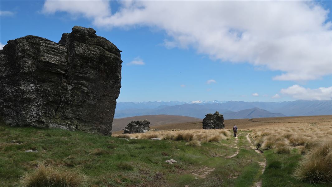
A formed 4WD track gives access through the Lauder Conservation Area. Some sections of the road are rutted and can be boggy after rain.
Cluden Station Easement Track (Lauder Basin Conservation Area boundary to Cluden Creek Road)
Distance and time:
- Lauder Basin Conservation Area boundary to Cluden Creek car park: 7 km, 2-3 hours walking
- Cluden Creek car park to Cluden Quarry car park: 8 km, 2 hours walking
Seasonal restrictions: Closed to vehicles from 1 May to 30 November.
Night driving restrictions: Vehicles are not permitted between 8 pm and 7 am.
From the boundary of Lauder Basin Conservation Area, follow the formed 4WD farm track through Cluden Station to Cluden Creek Road. Some sections of the road are rough with steep drop offs.
Cluden Creek Track
Distance: 20 km
Time: 7-8 hours walking
Activities: tramping, mountain biking, horse riding (partial access). No vehicles.
Walking track grade: Advanced
Mountain biking track grade: Advanced
Cluden Creek Track leads from Cluden Creek Car park to Lauder Basin Conservation Area, where it meets Lauder Basin Conservation Area Road.
It is a formed 4WD farm track and some sections are rough with steep drop offs. Parts of track may be boggy after rain.
The gate to Cluden Creek Track from Cluden Creek car park is locked and there is no key available. Horses can only enter and exit Cluden Creek Track via Lauder Basin Conservation Area or Dunstan Pass Track.
Cluden Creek Conservation Area
Distance:
- Cluden Creek car park to Cluden Creek Conservation Area boundary: 500 m
- Lauder Basin Conservation Area Road to Cluden Conservation Area: 2 km
Activities: tramping
Access into this small conservation area is signed from both entrance points. Walking access only is permitted. There are no marked tracks within the conservation area.
Dunstan Pass Track
Distance: 4 km
Time: 1 hour 30 mins walking
Activities: tramping, mountain biking, horse riding. No vehicles.
Walking track grade: Advanced
Mountain biking track grade: Advanced
From the junction of Cluden Creek Track and Chain Hills Access Track, Dunstan Pass Track climbs to Dunstan Pass.
At the pass, there is a junction with Chain Hills Track, which gives access to Long Acre Track, Shilmar Track and into the northern section of Lauder Basin Conservation Area.
From the pass, Dunstan Pass Track then descends to Dunstan Creek.
Chain Hills Access Track
Distance: 3.4 km
Activities: tramping, mountain biking, horse riding. No vehicles
This track leads from the junction of Cluden Creek Track and Dunstan Pass Track up the hill to the northern section of Lauder Basin Conservation Area.
Note: This track is different to Chain Hills Track, which runs along the top of Chain Hills.
Sailors Creek Track
Distance: 2 km
Time: 45 mins walking
Activities: tramping, mountain biking, horse riding. No vehicles.
Walking track grade: Advanced
Mountain biking track grade: Advanced
Gate codes: There is a locked gate at the carpark. Horse riders must obtain a gate code – contact the Tititea/Mount Aspiring National Park Visitor Centre or Kā Moana Haehae / Alexandra Office.
This track is accessed from the end of Cambrian Road, off St Bathans Loop Road, 10 km north of Becks. From the end of the road, 2WD access extends as far as a car park at Sailors Creek.
From the Sailors Creek car park, Sailors Creek Track starts from a stile and leads to the Lauder Basin Conservation Area boundary.
Access from the east:
- Lauder Station Easement Track. From SH85 heading towards St Bathans, turn onto St Bathans Loop Road, then turn onto Lauder Station Road. The car park is on the right before the end of Lauder Station Road.
- Sailors Creek Track. From SH85 heading towards St Bathans, turn onto St Bathans Loop road, then turn onto Cambrian Road. From the end of the road, 2WD access extends as far as a carpark at Sailors Creek.
Access from the west:
- Cluden Station Easement Track and Cluden Creek Track. From SH8 (the Tarras – Lindis Pass Road), turn onto Cluden Creek Road. The first car park is the Cluden Quarry car park. Cluden Station Easement Track and Cluden Creek Track start at the second car park, called Cluden car park, 8 kms further up Cluden Creek Road.
Track conditions
High-clearance 4WD drives with mud-tyres and recovery equipment are recommended for the Lauder Basin 4WD track.
Some sections of this track are rough and scoured. There are boggy sections on the flats near the Lauder Station Road gate where you could get stuck. We recommend you only use this track during dry periods.
The sidle down to Lauder Basin Hut has a section on an incline that is suitable for competent 4WDers only. Extreme care should be taken. There is no potential to turn at any point during this sidle.
Other 4WD tracks in this area have deteriorated and are unsafe to use. Stick to the main 4WD track only.
Weather
- In summer very hot and dry conditions are common. Carrying an adequate supply of both drinking water and sun protection is essential.
- In winter, mountaineering experience is required along with knowledge of avalanche conditions. Be prepared.
Access is by easements (crossing private land)
- These tracks cross and border private land. Respect livestock and property, ensure gates are left as you found them and that, where provided, stiles are used.
- Follow the seasonal closures and night driving restrictions.
- The easement across Lauder Station allows for 4WD motor vehicle use only. Motorcycles and all-terrain vehicles are not permitted.
- When entering through Cluden Station, access is allowed up the road past the Cluden Station no trespassing sign. Follow the orange poles to stay on the public track.
Camping, dogs, and fire
- Camping is permitted on conservation land only. Camping on the access easements or in the car parks is not permitted.
- Dogs are permitted in the conservation area but must be confined in a vehicle at all times on the Lauder and Cluden easement tracks.
- Fires are not permitted.
Avalanche risk
This area has terrain that can produce avalanches that cross the track, usually from May into November. View avalanche information.
Stay safe in the outdoors
- Choose the right trip for you. Learn about the route and make sure you have the skills for it.
- Understand the weather. Check weather forecasts.
- Pack warm clothes and extra food. Check gear lists.
- Share your plans and take ways to get help. Leave your intentions with a trusted contact and take a distress beacon.
- Take care of yourself and each other.
Wānaka Tititea/Mount Aspiring National Park
Visitor Centre
| Phone: | +64 3 443 7660 |
| WhatsApp: | +64 27 269 6871 |
| Email: | wanakavc@doc.govt.nz |
| Hours: | Visitor centre hours and services |