10 km return (from Camerons Flat). 16 km return (from Otago Boys' High Bridge)
Image gallery
Ford the Matukituki River at Camerons Flat. Walk upstream from the car park to find a suitable crossing point. If the river is high, drive 2.5 km further along the road towards Raspberry Creek and park by the Otago Boys' High Bridge at MacPherson Creek. Use the bridge to cross the West Matukituki and walk for an hour to join the East Matukituki track.
The track leads up the East Matukituki valley, passing the old Mount Aspiring Station homestead by Homestead Creek. The grassy river flats are leasehold farmland, do not disturb the stock.
Continue up the valley, then turn off onto Glacier Burn Track just before the bridge over Glacier Burn. The track is mostly well-formed but is steep in places and can be slippery after rain.
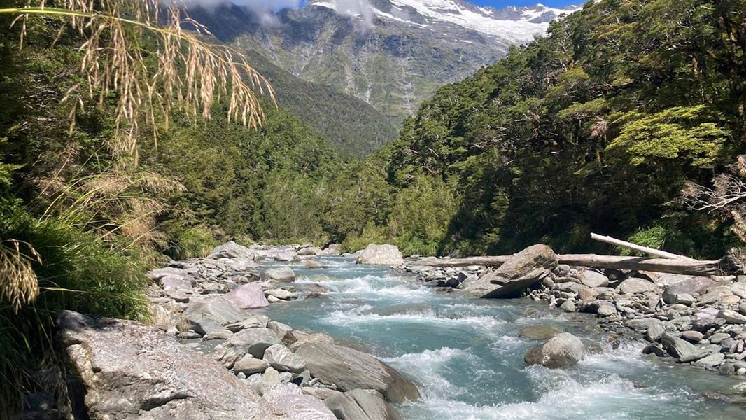
The track passes through beech forest, climbing to a small saddle and then descending to the Glacier Burn. The track ends when it reaches the river and there is no marked track beyond this point. Route-finding skills and backcountry experience are necessary if continuing off-track beyond this point.
Note: Camerons Flat where this track starts is on Wanaka Mount Aspiring Road and is different to Cameron Flat near Makarora on SH6 between Wānaka and Haast. There is also a different Glacier Burn Track in the Glenorchy area near Lake Wakatipu.
Mountain biking
Bikes are allowed from Camerons Flat to the boundary of Mount Aspiring National Park, at the turn off for the Glacier Burn Track.
This track starts on the opposite side of the Matukituki River from Camerons Flat.
Camerons Flat is a one-hour drive from Wānaka on the Wanaka Mount Aspiring Road. The last 25 km is gravel. The turn-off to the Camerons Flat car park, on the right, is signposted. The Otago Boys' High Bridge at MacPherson Creek is a further 2.5 km along the road.
Weather and flooding
Unpredictable weather patterns mean that snow, strong winds and heavy rain can occur at any time of year.
Check the forecast and pack gear for all conditions.
Stay safe when crossing rivers and streams
If you plan to cross unbridged rivers or side streams, know how to cross safely and be prepared for if you cannot cross.
Do not cross if the river or stream is flooded, you cannot find safe entry and exit points or are unsure it’s safe. Turn back or wait for the river to drop. If in doubt, stay out.
NIWA river flow forecasts: View a video of national followed by regional river flows
Private property and permissions
This track crosses private land. There is no camping until the conservation area boundary.
Respect the landowner's livestock and property:
- stay on the marked track until you reach the conservation land
- leave gates as you find them
- use stiles where provided
- keep your distance from livestock.
Swing bridges
There's a limit to the number people allowed on the swing bridges at any one time – be prepared to wait at each end if numbers allowed have been reached.
Stay safe in the outdoors
- Choose the right trip for you. Learn about the route and make sure you have the skills for it.
- Understand the weather. Check weather forecasts.
- Pack warm clothes and extra food. Check gear lists.
- Share your plans and take ways to get help. Leave your intentions with a trusted contact and take a distress beacon.
- Take care of yourself and each other.
Wānaka Tititea/Mount Aspiring National Park
Visitor Centre
| Phone: | +64 27 269 6871 |
| Email: | wanakavc@doc.govt.nz |
| Hours: | Visitor centre hours and services |