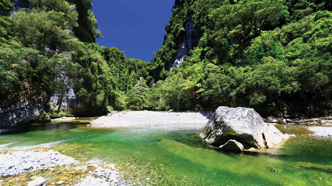
Built in 1867 during the gold rush to avoid dangerous coastal travel, the Inland Pack Track gives access to some of the finest features of Paparoa National Park.
There are no huts along the way, but there is sheltered camping under the Ballroom Overhang, where there is a toilet.
Track to the Ballroom Overhang.
Punakaiki River to Pororari River
Time: 1 hr
Distance: 3.5 km
The Inland Pack Track traditionally starts from the Waikori Road car park with the crossing of a large suspension bridge. This section is well formed as the bikers entrance/exit to the Paparoa Track Great Walk. Bikes may be encountered on this dual use section.
The track winds its way over a ridge. It then drops back down into the Pororari River Valley and passes through rainforest, kamahi and beech forest.
An alternative to the Punakaiki River entrance is the Pororari River Track.
Pororari River Track Junction to Bullock Creek
Time: 1 hr 30 min
Distance: 5 km
From where the Pororari River Track and Inland pack track meet, continue up the Paparoa Track for a few minutes to the Lower Pororari Swing Bridge.
Crossing this bridge leaves the Great Walk Track and becomes a tramping track. This part of the track was heavily damaged during cyclone Ita. The track has been cleared but you can still see damage to many large trees. You'll also see regeneration growing through the clearings left from the gaps created from fallen trees.
There are many tomos and grikes in this section, so stick to the track. You can see some of these next to the track.
Beyond the windfall there are still abundant old growth rimu and a diverse range of ferns. Just before you reach old Bullock Creek Farm is the Cave Creek Memorial track. The track to Bullock Creek follows and old farm road. There is no bridge across Bullock Creek and this can become impassable during and after heavy rain.
Bullock Creek to Fossil Creek
Time: 2 hr
Distance: 7 km
The farm road continues before narrowing to a single track skirting a swamp through rimu-beech forest. It climbs over the ridge dividing the Bullock Creek and Fox River Catchments and drops down to fossil creek. Many of the structures in this part are damaged and slippery. Take extra care.
Fossil Creek to Fox River / Dilemma Creek Junction
Time: 2 hr
Distance: 4 km
From here there is no formed track. Follow Fossil Creek downstream for about 30 min to Dilemma Creek, which is also followed downstream to Fox River. The forested limestone canyon is one of the most dramatic sections of the Inland Pack Track. This section has numerous crossings which change often, You need good river crossing skills.
There are sections of windfalls down Fossil Creek. You need appropriate navigation skills and may need extra time.
The Ballroom Overhang is a side track from here.
Dilemma Creek / Fox River Junction to Fox River Mouth
Time: 1 hr 30 min
Distance: 5 km
From here the Inland Pack Track is a formed track again on the true left of Fox River.
The track follows the gorge for 2 km climbing and dropping to negotiate bluffs. There are several good lookout points.
A wide river crossing brings you to the true right of the river. The track continues downstream with some river bed travel. Orange markers take you back into a forested track section leading back to the Fox River car park.
Start from either of these points:
- At the end of Waikori Road, 800 m south of the Paparoa National Park Visitor Centre.
- From the Pororari River Track car park, 1 km north of the Paparoa National Park Visitor Centre.
- An alternative access is the car park at the end of Bullock Creek road.
The Inland Pack Track is recommended South to North following Fossil and Dilemma Creek downstream, but can also be done in reverse from the Fox River car park.
This track is recommended for experienced trampers only.
Damaged structures: Many of the structures between Bullock Creek farm and Fossil Creek are damaged and slippery – take extra care walking this section.
Track condition: A 60 m section of the track is badly damaged approximately 40 minutes by foot from Fox River carpark. Take care and follow the track via a marked diversion.
Fallen trees: Walkers will also have to negotiate fallen trees along Fossil Creek – allow extra time.
Camping is prohibited within 500 m of the Paparoa Track. This includes the sections from the Waikori Road car park and Pororari River Track car park to the lower Pororari swing bridge.
Check the Paparoa National Park weather forecast to plan for your trip and cross rivers safely.
Stay safe when crossing rivers
If you plan to cross unbridged rivers, know how to cross safely and be prepared for if you cannot cross.
Do not cross if the river is flooded, you cannot find safe entry and exit points or are unsure it’s safe. Turn back or wait for the river to drop. If in doubt, stay out.
Stay safe in the outdoors
- Choose the right trip for you. Learn about the route and make sure you have the skills for it.
- Understand the weather. Check weather forecasts.
- Pack warm clothes and extra food. Check gear lists.
- Share your plans and take ways to get help. Share directly or use the Outdoor Intentions form or Plan My Walk. Take a distress beacon.
- Take care of yourself and each other.
Paparoa National Park Visitor Centre
| Phone: | +64 3 731 1895 |
| Email: | paparoavc@doc.govt.nz |
| Address: | 4294 Coast Road Punakaiki RD 1 Runanga 7873 |
| Hours: | Visitor centre hours and services |
