The Nevis Valley provides access to the North Hector Mountains and the Remarkables Range, where the highest vantage points in the Remarkables Conservation Area offer solitude and stunning views.
- Dark Elliots Track, Ryders Track and Scotchmans Creek Track are closed annually from 15 October – 30 November for lambing.
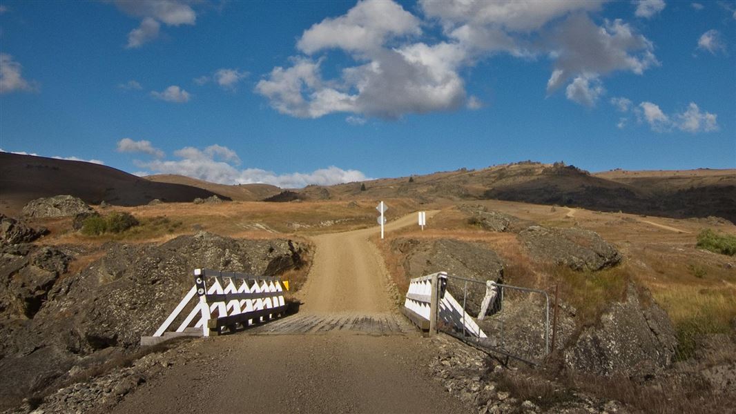
- Nevis Road from Comissioners Creek to the Southland district boundary is closed to motor vehicles annually from the first Monday in June to 30 September.
Image gallery
Nevis-Gibbston Track
Time: 2 hr one way
Distance: 8 km
Other activities: Four wheel driving, Mountain biking, Horse riding
Dog access: Dogs on a leash only until inside the conservation area boundary.
Beginning from Nevis Crossing on Nevis Road, the track gradually winds its way up rutted sections of farm road until the 993 m Doolans Saddle. From there it descends to its end point at a boundary gate.
Four wheel driving
Doolans Saddle is the furthest drivable point from the Nevis Road (8.5 km). It's rutted in sections and for dry weather only. A narrow section with a steep drop off prior to Doolans Saddle is not for novices or the faint hearted.
River Face Track
Time: 2–2 hr 30 min one way from Nevis Road
Distance: 9 km
Other activities: Mountain biking
Dog access: Dogs on a leash only until inside the conservation area boundary.
Branching off the Nevis-Gibbston Track, the River Face Track descends down a moderately steep farm road to the Nevis River. It provides fishing access to the Nevis catchment.
Dark Elliots Track
Time: 2–3 hr one way from Nevis Road
Distance: 7 km
Other activities: Mountain biking
Dog access: Dogs on a leash only until inside the conservation area boundary.
Seasonal restrictions: This track is closed annually from 15 October – 30 November for lambing.
Follow the Nevis Gibbston Track for 2 km (30–45 minutes) until the track sign on the left. For 5 km the track continues climbing a farm road to the conservation area boundary.
Sunny Elliots Track
Time: 3–4 hr one way from Nevis Road
Distance: 12 km
Other activities: Mountain biking, Horse riding
Dog access: Dogs on a leash only until inside the conservation area boundary.
Follow the Nevis Gibbston Track for 8 km (2–2 hours 30 minutes) to a sign that marks the start of the track, 500 m from Doolans Saddle. It's a steady climb to the conservation area boundary.
Ryders Track
Time: 1 hr 30 min – 2 hr one way
Distance: 4.5 km
Dog access: Dogs on a leash only until inside the conservation area boundary.
Seasonal restrictions: This track is closed annually from 15 October – 30 November for lambing.
From the sign on Nevis Road, the track follows a farm road, climbing steadily to the conservation area boundary.
Scotchmans Creek Track
Time: 1 hr one way from Nevis Road
Distance: 3.5 km
Dog access: No dogs
Seasonal restrictions: This track is closed annually from 15 October – 30 November for lambing.
Follow the Ryders Track for 2.5 km until the signed start of the Scotchmans Creek Track. This track climbs up onto a small knoll, which is a small independent section of the Remarkables Conservation Area.
Mountain biking
Nevis-Gibbston, River Face, Dark Elliots and Sunny Elliots Tracks can all be mountain biked.
Nevis Road can be accessed from Cromwell (northern end) and Garston (southern end):
- From Cromwell: Turn off SH 88 onto Barry Avenue, which becomes Bannockburn Road. Nevis Road starts where the seal ends at the end of Bannockburn Road. Nevis Crossing is 12 km from Cromwell.
- From Garston: 1.5 km north of Garston, turn off SH 6 onto Nevis Road.
- Very hot and dry conditions are common in summer – adequate drinking water and sun protection are essential.
- No fires.
Avalanche risk
This area has terrain that can produce avalanches that cross the track, usually from May into November. View avalanche information.
Private property and permissions
This track crosses private land. There is no camping until the conservation area boundary.
Respect the landowner's livestock and property:
- stay on the marked track until you reach the conservation land
- leave gates as you find them
- use stiles where provided
- keep your distance from livestock.
Stay safe in the outdoors
- Choose the right trip for you. Learn about the route and make sure you have the skills for it.
- Understand the weather. Check weather forecasts.
- Pack warm clothes and extra food. Check gear lists.
- Share your plans and take ways to get help. Leave your intentions with a trusted contact and take a distress beacon.
- Take care of yourself and each other.
Whakatipu-wai-Māori/Queenstown Visitor Centre
| Phone: | +64 3 442 7935 |
| Email: | queenstownvc@doc.govt.nz |
| Address: |
50 Stanley Street |
| Hours: | Visitor centre hours and services |