You can explore Bannockburn township and see the historic Bannockburn Post Office, visit the local pub or one of the wineries. You can also explore the walking and mountain bike tracks that pass through the historical landscape.
From Bannockburn, there are many 4WD, or longer walks or mountain bike trips. You can visit the Young Australian Water Wheel in the Carrick Range, or explore Carrick Town, or 4WD through the Nevis Valley to Garston.
Travel 6 km south through Cromwell, and cross Lake Dunstan to get to Bannockburn.
Most of the tracks in this area cross private property - stay on the tracks and roads and leave gates as you find them.
This is a very dry area with no water on the tracks - take water with you.
There are no designated campsites or huts in this area - do not camp on private land.
Remember that all rocks, historic artefacts (including earth and stone works), native plants and animals are protected on public land - tread carefully and take only photos.
All drone use must be authorised by DOC
You must have a permit to fly a drone on public conservation land.
Visit our Drone use on conservation land page for more information.
Carrick Range
This accessible wilderness has fantastic views of the Remarkables, Tapuae-o-Uenuku/Hector Mountains, Lake Dunstan, the Nevis valley and the Clutha River/Matau-Au valley. It offers a wide range of recreational opportunities: tramping, mountain biking, four-wheel driving, horse riding, hunting and exploring old gold diggings.
There are three conservation areas along the Carrick Range to explore, Potters Creek, Slapjacks Creek/Mt Difficulty and Long Gully/Mt Difficulty, and two historic reserves, Young Australian and Bannockburn Sluicings, with a network of easement tracks connecting them.
Bannockburn Sluicings Historic Reserve
The reserve is based around the historic goldmining town of Bannockburn which was established in 1858. This gold mining site, at the base of the Carrick Range, offers easy access by foot or mountain bike to a rich history of hydraulic gold mining.
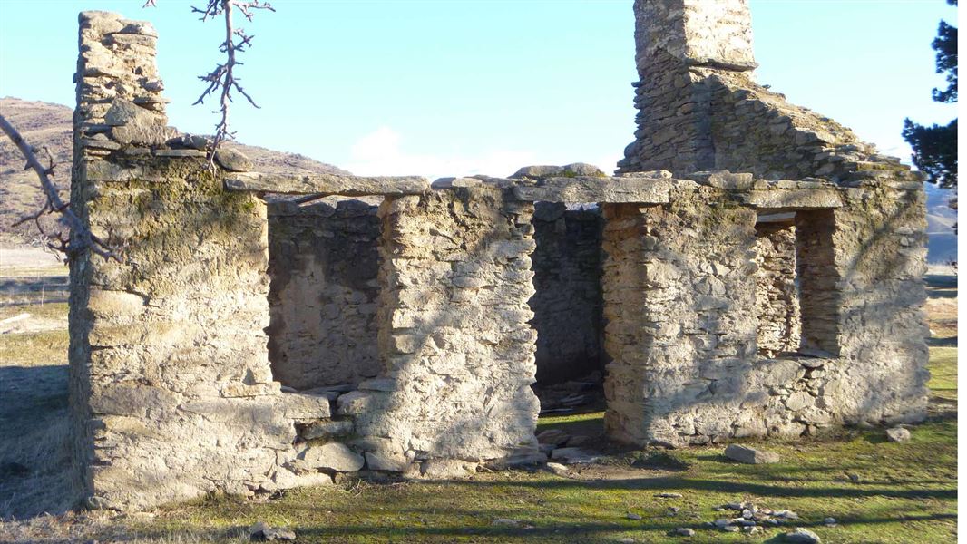
In such a dry landscape it was precious water that carved out the land in search of gold. The remains of mud and stone houses, stone walls, an orchard, water races and small caves that were homes for miners, can all be seen in this fascinating landscape that was dramatically reshaped by water.
Young Australian Historic Reserve
The road through the reserve follows an old dray track that connected the goldfields of Bannockburn with those of the Carrick Range and Nevis valley.
From the top of the range, this road offers great views down over Lake Dustan and the Cromwell basin. It descends from 1300 m near Duffers Saddle to 400 m at Quartzville Road.
John Towan discovered gold bearing quartz pebbles beneath his feet on the Carrick Range in 1864. So began the race for gold on the Carrick Range.
The Carrick Range was known for its gold-bearing quartz reefs. Throughout the landscape in the reserve you can clearly see the tracks for the sledges and carts that carried quartz rocks to the crushing batteries for gold extraction.
Stamping batteries

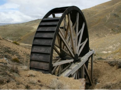
Young Australian Historic Reserve water wheel
Image: Chrissy Wickes | DOC
The stamping batteries were initially powered by coal. This was costly. The solution was water power. In 1872, construction of the ambitious 34 km Carrick water race began; it was finally completed in 1880.
Buoyed by the prospect of cheaper power, the Young Australian Mine Company, in 1874, shifted its 10 stamper battery and massive water wheel from Conroys Gully, Alexandra, to the top of the range.
The wheel still stands, a sobering reminder of shifting fortunes on the Carrick Range.
At the top of the reserve a short marked walking track takes you down to this impressive water wheel.
Carricktown
Further down the range is the remains of Carricktown, which grew up around two crushing batteries, the ‘Star’ and the ‘Elizabeth’. Old chimneys, the remains of stone huts, walls and mining structures are all that remain.
At the base of the range was a second township, Quartzville. Both towns were established in the early 1870s.
Many goldfields become richer with depth. At the Carrick, however, good returns were shallow and ran out quickly.
People began to leave. They took what resources they could to rebuild their lives elsewhere. Houses, hotels, shops and mining structures were dismantled and moved.
By 1886, large-scale mining on the Carrick Range was over.
Wānaka Tititea/Mount Aspiring National Park
Visitor Centre
| Phone: | +64 3 443 7660 |
| Email: | wanakavc@doc.govt.nz |
| Address: | 1 Ballantyne Road Wānaka 9305 |
| Hours: | Visitor centre hours and services |
