10.1 km one way
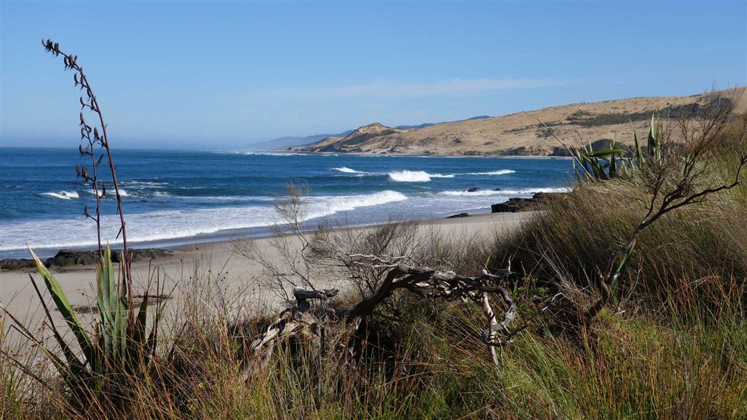
The Waimamaku Coastal Track follows a rugged and dynamic coastline from Arai Te Uru Recreation Reserve south to the Waimamaku River. Historically significant, this route used to be the main route for traffic before roads were built inland for travellers heading up the coast from further south.
The track branches off Signal Station Track. It heads down to the open coastline, then climbs up onto the high bluffs which extend southwards down the coastline.
From there the track heads down to wide open sandy beaches and over small headlands, skirting along the clifftops. It eventually heads down onto Waimamaku Beach and the mouth of the Waimamaku River and back inland alongside the river to Waimamaku Beach Road.
The views of the coastline and the Hokianga Harbour are exceptional, as are the many opportunities for fishing.
The track starts in the Arai Te Uru Recreation Reserve, at the end of Signal Station Road. The track ends on Waimamuku Beach Road, off SH12, 10 km south of Omapere.
Arai Te Uru Recreational Reserve is at Hokianga Heads, 56 km west of Kaikohe. From Kaikohe, travel west along SH12 through Omapere. Take a right into Signal Station Rd. The reserve and carpark is at the end of the road.
Keep to the track
This track crosses private land − keep to the track and follow the track markers.
Where the track follows the beach, you can only walk on the intertidal zone (ie, wet sand). Some areas above high tide are private land and tresspassers could be subject to prosecution.
Avoid walking during very high tides
The track from the beach at Waimamaku River mouth to the carpark at Waimamaku Beach Road follows the river shoreline. During high tides the river can rise to over 1 m deep along this section.
Plan your trip to avoid high tides.
Water Safety
Be aware that the beach is a challenging place for swimming and can be dangerous. There are rough seas, strong currents, hidden obstacles and it gets deep quickly.
Cell phone coverage is patchy and the nearest surf lifesaving and coastguard stations are over an hour away, so if you get into trouble it can take a long time to get help.
Stay safe in the outdoors
- Choose the right trip for you. Learn about the route and make sure you have the skills for it.
- Understand the weather. Check weather forecasts.
- Pack warm clothes and extra food. Check gear lists.
- Share your plans and take ways to get help. Leave your intentions with a trusted contact and take a distress beacon.
- Take care of yourself and each other.
DOC Customer Service Centre
| Phone: | 0800 275 362 |
| Email: | dargaville@doc.govt.nz |
| Address: | Te Tai Kauri / Kauri Coast Office |