The best time to cross Waiau Pass is between December and April, it is not recommended in winter or spring
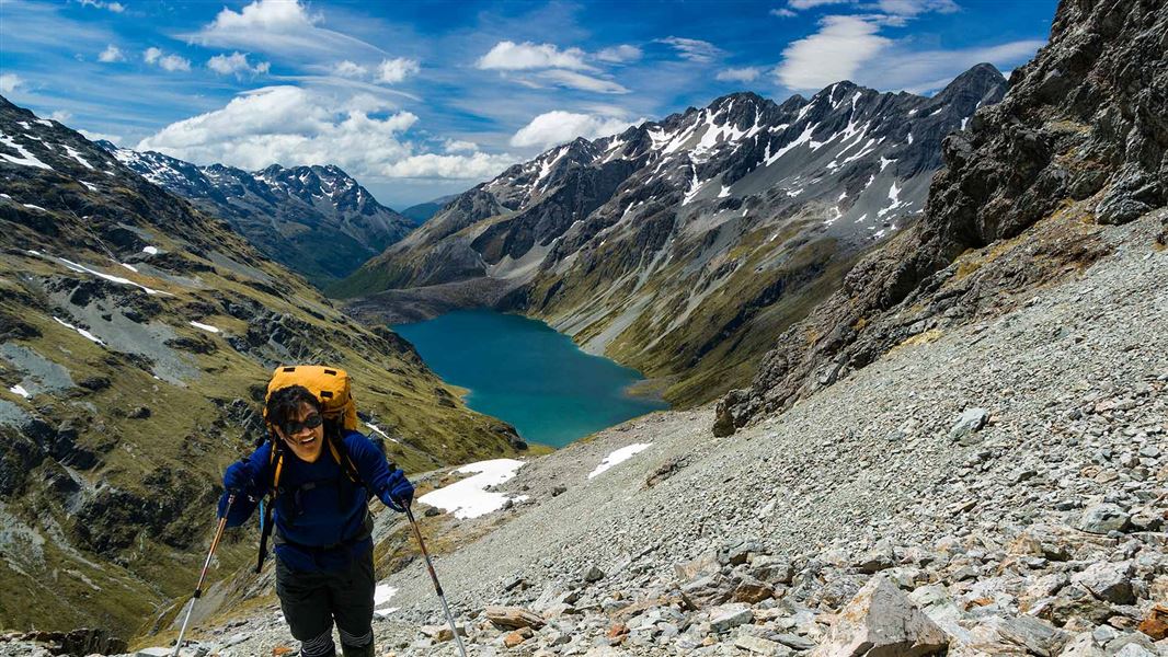
Image gallery
St Arnaud to Lakehead Hut/Coldwater Hut
Time: 3 hr
Distance: 10.4 km
Beginning at the eastern end of Kerr Bay, the Lakehead Track wanders through forest, crossing several shallow streams and shingle screes. Small beaches along the way offer picnicking opportunities and mountain views. At the head of Lake Rotoiti, the grassy flats of the lower Travers Valley greet you. Lakehead Hut is 15 min on from the jetty.
Lakehead Hut to John Tait Hut
Time: 4 hr 30 min
From Lakehead Hut, walk up the Travers River flats through forest and clearings. The track from Coldwater Hut passes the turnoff to Rotomaninitua/Lake Angelus. After 1 hr 30 min of easy walking you’ll reach a swing bridge, beyond which the track continues on the west bank of the Travers River.
Soon the valley narrows and walking becomes more varied, alternating between forested terraces and grassy river flats. Mount Travers can be glimpsed as the track nears Hopeless Creek.
Cross the creek on a swing bridge. Soon you’ll leave the river and notice the gradient becoming steeper. As it eases, you’ll hear the river again, cross a few small creeks and suddenly emerge to the welcome sight of John Tait Hut at the head of a small clearing.
Note: John Tait Hut is located below an avalanche path. Do not use the hut during storms or when the snow reaches the valley floor.
John Tait Hut to Upper Travers Hut
Time: 3 hr
Continue beyond John Tait Hut to Cupola Creek chasm, from where the track climbs steeply, leaving the river in its gorge below. A sign marks a short side track to Travers Falls, a 20 m cascade plunging into a deep bowl.
Back on the main track, the gradient soon eases. Cross several screes, and eventually the Travers River via a short bridge. From here, the forest is noticeably stunted and the track, although steep again, offers occasional views of the looming mountains.
Finally the track levels and emerges from the trees onto an extensive tussock covered flat, where Upper Travers Hut nestles at the base of the east face of Mount Travers.
Upper Travers Hut to West Sabine Hut
Time: 6–9 hr depending on conditions
Poukirikiri/Travers Saddle is an alpine pass requiring ice axes and crampons in winter and well into spring. Be prepared for sudden weather changes. The Sabine side of the saddle in particular is exposed to avalanches. At Upper Travers Hut, the track becomes a route marked with snow poles as far as the bushline on the Sabine side.
Cross the Travers River near the hut and follow the poles through dense alpine shrubs. Leaving the boulder strewn valley, the track steepens and zigzags up a scree slope before continuing more gently to the saddle with its panoramic views. The saddle is 450 m above the hut, about 1 hr 30 min walking.
From the saddle, the descent is steep – the Sabine forks lie 1000 m below. The track crosses tussock and scree, then briefly enters stunted beech forest before emerging into a steep gully. Descend by zigzagging to the valley floor, where the track begins again and the walking becomes easier.
Ten minutes further on, a bridge crosses the deep chasm of the East Branch Sabine River. The track sidles around the edge of this chasm before descending into the West Branch Sabine River valley and heading upstream a short distance to West Sabine Hut.
Watch a Mountain Safety Council video guide to the route over Poukirikiri/Travers Saddle:
West Sabine Hut to Blue Lake Hut
Time: 3 hr
Distance: 7.7 km
Head upstream from the West Branch Sabine swing bridge. After 1 hr 30 min, the valley broadens and the track passes through forest destroyed by an avalanche in 1980. Climb steeply in two stages to a high basin containing Blue Lake Hut.
Rotomairewhenua/Blue Lake is thought to be the clearest natural freshwater lake in the world. The lake is sacred to iwi and at significant risk from aquatic biosecurity threats. Please respect this pristine water by refraining from washing, swimming or touching the waters in the lake. Camping is not allowed close to the lake.
This section of track crosses several avalanche zones where avalanches commonly run to valley floor in spring.
Blue Lake Hut to Waiau Hut
Time: 9-12 hr
Assess the weather before starting the ascent over Waiau Pass. Only attempt the pass in good weather – if the weather is bad or the pass is in cloud, we recommend waiting in Blue Lake Hut and trying the pass another day.
Start early, as you should allow 9-12 hr to cross the pass and reach Waiau Hut. There is also a campsite (no toilet) available at Waiau Forks.
Watch a Mountain Safety Council video guide to the route over Waiau Pass:
Blue Lake Hut to top of Waiau Pass
From Blue Lake Hut follow the signs, orange triangle makers and orange poled route which lead you south. The route climbs the moraine which is damming Rotopohueroa/Lake Constance.
Once on top of the moraine, follow the marker poles which lead high above the cliffs on the western side of the lake. Do not follow the lake edge – you will eventually get stopped by impassable bluffs and deep water and have to turn back.
The route around the cliffs above Rotopohueroa/Lake Constance will lead you through some steep guts and spurs. It then drops back down to the lake edge (approximately 2.7 km from the hut) and follows the shoreline to the lakehead.
Waiau Pass Route leads high above the cliffs on the western side of the lake. Image: DOC
At the lake’s northern end, follow the route along the valley floor for approximately 1km, with several stream crossings. The route then turns to the left (south) and starts to climb scree and steep rocky sections to Waiau Pass. It is approximately 1.5 km from the valley floor to the pass and you gain 530 m in altitude. Hard icy snow can remain until December in these last 150+ metres of elevation, which can be very difficult to negotiate if the conditions are unfavourable.
Top of Waiau Pass to Upper Waiau Forks
Be aware that this section from the top of the pass to the valley floor is very steep and technical, even on a good day. There are many places where it is possible to slip or get stuck, particularly when there is snow and ice.
From the top of the pass, assess the conditions on the south side of the pass. Snow can be present at any time of the year – if there is snow, then do not proceed unless you have an ice axe, crampons and avalanche rescue equipment (and know how to use them). Return to Blue Lake Hut instead.
Follow the orange markers down from the Waiau Pass summit, ensuring you stay on the marked route. The route leads to the right from the summit, rather than descending directly into the valley. The descent is steep and rocky, so take your time and watch your footing.
Waiau Pass Route leads to the right from the summit. Image: DOC
When you reach the valley, the route leads down the west branch of the Waiau Uwha River. It descends through scrub, then crosses the east branch of the river not far above the forks.
Upper Waiau Forks to Waiau Hut
It is approximately 4 hours from Waiau Forks to Waiau Hut.
Follow the route down the true left of the river, passing through a camping spot (no toilet) in a stand of beech and through a natural clearing. The route then crosses to the true right of the Waiau Uwha River and continues following it downstream.
Take care as the track may be overgrown in places. It is essential you follow the orange markers to follow the best route.
You will cross various side streams on the way down the valley, the largest of which is Caroline Creek.
Topographic maps and the Mountain Safety Council video about the Waiau Pass Route include information about Caroline Creek Bivvy. This bivvy has been removed, there is no shelter or hut at this site. The nearest shelter is one hour downstream from Caroline Creek at Waiau Hut.
Waiau Hut to Anne Hut
Time: 7–8 hours
From Waiau Hut, continue following the Waiau Uwha River downstream on the true right bank. The valley gradually widens and you cross two old, bush-covered terminal moraines. The route continues down the valley, mainly over broad, grassy river flats, until you reach the junction of Waiau Uwha River and Ada River. Ada homestead is privately owned and trampers should avoid this area.
Cross Ada River – the crossing is usually straightforward in low/normal flows, but may not be safe if the river is high. Follow a vehicle track over the grassy flats and join the St James Walkway.
Follow the St James Walkway track up the Henry River valley to Anne Hut.
There is no longer a radio at Anne Hut.
Anne Hut to Boyle Flat Hut
Time: 7 hr
Distance: 17 km
The track crosses a footbridge over the Anne River to gain access to the true left, and 2 km upriver it crosses another footbridge back to the true right. The track continues up and over the Anne Saddle into the Boyle Valley. Orange pole markers indicate the route over the Boyle Flats, past the basic Rokeby Hut. The true left bank is followed to a suspension bridge over the Boyle River, 100 metres from the Boyle Flat Hut.
Boyle Flat Hut - Boyle settlement
Time: 4–5 hr
Distance: 14.5 km
After re-crossing the footbridge to join the walkway route on the true left bank, follow markers to the start of the track through the gorge.
A suspension bridge crosses the Boyle River, then the track follows the true right bank to another suspension bridge.
Magdalen Hut is 30 minutes from this second bridge.
A vehicle track is joined and followed down the valley to the shelter and car park at SH7 by the Boyle settlement.
Northern track entrance/exit: St Arnaud township is 1 hour 30 minutes by road from Nelson or Blenheim. Turn off SH63 at St Arnaud onto Kerr Bay Road and continue on to Kerr Bay.
The track starts at the eastern end of the bay.
Southern track entrance/exit: Boyle village is on SH7 (Lewis Pass Rd).
Waiau Pass is a very technical alpine crossing
You need backcountry and snowcraft experience in all seasons.
Waiau Pass is a difficult alpine crossing suitable for experienced parties only. Watch the Mountain Safety Council video about the pass and decide whether it is right for you and your group.
Weather conditions can deteriorate rapidly and icy snow conditions can be present at any time of the year. Snowcraft experience is required and equipment taken should include at least an ice axe and crampons.
The best time to attempt this trip is between December and April, it is not recommended in winter or spring.
This is a challenging and remote track
This is extremely remote tramping, always carry a distress beacon. It is very common for trampers to be delayed on this trip – even in the height of summer, people often have to wait extra nights at Blue Lake Hut until conditions are right to cross Waiau Pass.
Everyone tramping this route should carry enough extra food for several extra days.
Carry an emergency shelter in case you are trapped by high rivers and need to shelter while waiting for them to drop.
Freezing conditions and/or heavy rain can occur at any time of year. Take warm and waterproof clothing.
Watch the Mountain Safety Council video about Poukirikiri/Travers Saddle.
Stay safe when crossing rivers
If you plan to cross unbridged rivers, know how to cross safely and be prepared for if you cannot cross.
Do not cross if the river is flooded, you cannot find safe entry and exit points or are unsure it’s safe. Turn back or wait for the river to drop. If in doubt, stay out.
Wasps
There are high numbers of wasps, particularly between January and April. Consider carrying an antihistamine product and, if you are allergic to their stings, ensure you carry medication with you.
There is avalanche terrain on this route
Waiau Pass is complex avalanche terrain with significant avalanche risks. Dangerous avalanches occur regularly in this area. You need avalanche skills and equipment if you are attempting the pass from May to December.
If there is snow on the south side of Waiau Pass, do not continue unless you have an ice axe, crampons and avalanche rescue equipment (and know how to use them).
There is also avalanche terrain on other parts of the route, including on the St James walkway, Waiau valley above the Caroline Bivvy site, the track to Blue Lake Hut and the Travers Sabine Circuit. The Travers – Sabine Circuit has more than 20 recognised avalanche paths.
John Tait Hut is located below an avalanche path. Do not use the hut during storms or when the snow reaches the valley floor.
Find information about avalanche terrain in Nelson Lakes and St James Conservation Area.
Talk to the staff at the Rotoiti/Nelson Lakes Visitor Centre about the latest snow and track conditions, and check the NZ Avalanche Advisory.
Respect Rotomairewhenua/Blue Lake and Rotopōhueroa/Lake Constance
Rotomairewhenua/Blue Lake and Rotopōhueroa/Lake Constance hold high cultural significance to Māori, particularly Ngāti Apa ki te Rā Tō iwi. The lakes are tapu (sacred) and restrictions are placed on these lakes to uphold their mauri (life force) and purity.
Show respect by not touching the water. Do not swim, wash, take water or put any equipment into these lakes. This will also help keep the lakes free of the invasive lindavia (lake snow) that is present in Lakes Rotoiti and Rotoroa.
Stay safe in the outdoors
- Choose the right trip for you. Learn about the route and make sure you have the skills for it.
- Understand the weather. Check weather forecasts.
- Pack warm clothes and extra food. Check gear lists.
- Share your plans and take ways to get help. Leave your intentions with a trusted contact and take a distress beacon.
- Take care of yourself and each other.
Check, Clean, Dry
Clean all gear when moving between waterways to prevent the spread of didymo and other freshwater pests.
Nelson Lakes National Park Visitor Centre
| Phone: | +64 3 521 1806 |
| Email: | nelsonlakesvc@doc.govt.nz |
| Address: | View Road St Arnaud 7072 |
| Hours: | Visitor centre hours and services |
Nelson/Tasman/Marlborough information
| Phone: | +64 3 546 9339 |
| Email: | nelsonvc@doc.govt.nz |
| About: | Whakatū/Nelson visitor services provide information for this area |
Arthur's Pass National Park Visitor Centre
| Phone: | +64 3 318 9211 |
| Email: | arthurspassvc@doc.govt.nz |
| Address: | 104 West Coast Road Arthur's Pass 7654 |
| Hours: | Visitor centre hours and services |