Fires are not allowed at any time. See fire rules on conservation land.
Other facilities
- Picnic table and shelter
- Toilets
Fees
Free.
Getting to Makahu Road
Makahu Road is 75 km north-west of Napier. From Napier follow Puketitiri Road for 40 km before turning right into Pakaututu Road. Makahu Road is 9 km on the left.
At the very end of the road, 500 metres from the Mangatutu Hot Springs and camping area, is "The Gums" parking area and shelter. The tracks to Te Puia Lodge and Mangatainoka Hot Springs begin here.
The trip involves about 1 hr of travel on unsealed gravel roads. There is a river ford on Makahu Road 7.5 km from the road end – heavy rain and snow melt can affect the water level.
Makahu Road is steep and narrow in places. It may be slippery when wet. Take extra caution driving this road.
The road is not suitable for caravans or campervans.
Check with Hasting's District Council for road closures.
Kaweka Forest Park access conditions
We recommend 4WD vehicles to reduce wear on the road and safe travel.
- Lotkow Road: The river crossings are regularly changing, check before crossing.
- Lakes carpark is accessible via Kuripapango road. The previous access Castle Rock road is now closed due to ongoing forestry operations.
- Lawrence Carpark access road: The last 600 m of the road is steep and not recommended for 2WD vehicles - a parking space is available before the descent. The Lawrence swing bridge has been removed.
- Mackintosh car park is currently closed due to ongoing forestry operations. A new parking location can be located at a skid site near the closed gate (end of Kuripapango Road), this will add on 500 m walking to reach the start of the track.
- Whittle Road: Be aware of trucks using the quarry. Give them right of way where possible.
Location
NZTM2000 coordinates: E1898608, N5657147
Latitude: -39.18229238, Longitude: 176.45897967
Water can be gathered from the stream at the road end. There are signs showing the way here. There's no need to collect water from Mohaka River.
Fishing
The river offers rainbow and brown trout.
Hunting
Hunt sika and red deer in the park.
Thermal springs
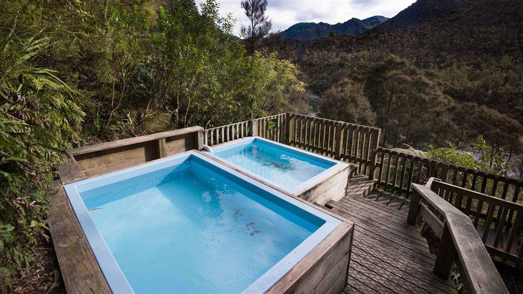
A short, steep track descends from the campsite to Mangatutu Hot Springs. Thermal water issues from a deep hole in an undercut bank near the top terrace. The water trickles down a riverside bluff, where it is channelled into two pools.
Walking and tramping
DOC Customer Service Centre
| Phone: | 0800 275 362 |
| Email: | napier@doc.govt.nz |
| Address: | Ahuriri / Napier Office |