
Dog access
No dogs. Other pets on conservation land rules.
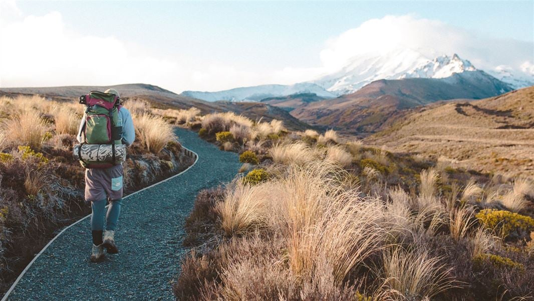
Visit Whakapapa area – the main entrance to Tongariro National Park, with many walks as well as the Tongariro National Park Visitor Centre.
Tongariro National Park is located in the central North Island. It is easily accessed by road and a 4–5 hr drive from both Auckland and Wellington. Whakapapa Village is the main gateway into the park, accessible on the western side off SH48.
Daily national bus services are available to and from Tongariro National Park and the nearby towns of Ohakune, Waiouru, Waimarino (formerly National Park Village), and Tūrangi. Various shuttle buses meet the national buses and trains at Whakapapa Village and nearby towns.
There are risks from avalanches and risks from volcanoes in Tongariro National Park. Learn about these hazards and how you can be prepared.
Get information about weather conditions.
Weather forecast
Tongariro National Park weather forecast – NIWA website
Dogs are not allowed in Tongariro National Park
No dogs are not allowed in Tongariro National Park including Whakapapa Village, Whakapapa Ski Area, Tūroa Ski Area or inside vehicles anywhere in the park.
Do not leave your dog in your vehicle when you visit any of the ski fields. This is not allowed.
The national park boundary starts at the intersection of SH 47 and SH 48. No dogs are allowed past this point. This is before you reach Whakapapa Village.
Find areas outside of the national park where dogs are allowed.
4x4 off-roading is not allowed in Tongariro National Park.
There are no 4x4 off-roading tracks in Tongariro National Park. Vehicles must always stay on the road on the Tukino Access Road (off the Desert Road). It is an offence to leave the formed road.
Find areas outside of the national park where 4x4 off-roading is allowed.
Tongariro Alpine Crossing booking system
Bookings are recommended for all visitors using any part of the Tongariro Alpine Crossing Track. A track booking is required for shuttle and guided walk services.
Book to use any part of the Tongariro Alpine Crossing.
Read about why a booking is recommended and sustainable visitor management for Tongariro.
Climbing on Mt Ruapehu
The mountains are sacred to local iwi (Māori tribal groups). Respectfully they ask visitors not to summit the mountains in the Tongariro National Park.
DOC discourages hiking or climbing into the summit hazard zones. See Volcanic risk in Tongariro National Park.
Anyone attempting to climb Mt Ruapehu during the summer months must have mountaineering, alpine, backcountry, navigation skills and experience. Ice axes and crampons will be required past the snow line.
There is no marked track to the summit. DOC do not administer any alpine climbing tracks on Mt Ruapehu.
There is avalanche terrain on all routes to the summit. Approaches from most directions and onto the summit of Ruapehu involve travel through challenging and complex terrain. Read more about avalanche terrain in Tongariro National Park.
A good alternate to summiting Mt Ruapehu is the Skyline Walk located within the Whakapapa Ski Area. This track has marker poles. See Whakapapa Ski Area's self-guided and marked short walks.
There are local concessionaires who offer guided trips on all the mountains.
 No unauthorised drone use in the national park
Unauthorised use of drones is prohibited. You must have a permit to fly a drone.
DOC does not generally approve permits to fly drones in this national park and we do not recommend you apply for one.
Tongariro National Park has several heritage sites:
Tongariro National Park Visitor Centre
| Phone: | +64 7 892 3729 |
| Email: | tongarirovc@doc.govt.nz |
| Address: | Whakapapa Village State Highway 48 Mount Ruapehu 3951 |
| Hours: | Visitor centre hours and services |