7 km one way
From the track entrance, the track climbs steadily up through beech forest to the bush line.
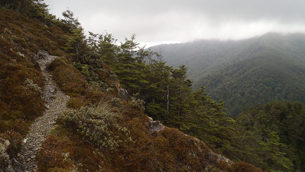
After the bush line, the track continues to climb towards the summit of Urchin. It passes an interesting array of alpine plants.
The Urchin trig is located at 1391 m, usually reached 2-2 hours 30 mins from the road end. The trig is a good place to stop for lunch, with a wide vista of Lake Taupō and the volcanoes of the Tongariro National Park.
From the trig, the track travels for about 2 km across the open tops. You reach a track junction, with the option of descending off the side of the ridge or continuing along a ridge towards Umukarikari (U2 Route).
Take the right-hand track, to descend off the ridge. The track descends steeply into the middle reaches of the Waipakihi River Valley.
There are many great places to camp in the valley or you can continue upstream to Waipākihi Hut near the top of the valley (an additional 5 - 6 hours of tramping).
There is no marked route to Waipahiki Hut, you will need to follow the river valley. It will be dangerous if the river is high (for example, during/following heavy rain). Assess the river carefully and don’t attempt this trip if you aren’t confident that it’s safe. Genesis Energy monitors flows in the Waipakihi River, see Genesis Energy website or phone +64 7 386 8113.
Mountain biking
No mountain biking allowed.
Turn off SH1 onto Kaimanawa Road, 15 km south of Tūrangi. After the bridge over Tongariro River, take the next right. Follow this road past the Pillars of Hercules turnoff and almost all the way to Urchin Campsite. Turn off onto a 4WD road shortly before the campsite, then continue up this road until you see the Urchin Track entrance.
Take care if tramping up Waipakihi River
It is not safe to tramp up the Waipakihi riverbed in all conditions – it will be dangerous if the river is high (for example, during/following heavy rain). Assess the river carefully and don’t attempt this trip if you aren’t confident that it’s safe.
Have a back-up plan for if this route is not possible and carry an emergency shelter and extra food, in case you are delayed by a rising river.
Genesis Energy monitors flows in the Waipakihi River, see Tongariro flow, level and rain data or phone +64 7 386 8113 (or free phone 0800 435 697 (0800 4 FLOWS)).
Be prepared for cold, wet weather at any time of year
The weather in Kaimanawa Forest Park is extremely changeable. Visitors should be prepared for cold wet conditions even in summer. Frosts and snow are likely on high ground throughout the year.
The annual rainfall is approximately 3500 mm and decreases towards the east.
Always carry warm and waterproof clothing. Check weather forecast
Pack for a remote, backcountry area
The Kaimanawa Forest Park is a remote area and you can expect rough, tramping tracks. It is best suited to experienced trampers with river crossing, navigation and backcountry skills.
Pack to be self-sufficient by packing everything on this tramping packing list.
There is no cell phone coverage in many parts of the park. Always carry a distress beacon.
Check the fire danger
During periods of extreme fire danger the lighting of fires in the open may be prohibited. Check the fire danger on checkitsalright.nz
Even when fires are allowed, we recommend using portable stoves rather than lighting open fires. If you must use a wood fire, obtain firewood from dead trees only.
Stay safe in the outdoors
- Choose the right trip for you. Learn about the route and make sure you have the skills for it.
- Understand the weather. Check weather forecasts.
- Pack warm clothes and extra food. Check gear lists.
- Share your plans and take ways to get help. Share directly or use the Outdoor Intentions form or Plan My Walk. Take a distress beacon.
- Take care of yourself and each other.
DOC Customer Service Centre
| Phone: | 0800 275 362 |
| Email: | turangi@doc.govt.nz |
| Address: | Tūrangi Office |
