Image gallery
View Hill car park to Wharfedale Hut
Time: 5 hr one way
Distance: 15 km one way
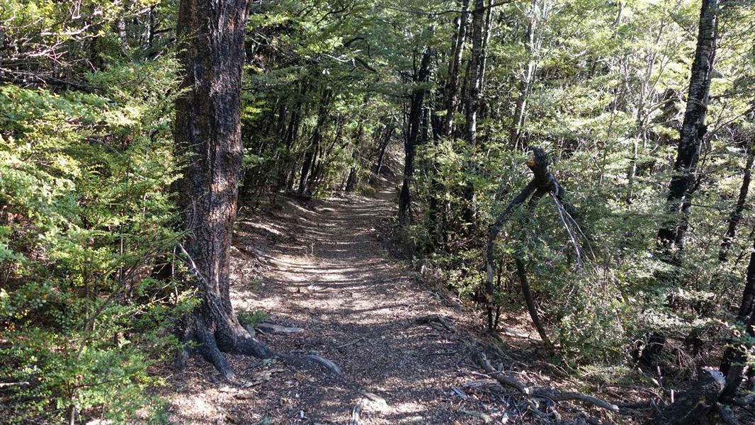
The track sidles and gently climbs through beech forest to the saddle. It is then mostly downhill to Wharfedale Hut, close to Dobson Stream.
This track was formed originally as a stock route with the intention of eventually becoming a road linking the plains with Lees Valley. Work began in 1879 but after seven years it was abandoned as a possible road.
Mountain biking
Time: 3 hr one way
Grade: 3/Intermediate
Townshend Track
Time: 2 hr 30 min one way
Distance: 8.5 km one way
Permission from Lees Valley Station is required for access to the Townshend Track as the track crosses private land. Email Lees Valley Station with at least one week's notice: themuster@grasslands-llc.com
About half an hour after leaving Wharfedale Hut, the track opens out and follows a 4WD track over grazed flats coming out at Lees Valley Road.
This track crosses the Townshend River twice and may be impassable if river levels are high.
The Townshend Track is on unformed legal road. See Unformed legal roads for more information.
The farm track varies from the unformed legal road at the beginning of this track from Lees Valley Road.
Mountain biking
Grade: 2/Easy
These tracks connect with tracks to Birch Hill Hut.
Horse riding
You can ride your horse on this track.
Townshend Track access
Access to Wharfedale Hut via the Townshend Track is on a mixture of private land and unformed legal road. Permission from Lees Valley Station is required for access. Email Lees Valley Station with at least one week's notice: themuster@grasslands-llc.com
See Unformed legal roads for more information.
The farm track varies from the unformed legal road at the beginning of this track from Lees Valley Road.
If you have difficulty using an unformed legal road, you can contact the relevant territorial authority, as they are responsible for unformed legal roads. The relevant council to this area is the Waimakariri District Council.
To get to View Hills carpark
4 km south of Oxford, turn off SH72 (Inland Scenic Route) onto Woodstock Road. Follow this for 10 km then turn into Ingrams Road, then into Limeworks Road, which becomes Perhams Road. An AA sign here indicates the turn-off to the start of the Wharfedale Track where the View Hill car park is located.
In times of heavy rain two fords on Perhams Road may become impassable and the road may be muddy. 4WD vehicles are advisable.
To get to Lees Valley - access to Townshend Track
From Oxford, follow Ashely Gorge Road for 6 km. Turn into Lees Valley Road and follow this for 20 km to the DOC sign. Leave your vehicle outside the locked gate, foot access only from here.
Shared use track
This is a shared use track for walkers, mountain bikers and horse riders. Be mindful of other users.
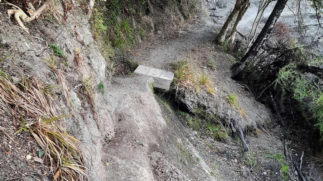
Slip on the track
There is a slip on the Wharfedale Track between Wharfdale Hut and Fosters Ridge Track Junction.
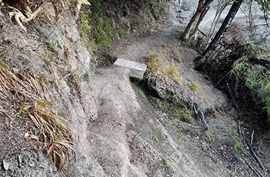
Wharfedale Track slip. View larger image (JPG, 201K).
Image: DOC
A section of the track is gone and there is about a 5 m drop. You may need to go through the bush to get around the slip. Take care. If you're not confident in doing this, do not proceed.
The slip is difficult to negotiate and not recommended for mountain biking as the track across is very narrow and bumpy with the 5 m drop on one side.
NZTopo50 map sheet: BW22
This track crosses the Townshend River twice and may be impassable if river levels are high.
Stay safe when crossing rivers and streams
If you plan to cross unbridged rivers or side streams, know how to cross safely and be prepared for if you cannot cross.
Do not cross if the river or stream is flooded, you cannot find safe entry and exit points or are unsure it’s safe. Turn back or wait for the river to drop. If in doubt, stay out.
NIWA river flow forecasts: View a video of national followed by regional river flows
Wasp warning
Wasp populations reach high numbers from January to April – wear light-coloured clothing and carry antihistamine cream/tablets as a precaution.
Stay safe in the outdoors
- Choose the right trip for you. Learn about the route and make sure you have the skills for it.
- Understand the weather. Check weather forecasts.
- Pack warm clothes and extra food. Check gear lists.
- Share your plans and take ways to get help. Leave your intentions with a trusted contact and take a distress beacon.
- Take care of yourself and each other.
Arthur's Pass National Park Visitor Centre
| Phone: | +64 3 318 9211 |
| Email: | arthurspassvc@doc.govt.nz |
| Address: | 104 West Coast Road Arthur's Pass 7654 |
| Hours: | Visitor centre hours and services |