5.7 km one way one way
The best time to hike this track is from November to April. It has persistent snow and ice in winter and spring, which requires winter alpine skills and equipment.
Video
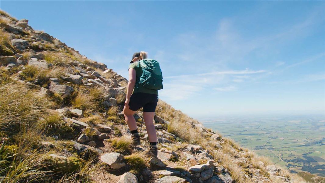
The hike to Mount Somers summit is a challenging day walk that is best suited to fit, experienced trampers. It involves a gain of 1200m elevation, and the track is rough, steep and unformed.
From Sharplin Falls car park, follow the South Face Track as it climbs through forest.
A track junction marks the start of the Mount Somers Summit Track. From here it is 2.1 km/1 hour 30 min to the summit. This is a good decision point to:
- check that there is no snow on Mount Somers. If there is snow, you need winter alpine skills and equipment
- consider turning around if the top of Mount Somers is in cloud. This will mean there is low visibility further up the mountain and it may be difficult to follow the track
- check that there isn’t any bad weather coming from the south. The summit is very exposed to southerly fronts.
The track climbs steeply up the side of Mount Somers. Follow the orange marker poles.
The summit at 1687 m has excellent views of the surrounding mountains and coastal plain.
You can return back down the summit track or continue on Te Kiekie Route, which starts at the summit.
In winter, the south face of Mount Somers gets very little sunlight, making the snow hard and icy. An ice axe, crampons and some mountaineering experience are required to safely reach the summit.
Understand if you are ready for Mt Somers tracks
Watch the NZ Mountain Safety Council’s walk-through video which takes you through how to prepare for the tracks on Mount Somers, including this track. It explains the facilities, key decision points, hazards and typical conditions for the area.
The summit can be reached from the Sharplin Falls car park. From Staveley, follow Boyds Road for approximately 450 m, then turn right onto Flynns Road and follow this to the end.
Be ready for all weather
The Mount Somers area is an alpine environment and bad weather can occur at any time of the year. The area can be extremely hot and dry, and at others times can experience freezing cold, high winds, heavy rain and snow.
There is no tree cover on much of the route and you are fully exposed to the weather.
Always bring warm, waterproof layers, sturdy footwear and sun protection.
Be careful of low visibility. Always carry navigation aids (eg, map, compass, GPS) and know how to use them.
Check the Mount Somers Track weather forecast
Expect snow and challenging alpine conditions in winter
In winter, the south face of Mount Somers gets very little sunlight, making the snow hard and icy. An ice axe, crampons and some mountaineering experience are required to safely reach the summit. The summit of Mount Somers is very exposed to southerly fronts.
Pack well for your hike
Overnight and multi-day packing list for tramping
We recommend carrying a distress beacon. This track is on NZTopo50 map sheets BX20, with BX19 covering adjacent terrain on Mount Somers.
There are wasps
Wasps may be present in high numbers, particularly during summer. Consider carrying an antihistamine product and if you are allergic to stings, ensure you bring your medication.
Stay safe in the outdoors
- Choose the right trip for you. Learn about the route and make sure you have the skills for it.
- Understand the weather. Check weather forecasts.
- Pack warm clothes and extra food. Check gear lists.
- Share your plans and take ways to get help. Leave your intentions with a trusted contact and take a distress beacon.
- Take care of yourself and each other.
DOC Customer Service Centre
| Phone: | 0800 275 362 |
| Email: | info@doc.govt.nz |