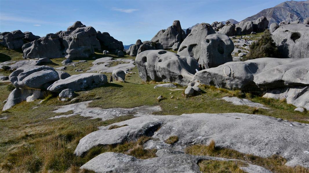
Climbers, families, students, scientists and travellers have always been drawn to this spectacular place, to explore its natural, cultural, historic and recreation values.
Bounded by the high mountains of the Torlesse Range to the east and the Craigieburn Range to the west, the limestone tors of Kura Tawhiti Conservation Area dominate the Waimakariri Basin, Canterbury.
From Christchurch take SH73 towards the West Coast. Kura Tawhiti is beside the highway in the Waimakariri Basin, about 80 minutes from Christchurch.
Visitors here to enjoy this intriguing landscape are asked to help protect these values by following the code of conduct.
- Dogs are not permitted in this reserve
- Stay on the access track - the paddocks are private property.
- Use the provided toilet facilities.
- Refrain from digging holes or disturbing the ground surface - wahi tapu (sacred places) are here.
- Avoid trampling on endangered plants - use open spaces between rock outcrops rather than the bases of rock faces.
- Respect fenced areas.
- Take all rubbish away with you.
- Do not mark the surface of the rocks.
- Consider others in the area.
- Rock climbers must follow the climbing code of conduct.
All drone use must be authorised by DOC
You must have a permit to fly a drone on public conservation land.
Visit our Drone use on conservation land page for more information.
Landforms
Sculptures in stone
The geology of the rocks at Kura Tawhiti is tertiary limestone, mudstone, sandstone and tuffs. Limestone is formed from layers of organic sediment, deposited in deep oceans far from land. The layers are compressed into soft, soluble rock.
The area was once under a large, shallow inland sea that began to infill some 30 million years ago. Pressure over time caused extensive uplift and folding and faulting of the Torlesse and Craigieburn Ranges.
Thrust up from their origin, the limestone rock was eroded by water into these distinctive sculptured landforms, called a karst landscape.
Plants
Kura Tawhiti is a refuge for hidden treasures - some of the rarest and most endangered plants in Canterbury. Once covered in tōtara and tall shrubs, the area was cleared 600 years ago by fire and has been grazed for almost 150 years. Tussock and pasture are now the norm, with one lone, surviving tōtara nearby.
Thanks to the work of Dr Lance McCaskill in the early 1950s, this habitat is the site of the first reserve in New Zealand established specifically to protect a plant - the Castle Hill buttercup (Ranunculus paucifolius). Gazetted as a 'Reserve for the Protection of Flora and Fauna' in 1954, it was named Lance McCaskill Nature Reserve in 1987 when DOC was founded in recognition of the work that Lance did for the buttercup.
With just 67 plants in existence, the Castle Hill buttercup requires very specific conditions for its survival. It is only found within the 6 ha reserve (a naturally rare ecosystem of gently sloping limestone debris) which was recently re-fenced to protect the plant from being consumed by hares. Other factors that have led to the buttercup’s dwindling numbers include being crowded out by invasive weeds, trampled by livestock and stolen by collectors.
The Lance McCaskill Nature Reserve has important scientific value as the longest running plant-monitoring project in New Zealand, and has also protected the Castle Hill forget-me-not (Myosotis colensoi).
The Castle Hill Basin is also home to two other very rare plants that prefer to live in limestone landscapes. These are limestone wheatgrass (Australopyrum calcis subspecies obtatum) and a tiny 3 cm high sedge (Carex inopinata).
Tōpuni - a symbolic cloak of protection
This area has special significance to Ngāi Tahu, with ties that stretch unbroken from distant ancestors to present generations.
Kura Tawhiti literally means “the treasure from a distant land”, referring to the kumara that was once cultivated in this region. Kura Tawhiti was claimed by the Ngāi Tahu ancestor Tane Tiki, son of celebrated chief Tuahuriri. The nearby mountains were famed for kakapo, and Tane Tiki wanted their soft skins and glowing green feathers for clothing to be worn by his daughter Hine Mihi.
Such stories link Ngāi Tahu to the landscape. The traditional knowledge of trails, rock shelters and rock drawings, and places for gathering kai (food) in the area known as Kura Tawhiti form an integral part of past and present tribal identity.
Kura Tawhiti has Tōpuni status, which is a legal recognition of the site’s importance to the Ngāi Tahu tribe. The term comes from the traditional custom of chiefs extending power and authority over areas or people by placing a cloak over them.
The existing status of the land as a conservation area is unchanged, but Tōpuni status ensures that Ngai Tahu values are recognised, acknowledged and respected and Ngai Tahu take an active role in management. It recognises Ngāi Tahu mana whenua and rangatiratanga and symbolises the tribe’s commitment to conservation.
To find our more about the cultural and historic significance of this site to Ngai Tahu and Ngai Tūāhuriri, watch this 4-minute video produced by Selwyn District Council.
Arthur's Pass National Park Visitor Centre
| Phone: | +64 3 318 9211 |
| Email: | arthurspassvc@doc.govt.nz |
| Address: | 104 West Coast Road Arthur's Pass 7654 |
| Hours: | Visitor centre hours and services |
